MyTopo
Sugarloaf Utah US Topo Map
Couldn't load pickup availability
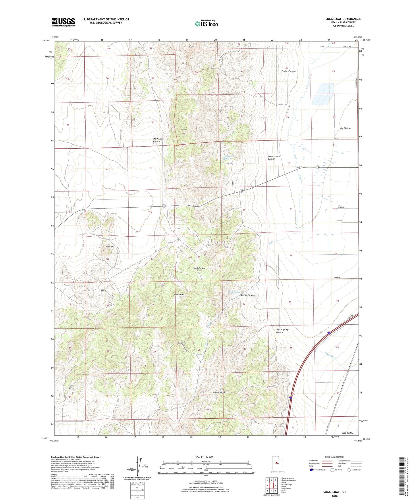
2023 topographic map quadrangle Sugarloaf in the state of Utah. Scale: 1:24000. Based on the newly updated USGS 7.5' US Topo map series, this map is in the following counties: Juab. The map contains contour data, water features, and other items you are used to seeing on USGS maps, but also has updated roads and other features. This is the next generation of topographic maps. Printed on high-quality waterproof paper with UV fade-resistant inks.
Quads adjacent to this one:
West: Furner Ridge
Northwest: Tintic Mountain
North: Slate Jack Canyon
Northeast: Mona
East: Nephi
Southeast: Levan
South: Juab
Southwest: Sage Valley
This map covers the same area as the classic USGS quad with code o39111f8.
Contains the following named places: Big Hollow, Cazier Canyon, Fourmile Creek, Government Canyon, Government Spring, Hall Canyon, McPherson Canyon, Orme Spring, South Spring Canyon, Spring Canyon, Sugarloaf