MyTopo
Taylor Mountain Utah US Topo Map
Couldn't load pickup availability
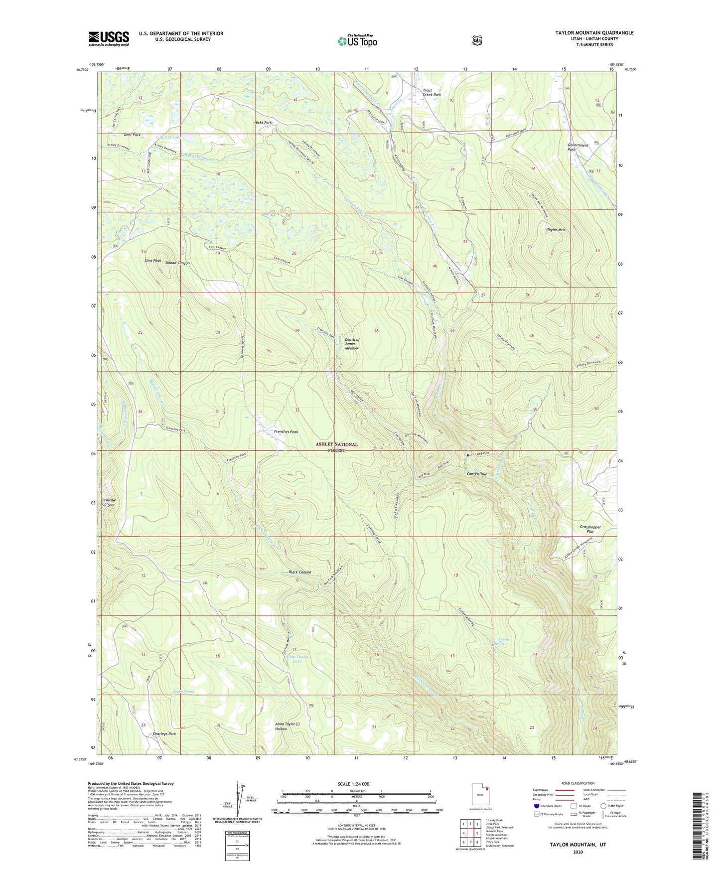
2020 topographic map quadrangle Taylor Mountain in the state of Utah. Scale: 1:24000. Based on the newly updated USGS 7.5' US Topo map series, this map is in the following counties: Uintah. The map contains contour data, water features, and other items you are used to seeing on USGS maps, but also has updated roads and other features. This is the next generation of topographic maps. Printed on high-quality waterproof paper with UV fade-resistant inks.
Quads adjacent to this one:
West: Marsh Peak
Northwest: Leidy Peak
North: Elk Park
Northeast: East Park Reservoir
East: Dyer Mountain
Southeast: Steinaker Reservoir
South: Dry Fork
Southwest: Lake Mountain
Contains the following named places: Alma Taylor Lake, Bodily Spring, Cow Hollow, Death of James Meadow, Deer Park, Dry Fork Overlook, Frenches Park, Galloway Corral, Galloway Spring, Government Park, Grasshopper Flat, Hicks Park, Hicks Park Corral, Lily Pad Lake, North Brownie Creek, North Fork Ashley Creek, Red Pine Creek, Sims Peak, South Brownie Creek, South Fork Ashley Creek, Taylor Mountain, Trout Creek, Trout Creek Park