MyTopo
The Wickiup Utah US Topo Map
Couldn't load pickup availability
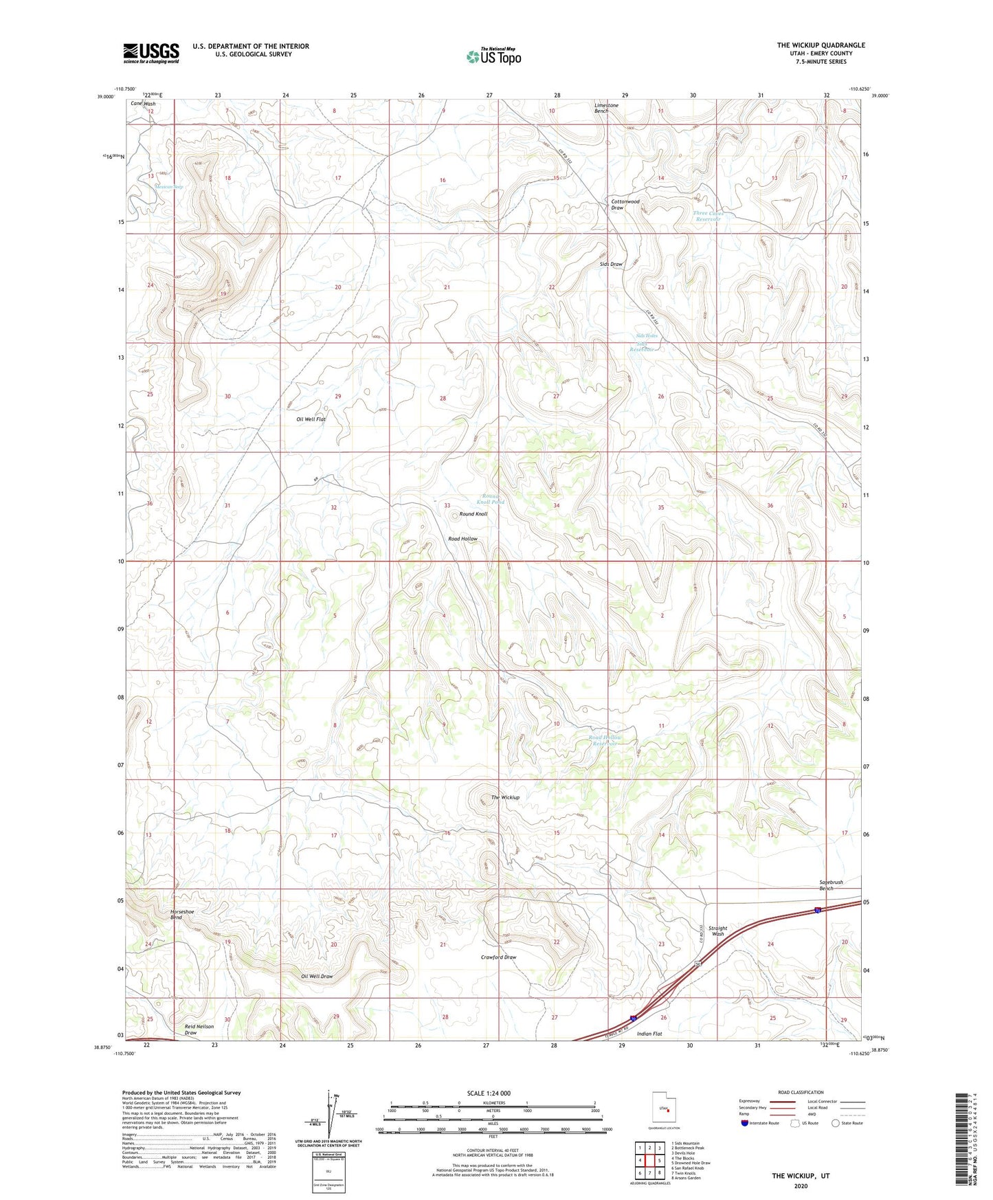
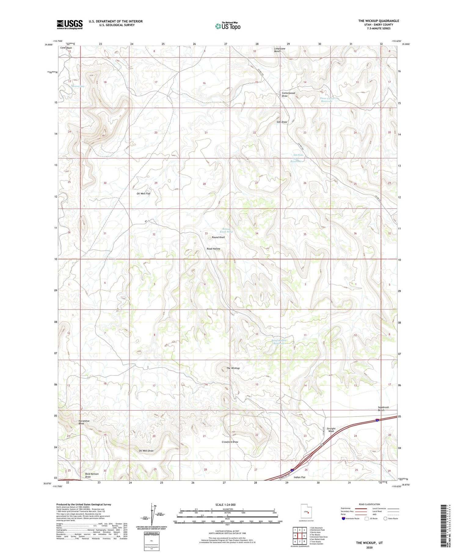
2020 topographic map quadrangle The Wickiup in the state of Utah. Scale: 1:24000. Based on the newly updated USGS 7.5' US Topo map series, this map is in the following counties: Emery. The map contains contour data, water features, and other items you are used to seeing on USGS maps, but also has updated roads and other features. This is the next generation of topographic maps. Printed on high-quality waterproof paper with UV fade-resistant inks.
Quads adjacent to this one:
West: The Blocks
Northwest: Sids Mountain
North: Bottleneck Peak
Northeast: Devils Hole
East: Drowned Hole Draw
Southeast: Arsons Garden
South: Twin Knolls
Southwest: San Rafael Knob
Contains the following named places: Cottonwood Draw, Emery County, Horseshoe Bend, Mexican Seep, Oil Well Flat, Road Hollow, Road Hollow Reservoir, Round Knoll, Round Knoll Pond, Sids Draw, Sids Holes, Sids Reservoir, The Wickiup, Three Coves Reservoir