MyTopo
Ticaboo Mesa Utah US Topo Map
Couldn't load pickup availability
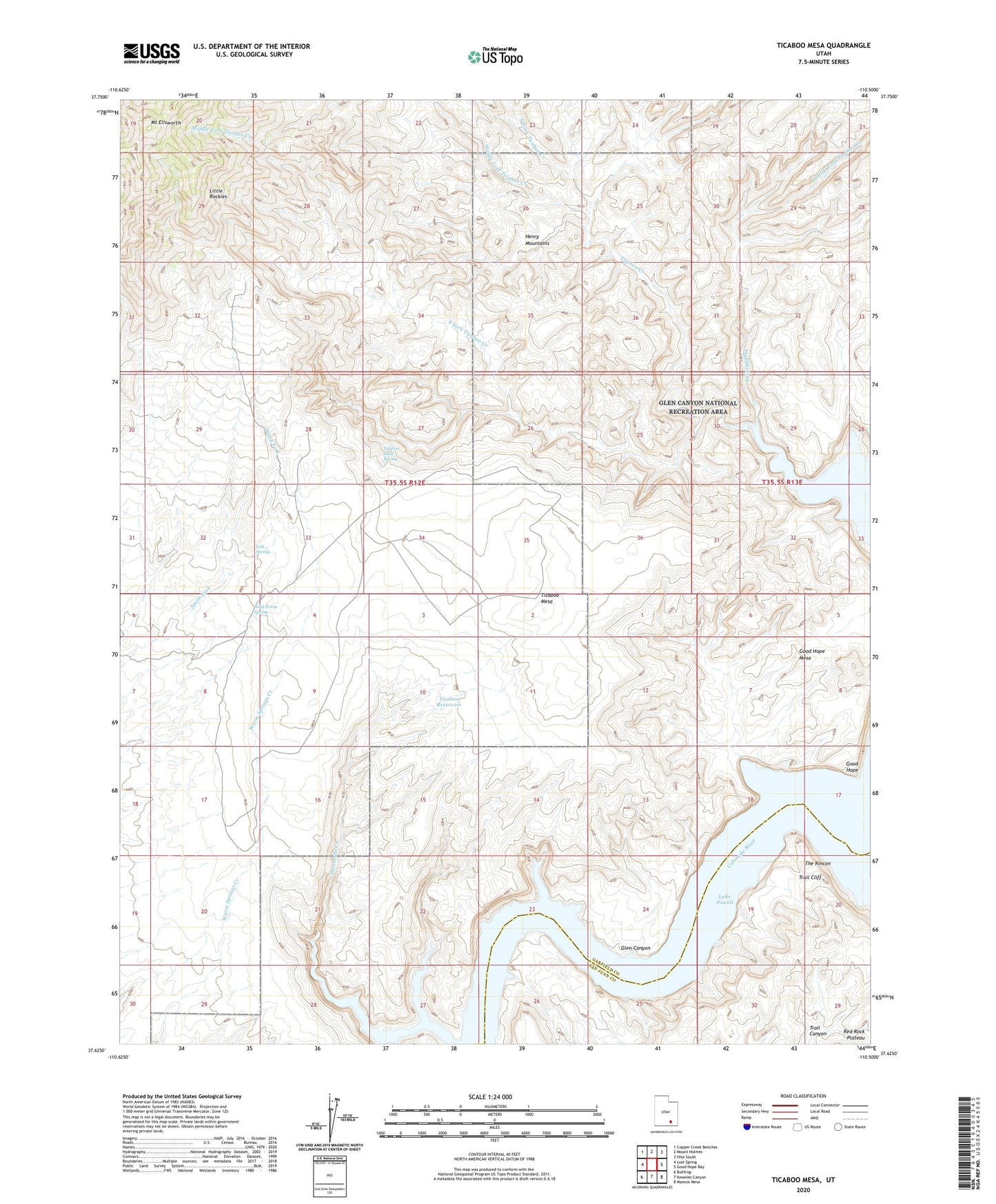
2020 topographic map quadrangle Ticaboo Mesa in the state of Utah. Scale: 1:24000. Based on the newly updated USGS 7.5' US Topo map series, this map is in the following counties: Garfield, San Juan. The map contains contour data, water features, and other items you are used to seeing on USGS maps, but also has updated roads and other features. This is the next generation of topographic maps. Printed on high-quality waterproof paper with UV fade-resistant inks.
Quads adjacent to this one:
West: Lost Spring
Northwest: Copper Creek Benches
North: Mount Holmes
Northeast: Hite South
East: Good Hope Bay
Southeast: Mancos Mesa
South: Knowles Canyon
Southwest: Bullfrog
Contains the following named places: Colt Spring, Good Hope, Good Hope Mesa, Middle Fork Ticaboo Creek, Mount Ellsworth, North Fork Ticaboo Creek, Peshliki Fork, Peshliki Fork Ticaboo Creek, Sevenmile Creek, South Fork Ticaboo Creek, Ticaboo Mesa, Ticaboo Reservoir, Ticaboo Shelf Spring, Trail Cliff, Wild Horse Spring