MyTopo
Vernon Utah US Topo Map
Couldn't load pickup availability
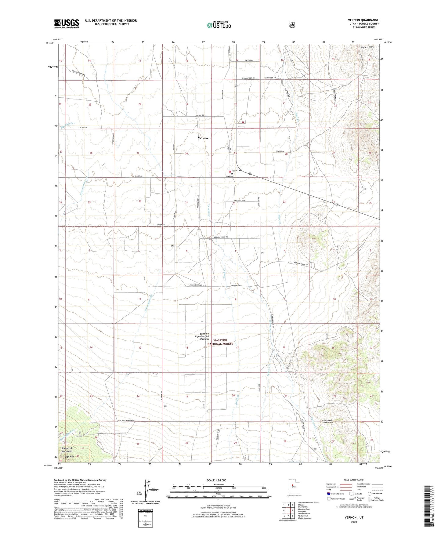
2020 topographic map quadrangle Vernon in the state of Utah. Scale: 1:24000. Based on the newly updated USGS 7.5' US Topo map series, this map is in the following counties: Tooele. The map contains contour data, water features, and other items you are used to seeing on USGS maps, but also has updated roads and other features. This is the next generation of topographic maps. Printed on high-quality waterproof paper with UV fade-resistant inks.
Quads adjacent to this one:
West: Lookout Pass
Northwest: Onaqui Mountains South
North: Faust
Northeast: Vernon NE
East: Lofgreen
Southeast: Sabie Mountain
South: Dutch Peak
Southwest: Erickson Knoll
Contains the following named places: Benmore, Benmore Experiment Station, Benmore Experimental Pastures, Benmore Guard Station, Bennion Creek, Bureau Land Management Fire Station West Desert Vernon Station, Chief Green Jacket Grave, Dutch Creek, East Government Creek, North Oak Brush Creek, Red Pine Creek, The Church of Jesus Christ of Latter Day Saints, Town of Vernon, Vernon, Vernon Airstrip, Vernon Cemetery, Vernon Creek, Vernon Elementary School, Vernon Fire Department, Vernon Post Office, ZIP Code: 84080