MyTopo
Warren Canyon Utah US Topo Map
Couldn't load pickup availability
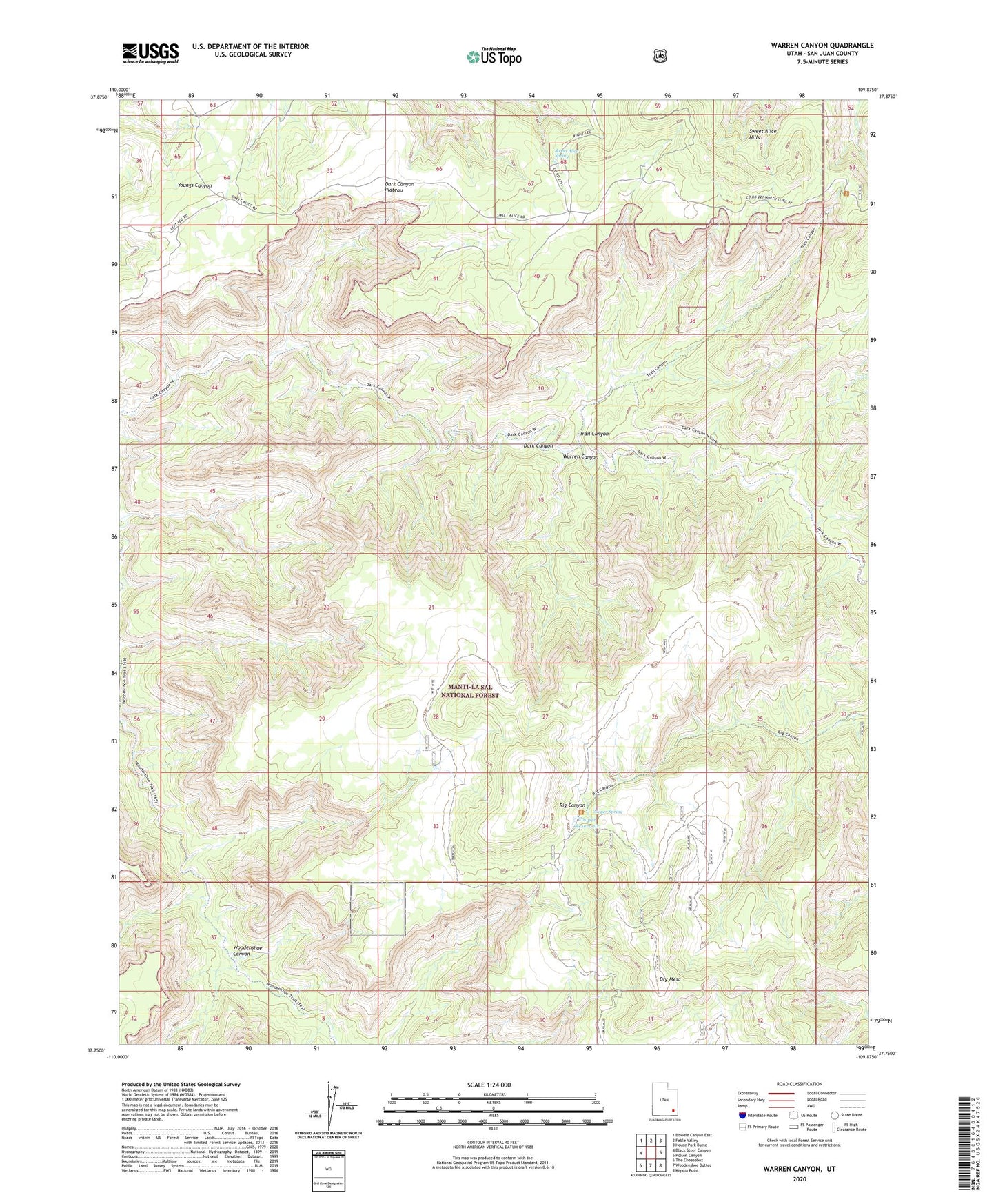
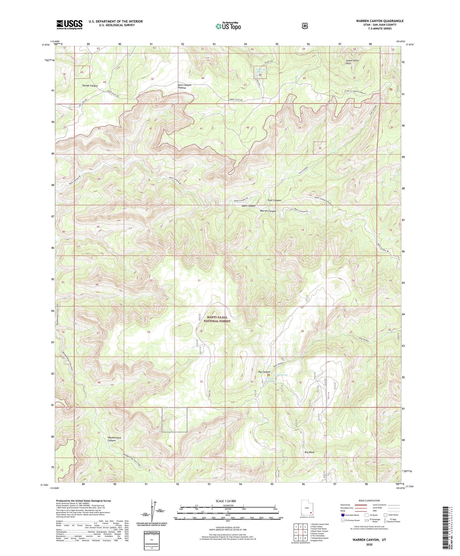
2020 topographic map quadrangle Warren Canyon in the state of Utah. Scale: 1:24000. Based on the newly updated USGS 7.5' US Topo map series, this map is in the following counties: San Juan. The map contains contour data, water features, and other items you are used to seeing on USGS maps, but also has updated roads and other features. This is the next generation of topographic maps. Printed on high-quality waterproof paper with UV fade-resistant inks.
Quads adjacent to this one:
West: Black Steer Canyon
Northwest: Bowdie Canyon East
North: Fable Valley
Northeast: House Park Butte
East: Poison Canyon
Southeast: Kigalia Point
South: Woodenshoe Buttes
Southwest: The Cheesebox
Contains the following named places: Cooper Reservoir, Cooper Spring, Dry Mesa, Sweet Alice Spring, Trail Canyon, Warren Canyon