MyTopo
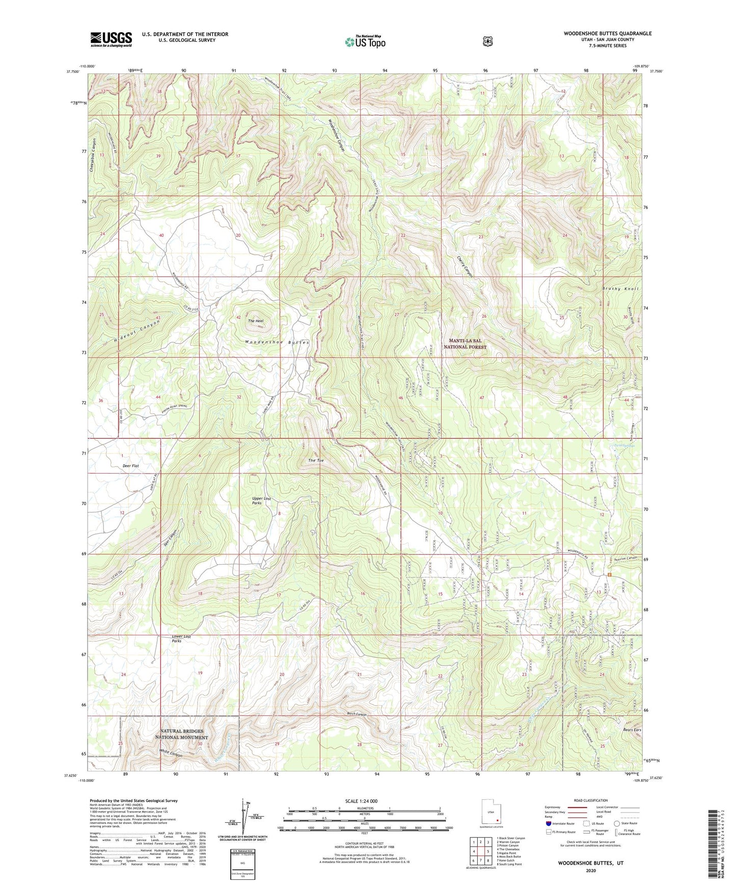
Woodenshoe Buttes Utah US Topo Map
Couldn't load pickup availability
Also explore the Woodenshoe Buttes Forest Service Topo of this same quad for updated USFS data
2023 topographic map quadrangle Woodenshoe Buttes in the state of Utah. Scale: 1:24000. Based on the newly updated USGS 7.5' US Topo map series, this map is in the following counties: San Juan. The map contains contour data, water features, and other items you are used to seeing on USGS maps, but also has updated roads and other features. This is the next generation of topographic maps. Printed on high-quality waterproof paper with UV fade-resistant inks.
Quads adjacent to this one:
West: The Cheesebox
Northwest: Black Steer Canyon
North: Warren Canyon
Northeast: Poison Canyon
East: Kigalia Point
Southeast: South Long Point
South: Kane Gulch
Southwest: Moss Back Butte
This map covers the same area as the classic USGS quad with code o37109f8.
Contains the following named places: Brushy Knoll, Burch Canyon, Cherry Canyon, Cys Monument Mine, Dark Canyon Wilderness, Lower Lost Parks, Pinon Point, The Heel, The Hideout, The Toe, Twin Springs, Upper Lost Parks, Woodenshoe Buttes