MyTopo
Albany Vermont US Topo Map
Couldn't load pickup availability
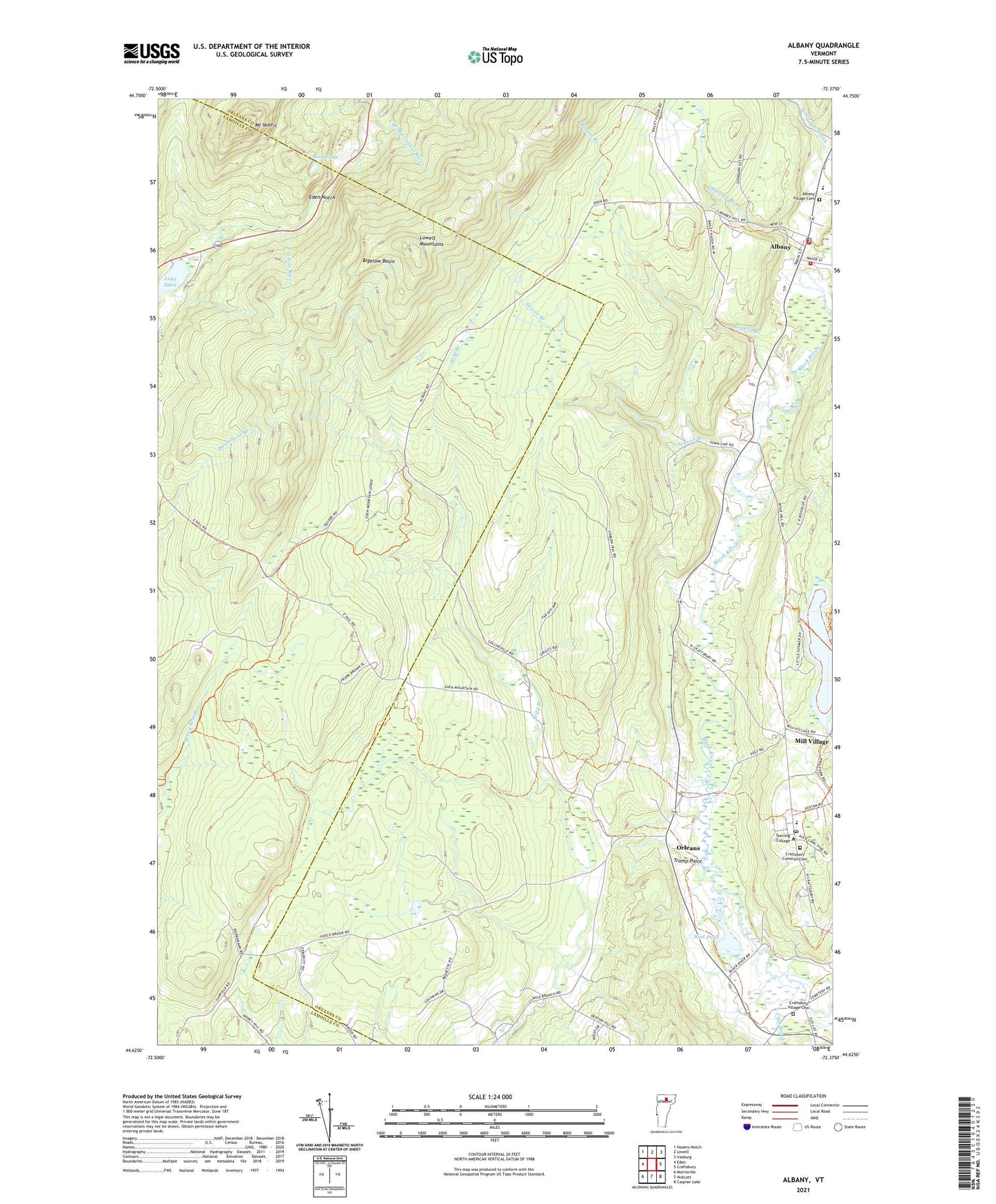
2024 topographic map quadrangle Albany in the state of Vermont. Scale: 1:24000. Based on the newly updated USGS 7.5' US Topo map series, this map is in the following counties: Orleans, Lamoille. The map contains contour data, water features, and other items you are used to seeing on USGS maps, but also has updated roads and other features. This is the next generation of topographic maps. Printed on high-quality waterproof paper with UV fade-resistant inks.
Quads adjacent to this one:
West: Eden
Northwest: Hazens Notch
North: Lowell
Northeast: Irasburg
East: Craftsbury
Southeast: Caspian Lake
South: Wolcott
Southwest: Morrisville
This map covers the same area as the classic USGS quad with code o44072f4.
Contains the following named places: Albany, Albany Community School, Albany Post Office, Albany Village Cemetery, Albany Volunteer Fire Department, Bigelow Basin, Branch School, Cass Brook, Craftsbury Academy, Craftsbury Common, Craftsbury Common Cemetery, Craftsbury Common Congregational Church, Craftsbury Common Post Office, Craftsbury Schools, Craftsbury Village Cemetery, Eden Notch, Little Hosmer Pond, Little Hosmer Pond Dam, Mill Village, Mount Norris, Mount Norris Boy Scout Reservation, Mud Pond, Old Covenater Church, Rogers Branch, Seaver Branch, Shalney Branch, Sterling College, Town of Craftsbury, Tromp Point, Village of Albany, ZIP Codes: 05653, 05826