MyTopo
Wolcott Vermont US Topo Map
Couldn't load pickup availability
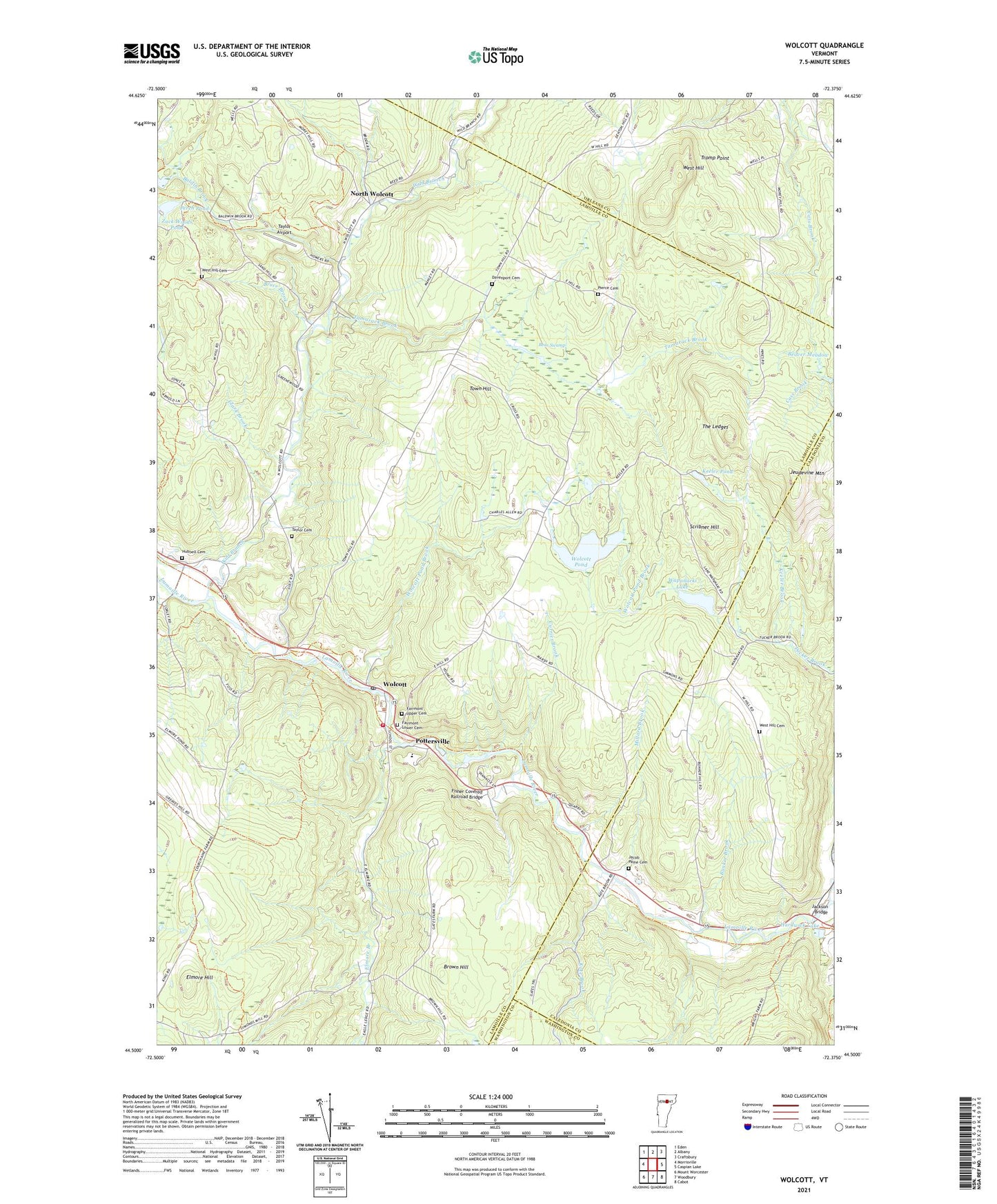
2024 topographic map quadrangle Wolcott in the state of Vermont. Scale: 1:24000. Based on the newly updated USGS 7.5' US Topo map series, this map is in the following counties: Lamoille, Caledonia, Orleans, Washington. The map contains contour data, water features, and other items you are used to seeing on USGS maps, but also has updated roads and other features. This is the next generation of topographic maps. Printed on high-quality waterproof paper with UV fade-resistant inks.
Quads adjacent to this one:
West: Morrisville
Northwest: Eden
North: Albany
Northeast: Craftsbury
East: Caspian Lake
Southeast: Cabot
South: Woodbury
Southwest: Mount Worcester
This map covers the same area as the classic USGS quad with code o44072e4.
Contains the following named places: Baldin Brook, Bear Swamp, Beaver Meadow, Brown Hill, Bruce Brook, Bunker Brook, Camp Wapanacki, Center for Northern Studies, Church of the Nazarene, Clark Brook, Currier Brook, Davenport Cemetery, East Hill Wildlife Management Area, Elmore Branch, Elmore Hill, Fairmont Lower Cemetery, Fairmont Upper Cemetery, Fisher Covered Railroad Bridge, Green Mountain Waldorf School, Hampshire School, Hardwick Lake Dam, Hubbell Cemetery, Jackson Bridge, Jackson School, Jacob Paine Cemetery, Jeudevine Mountain, Kate Brook, Keeler Brook, Keeler Pond, Lamoille River Reservoir, Millard Brook, North Wolcott, Perch Pond, Pierce Cemetery, Pleasant Valley School, Pottersville, Riverside School, Scribner Hill, Tamarack Brook, Taylor Airport, Taylor Cemetery, The Ledges, Town Hill, Town Hill School, Town of Wolcott, Wapanacki Lake, West Hill, West Hill Cemetery, Wild Branch, Wolcott, Wolcott Census Designated Place, Wolcott Dam, Wolcott Elementary School, Wolcott Fire Department, Wolcott Mennonite Church, Wolcott Pond, Wolcott Pond Brook, Wolcott Pond Dam, Wolcott Post Office, ZIP Code: 05680