MyTopo
Barnet Vermont US Topo Map
Couldn't load pickup availability
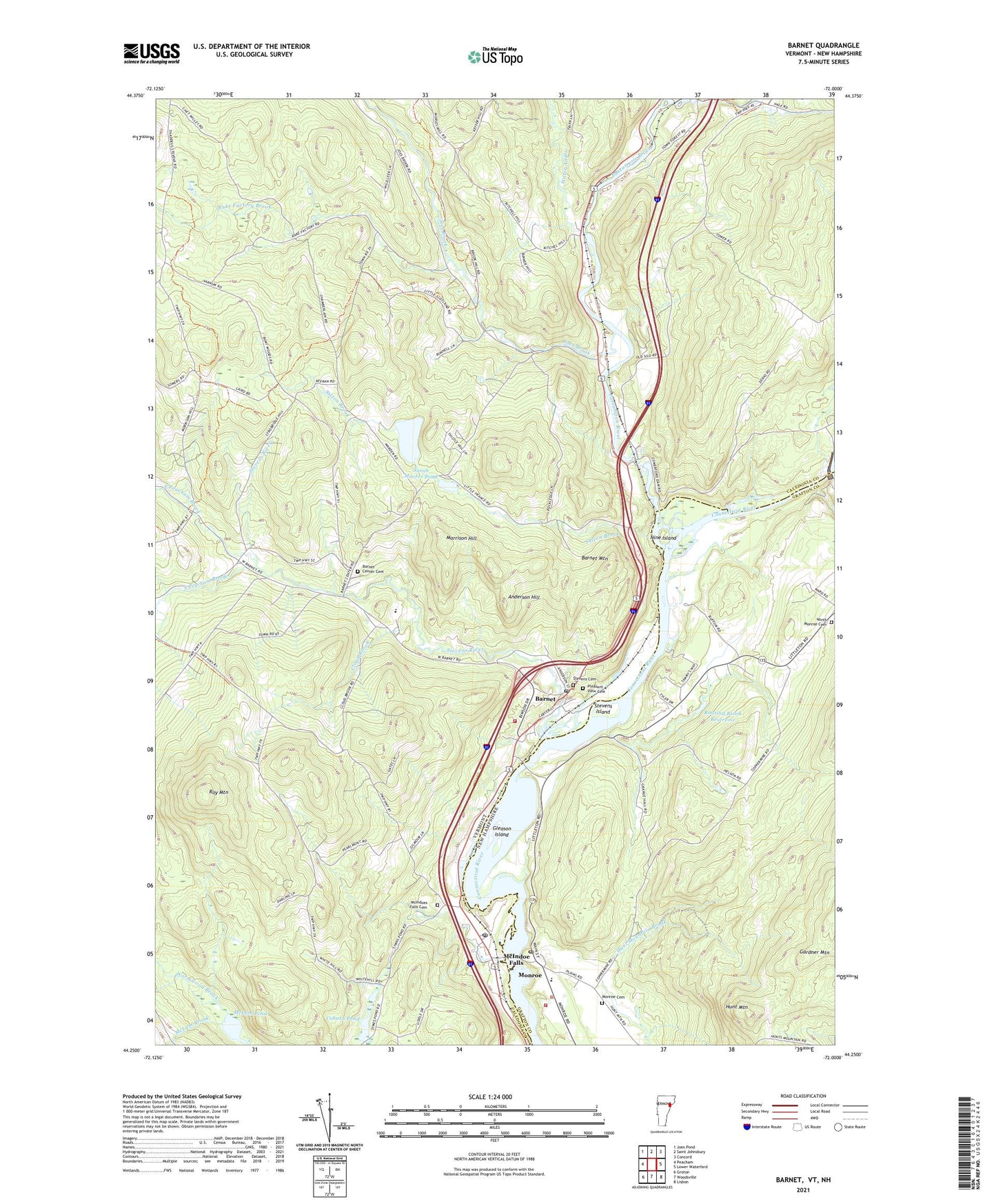
2024 topographic map quadrangle Barnet in the states of New Hampshire, Vermont. Scale: 1:24000. Based on the newly updated USGS 7.5' US Topo map series, this map is in the following counties: Caledonia, Grafton. The map contains contour data, water features, and other items you are used to seeing on USGS maps, but also has updated roads and other features. This is the next generation of topographic maps. Printed on high-quality waterproof paper with UV fade-resistant inks.
Quads adjacent to this one:
West: Peacham
Northwest: Joes Pond
North: Saint Johnsbury
Northeast: Concord
Southeast: Lisbon
South: Woodsville
Southwest: Groton
This map covers the same area as the classic USGS quad with code k44072c1.
Contains the following named places: Anderson Hill, Barnet, Barnet Census Designated Place, Barnet Center, Barnet Center Cemetery, Barnet Elementary School, Barnet Fire and Rescue Department, Barnet Mountain, Barnet Municipal Forest, Barnet Post Office, Barnet Public Library, Cloud Brook, Coburn Pond, Comerford Station Dam, East Barnet Inwood Station, East Peacham Brook, Fifteen-Mile Fall Dam, Four Corners School, Frank D Comerford Hydro-Electric Plant, Gleason Island, Hunt Mountain, Joes Brook, Lamothe Dairy Farm, Mc Indoe Falls Post Office, McIndoe Falls, McIndoes Academy, McIndoes Falls Cemetery, McIndoes Station Dam, McLam Brook, McLam Pond, Milarepa Center, Monroe, Monroe Cemetery, Monroe Consolidated School, Monroe Fire Department Station 1 Headquarters, Monroe First Aid Stabilization Team Squad, Monroe Police Department, Monroe Post Office, Monroe United Methodist Church, Morrison Hill, Nine Island, North Monroe Cemetery, North Monroe Church, Passumpsic River, Pleasant View Cemetery, Rake Factory Brook, Roaring Brook Reservoir, Roy Mountain, Roy Mountain State Wildlife Management Area, Sarah Moores Pond, Scotch United Presbyterian Church, Simpson Brook, Smith Brook, Smutty Hollow, South Peacham Brook, Stevens Cemetery, Stevens Island, Stevens River, Sutton Brook, Town of Barnet, Town of Monroe, Tyler Tree Farm Dam, Wardens Pond, Water Andric, Wormwood Brook, ZIP Codes: 05050, 05821