MyTopo
Groton Vermont US Topo Map
Couldn't load pickup availability
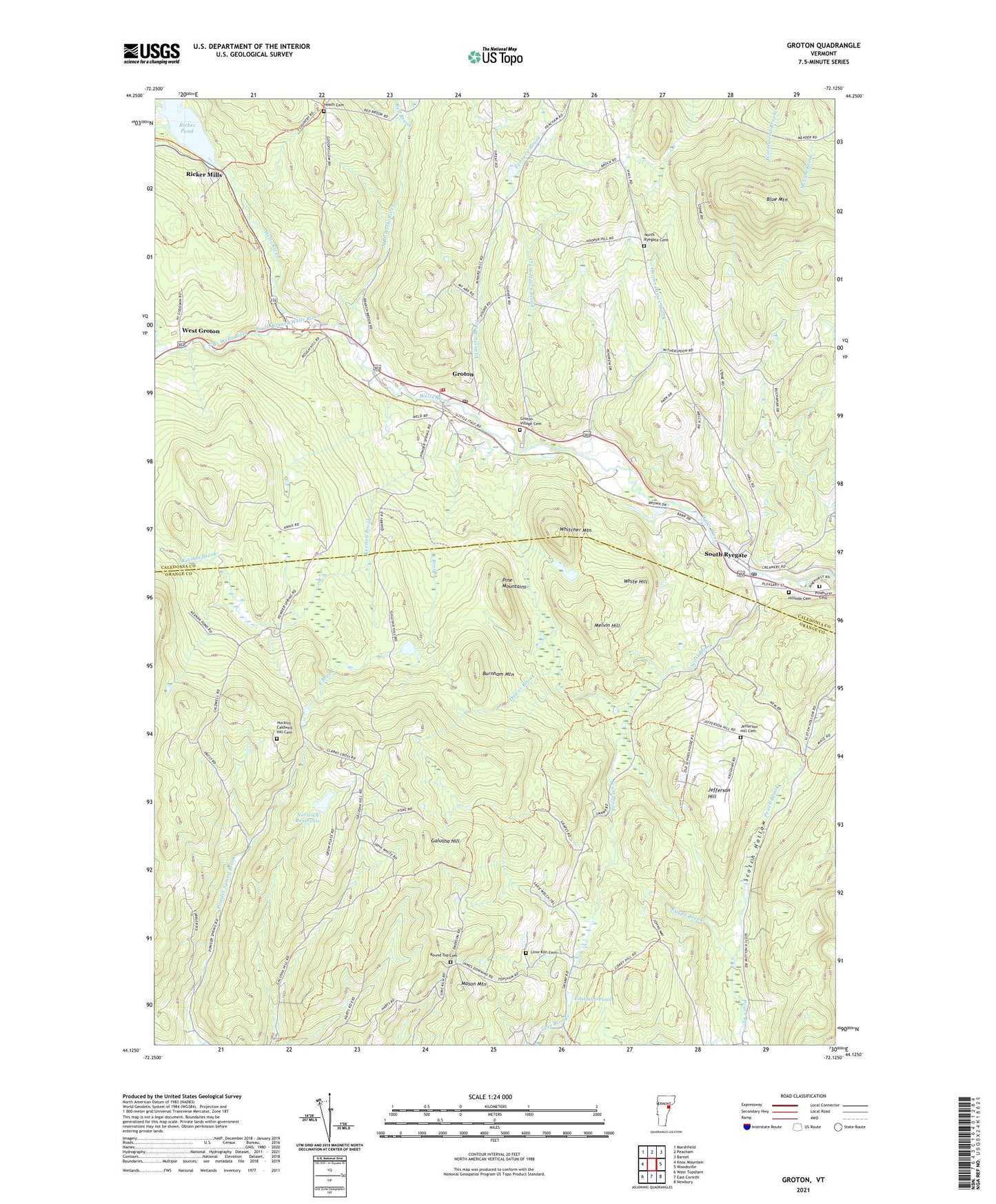
2024 topographic map quadrangle Groton in the state of Vermont. Scale: 1:24000. Based on the newly updated USGS 7.5' US Topo map series, this map is in the following counties: Caledonia, Orange. The map contains contour data, water features, and other items you are used to seeing on USGS maps, but also has updated roads and other features. This is the next generation of topographic maps. Printed on high-quality waterproof paper with UV fade-resistant inks.
Quads adjacent to this one:
West: Knox Mountain
Northwest: Marshfield
North: Peacham
East: Woodsville
South: East Corinth
Southwest: West Topsham
This map covers the same area as the classic USGS quad with code o44072b2.
Contains the following named places: Blue Mountain, Bonazzi Quarry, Burnham Mountain, Clark Hatch Brook, Clark Site Number 2 Dam, Darius James Brook, Dawes Brook, East Brook, Eastman Pond, Egypt Brook, First Baptist Church, Galusha Hill, Gibson Granite Quarry, Groton, Groton - Ryegate Emergency Medical Services, Groton Census Designated Place, Groton Constable, Groton Post Office, Groton Village Cemetery, Groton Volunteer Fire Department, Heath Cemetery, Hillside Cemetery, Huckins - Caldwell Hill Cemetery, Jefferson Hill, Jefferson Hill Cemetery, Keenan Brook, Lime Kiln Cemetery, Lime Kiln School, Mason Mountain, Melvin Hill, Newbury Municipal Forest, North Branch Wells River, North Ryegate Cemetery, Norwich Reservoir, Norwich Reservoir Dam, Pine Mountain Wildlife Management Area, Pine Mountains, Pinehurst Cemetery, Powder Spring Brook, Red Brook, Ricker Mills, Ricker Pond, Round Top Cemetery, Ryegate Quarry, School Number 3, Scotch Hollow, Scott Brook, South Branch Wells River, South Groton School, South Ryegate, South Ryegate Post Office, South Ryegate Presbyterian Church, South Ryegate Public Library, Tannery Brook, Town of Topsham, West Groton, Whitcher Mountain, White Hill, ZIP Codes: 05069, 05076