MyTopo
Lowell Vermont US Topo Map
Couldn't load pickup availability
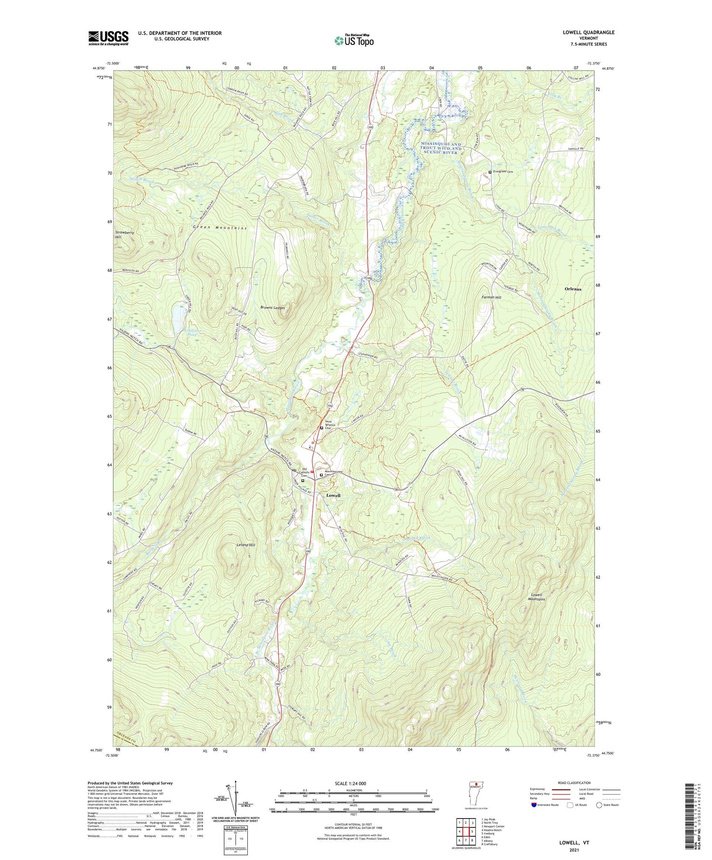
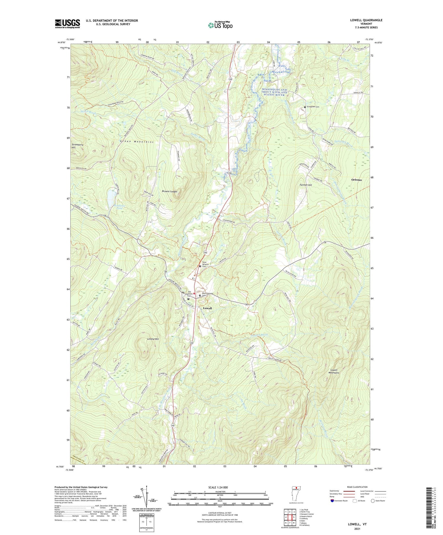
2021 topographic map quadrangle Lowell in the state of Vermont. Scale: 1:24000. Based on the newly updated USGS 7.5' US Topo map series, this map is in the following counties: Orleans, Lamoille. The map contains contour data, water features, and other items you are used to seeing on USGS maps, but also has updated roads and other features. This is the next generation of topographic maps. Printed on high-quality waterproof paper with UV fade-resistant inks.
Quads adjacent to this one:
West: Hazens Notch
Northwest: Jay Peak
North: North Troy
Northeast: Newport Center
East: Irasburg
Southeast: Craftsbury
South: Albany
Southwest: Eden
Contains the following named places: Ace Brook, Browns Ledges, Burgess Branch, East Branch Missisquoi River, Evergreen Cemetery, Farman Hill, Federated Church, Hitchcock School, Le Clair Brook, Leland Hill, Lowell, Lowell Census Designated Place, Lowell Graded School, Lowell Mountains, Lowell Municipal Forest, Lowell Plain, Lowell Post Office, Lowell Volunteer Fire Department, McAllister Pond, Mineral Spring Brook, Mountainview Cemetery, Old Catholic Cemetery, Saint Ignatius Cemetery, Shortsleve Mink Farm, Snider Brook, Tamarack Brook, Town of Lowell, Truland Brook, ZIP Codes: 05820, 05847