MyTopo
Lower Waterford Vermont US Topo Map
Couldn't load pickup availability
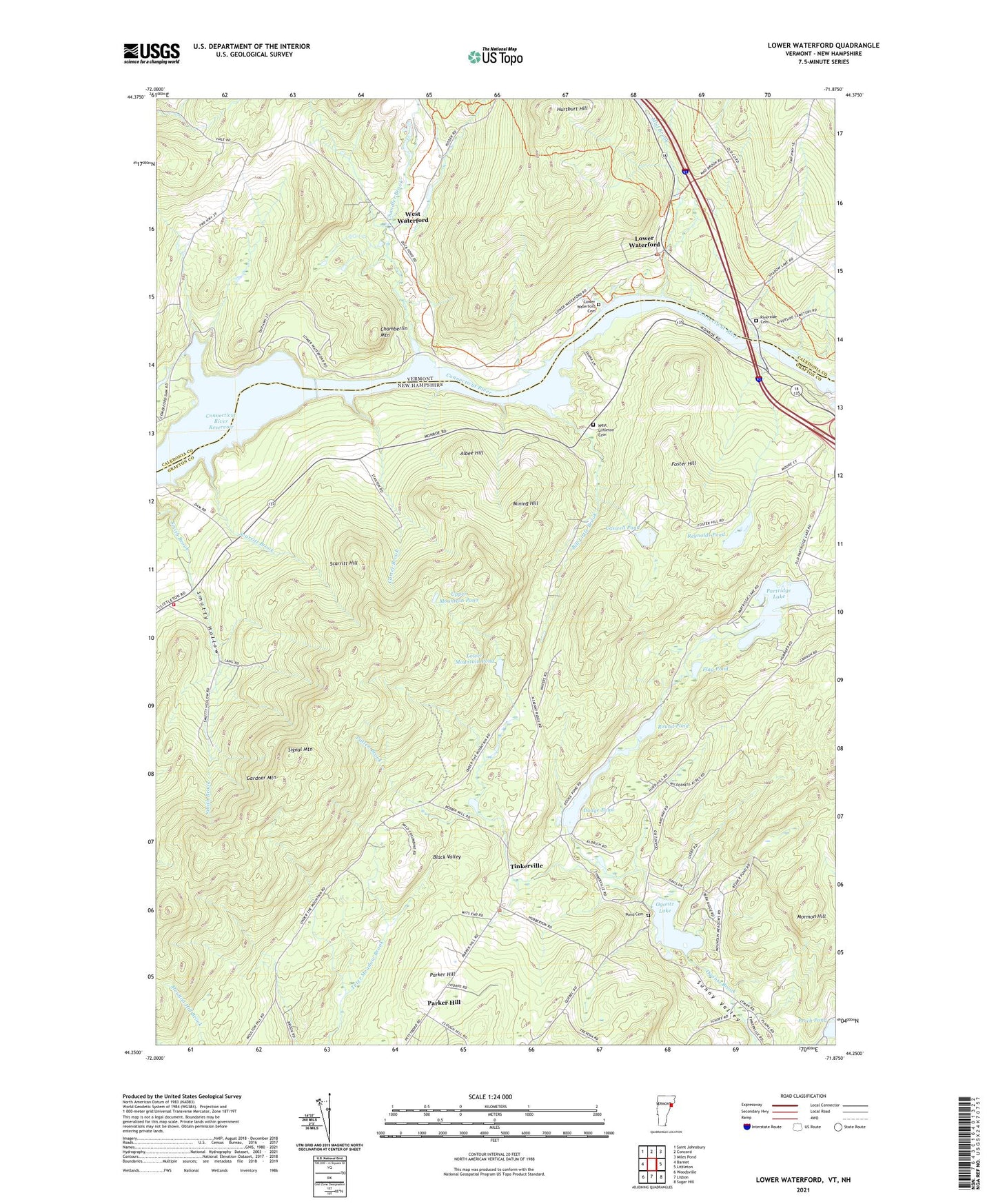
2024 topographic map quadrangle Lower Waterford in the states of New Hampshire, Vermont. Scale: 1:24000. Based on the newly updated USGS 7.5' US Topo map series, this map is in the following counties: Caledonia, Grafton. The map contains contour data, water features, and other items you are used to seeing on USGS maps, but also has updated roads and other features. This is the next generation of topographic maps. Printed on high-quality waterproof paper with UV fade-resistant inks.
Quads adjacent to this one:
Northwest: Saint Johnsbury
North: Concord
Northeast: Miles Pond
East: Littleton
Southeast: Sugar Hill
South: Lisbon
Southwest: Woodsville
This map covers the same area as the classic USGS quad with code o44071c8.
Contains the following named places: Albee Hill, Bill Little Brook, Carter Brook, Caswell Pond, Chamberlin Mountain, Chandler Brook, Connecticut River Reservoir, Dodge Pond, Dodge Pond Dam, Flag Pond, Foster Hill, Gardner Mountain, Hill School, Hurtburt Hill, Lower Mountain Pond, Lower Waterford, Lower Waterford Cemetery, Lower Waterford Post Office, Mad Brook, Mining Hill, Monroe Fire Department Station 2, Mormon Hill, North Monroe School, Ogontz Lake, Ogontz White Mountain Camp, Parker Hill, Partridge Lake, Patten Brook, Perch Pond, Pond Cemetery, Reynolds Pond, Riverside Cemetery, Round Pond, Scarritt Brook, Scarritt Hill, Signal Mountain, Tinkerville, Town of Lyman, Upper Mountain Pond, West Littleton Cemetery, West Waterford, ZIP Code: 03771