MyTopo
Warren Vermont US Topo Map
Couldn't load pickup availability
Also explore the Warren Forest Service Topo of this same quad for updated USFS data
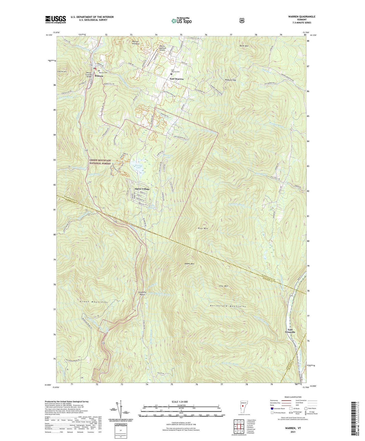
2024 topographic map quadrangle Warren in the state of Vermont. Scale: 1:24000. Based on the newly updated USGS 7.5' US Topo map series, this map is in the following counties: Washington, Addison, Orange. The map contains contour data, water features, and other items you are used to seeing on USGS maps, but also has updated roads and other features. This is the next generation of topographic maps. Printed on high-quality waterproof paper with UV fade-resistant inks.
Quads adjacent to this one:
West: Lincoln
Northwest: Mount Ellen
North: Waitsfield
Northeast: Northfield
East: Roxbury
Southeast: Randolph
South: Hancock
Southwest: Bread Loaf
This map covers the same area as the classic USGS quad with code o44072a7.
Contains the following named places: Adams Mountain, Alpine Village, Austin Brook, Blueberry Lake, Blueberry Lake Ski Touring Center, Bradley Brook, Burnt Mountain, Deer Hollow Brook, East Granville, East Granville Brook, East Warren, East Warren Cemetery, Freeman Brook, Granville Notch, Granville State Reservation, Lake Robinson, Lincoln Brook, Lost Mountain, Mills Brook, Moss Glen Falls, Oles Cross Country Ski Center, Rice Mountain, Roxbury Gap, Sandusky Brook, Stetson Brook, Sugarloaf Mountain, Town of Granville, Town of Warren, United Church, Warren, Warren Cemetery, Warren Covered Bridge, Warren Elementary School, Warren Lake, Warren Lake Dam, Warren Pinnacle, Warren Post Office, Warren Public Library, Warren Volunteer Fire Department, Warren-Sugarbush Airport, ZIP Codes: 05674, 05747