MyTopo
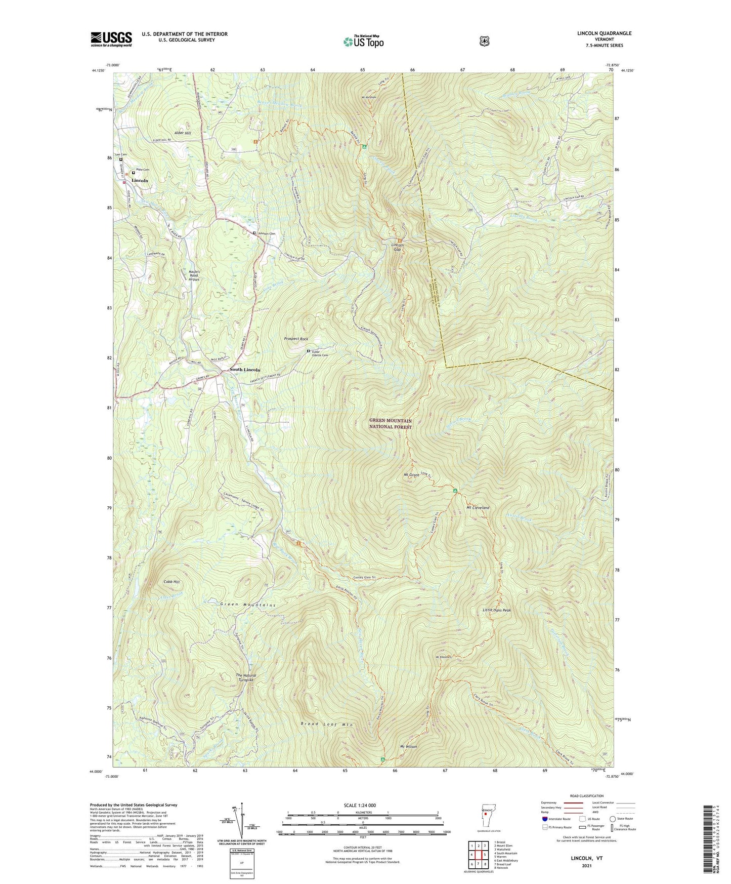
Lincoln Vermont US Topo Map
Couldn't load pickup availability
Also explore the Lincoln Forest Service Topo of this same quad for updated USFS data
2024 topographic map quadrangle Lincoln in the state of Vermont. Scale: 1:24000. Based on the newly updated USGS 7.5' US Topo map series, this map is in the following counties: Addison, Washington. The map contains contour data, water features, and other items you are used to seeing on USGS maps, but also has updated roads and other features. This is the next generation of topographic maps. Printed on high-quality waterproof paper with UV fade-resistant inks.
Quads adjacent to this one:
West: South Mountain
Northwest: Bristol
North: Mount Ellen
Northeast: Waitsfield
East: Warren
Southeast: Hancock
South: Bread Loaf
Southwest: East Middlebury
This map covers the same area as the classic USGS quad with code o44072a8.
Contains the following named places: Alder Hill, Battell Shelter, Battell Trail, Blue Bank Brook, Bread Loaf Mountain, Breadloaf Wilderness, Clark Brook Trail, Cobb Hill, Cooley Glen Shelter, Cooley Glen Trail, Cota Brook, Emily Proctor Shelter, Emily Proctor Trail, Eubar - Odette Cemetery, Johnson Cemetery, Lee Cemetery, Lincoln, Lincoln Census Designated Place, Lincoln Community School, Lincoln Gap, Lincoln United Church, Lincoln Volunteer Fire Department, Little Hans Peak, Maule's Roost Airport, Mount Abraham, Mount Cleveland, Mount Grant, Mount Roosevelt, Mount Wilson, Pope Cemetery, Prospect Rock, South Lincoln, South Lincoln Census Designated Place, The Natural Turnpike, Town of Lincoln