MyTopo
Pico Peak Vermont US Topo Map
Couldn't load pickup availability
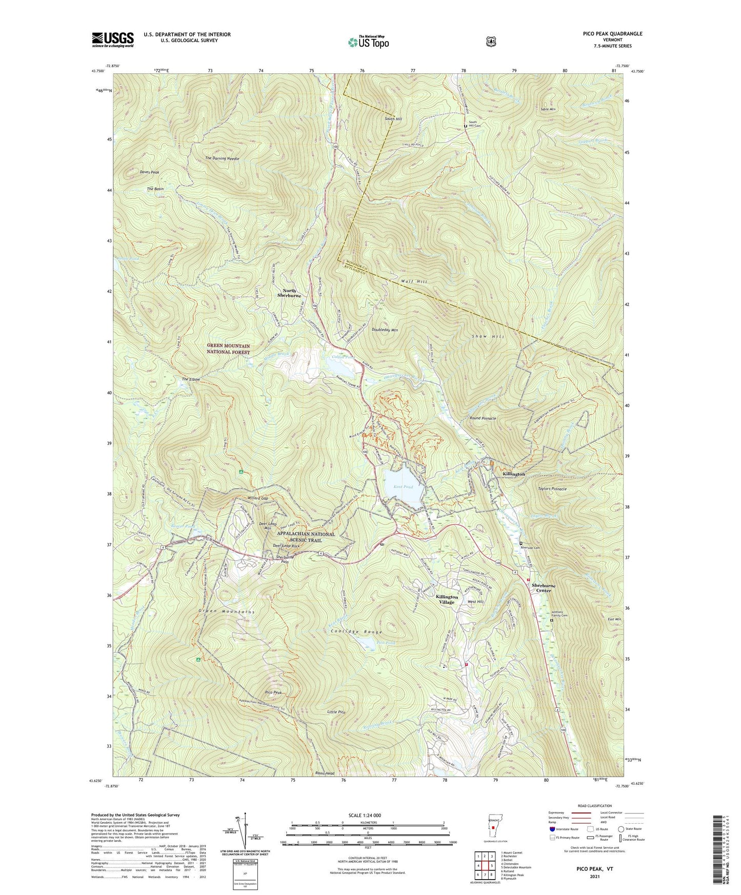
2021 topographic map quadrangle Pico Peak in the state of Vermont. Scale: 1:24000. Based on the newly updated USGS 7.5' US Topo map series, this map is in the following counties: Rutland, Windsor. The map contains contour data, water features, and other items you are used to seeing on USGS maps, but also has updated roads and other features. This is the next generation of topographic maps. Printed on high-quality waterproof paper with UV fade-resistant inks.
Quads adjacent to this one:
West: Chittenden
Northwest: Mount Carmel
North: Rochester
Northeast: Bethel
East: Delectable Mountain
Southeast: Plymouth
South: Killington Peak
Southwest: Rutland
Contains the following named places: Anthony Family Cemetery, Beaver Pond, Beaver Pond Dam, Brimstone Brook, Circle Trail, Colony Club, Colton Pond, Colton Pond Dam, Daves Peak, Deer Leap Mountain, Deer Leap Rock, Doubleday Mountain, East Mountain, Gifford Woods Natural Area, Giffords Woods State Forest Park, Green Mountain Golf Course, Jimmy Dean Brook, Johnson Brook, Kent Brook, Kent Pond, Kent Pond Dam, Killington, Killington Basin Ski Center, Killington Fire And Rescue Station 1, Killington Fire And Rescue Station 2, Killington Golf Course, Killington Mountain School, Killington Post Office, Killington Village, Killington Village Census Designated Place, Lew Newall Wildlife Management Area, Little Pico, Middle Brook, Mountain Meadows Ski Touring Center, North Sherburne, Pico Peak, Pico Peak Ski Area, Pico Peak Winter Sprorts Area, Pico Pond, Pico Trail Shelter, Quimby Brook, Quimby Mountain, Rams Head, Riverside Cemetery, Roaring Brook, Rolston Rest Shelter, Round Pinnacle, Sable Mountain, Shaw Hill, Shaw Hill Brook, Sherburne Center, Sherburne Center Post Office, Sherburne Church of Christ, Sherburne Corporation Site 1 Dam, Sherburne Elementary School, Sherburne Pass, Sherburne Town Hall, Sherburne Valley School, Sherburne Volunteer Fire Department, South Hill, South Hill Cemetery, South Pond, Taylor Brook, Taylors Pinnacle, Telefon Trail, Telemark Village, The Basin, The Darning Needle, The Elbow, The Woods, Town of Killington, Tucker Johnson Shelter, Valley Park, West Hill, Willard Gap, Wolf Hill, WRUT-FM (West Rutland), ZIP Code: 05751