MyTopo
Mount Carmel Vermont US Topo Map
Couldn't load pickup availability
Also explore the Mount Carmel Forest Service Topo of this same quad for updated USFS data
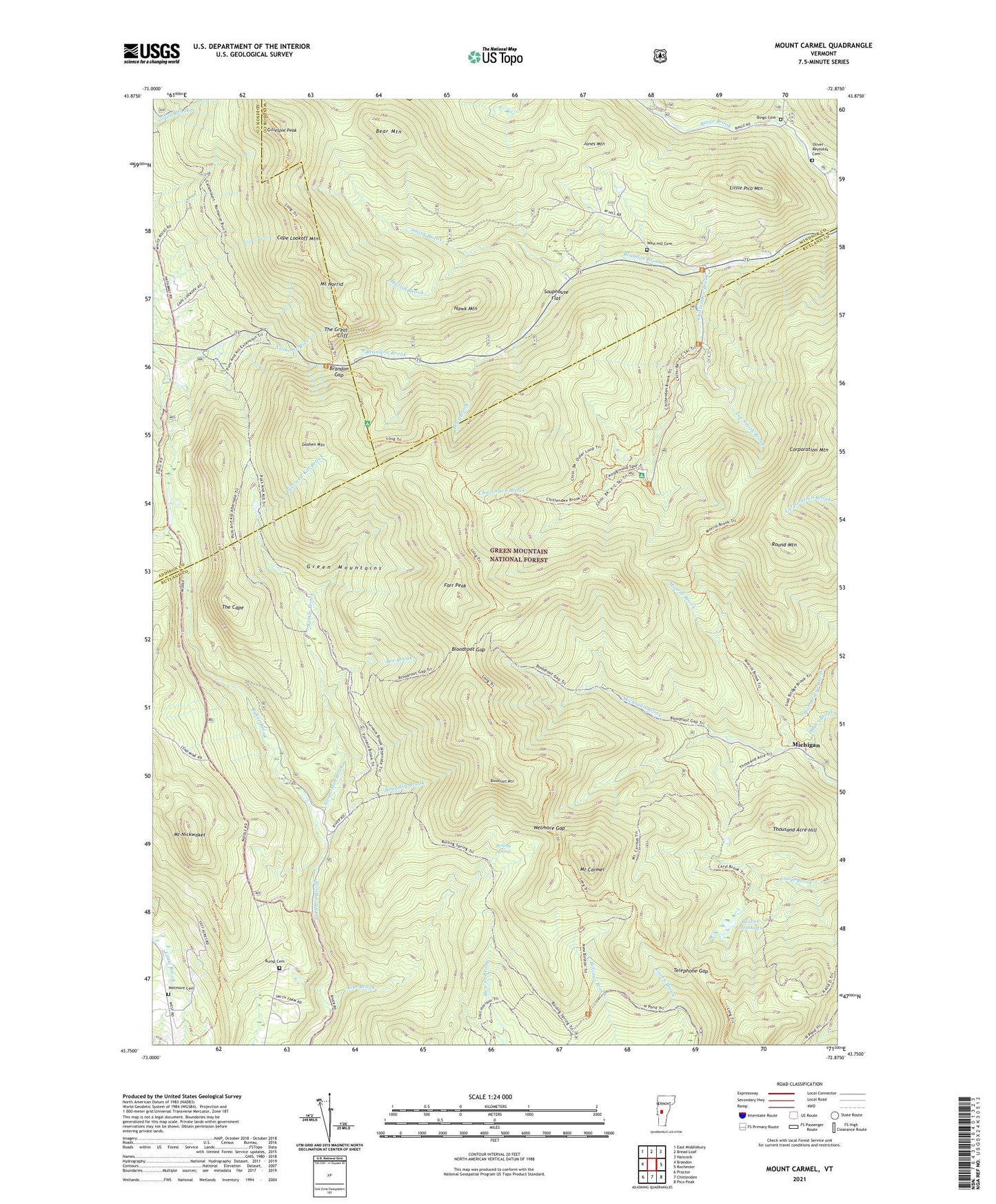
2024 topographic map quadrangle Mount Carmel in the state of Vermont. Scale: 1:24000. Based on the newly updated USGS 7.5' US Topo map series, this map is in the following counties: Rutland, Windsor, Addison. The map contains contour data, water features, and other items you are used to seeing on USGS maps, but also has updated roads and other features. This is the next generation of topographic maps. Printed on high-quality waterproof paper with UV fade-resistant inks.
Quads adjacent to this one:
West: Brandon
Northwest: East Middlebury
North: Bread Loaf
Northeast: Hancock
East: Rochester
Southeast: Pico Peak
South: Chittenden
Southwest: Proctor
This map covers the same area as the classic USGS quad with code o43072g8.
Contains the following named places: Baker Brook, Bear Brook, Bear Mountain, Beaudry Brook, Beaver Meadows, Bee Brook, Bingo Cemetery, Bloodroot Gap, Bloodroot Mountain, Bloodroot Mountain Trail, Boiling Spring, Brandon Brook Picnic Ground, Brandon Gap, Bump Cemetery, Cape Lookoff Mountain, Carmel Camp, Chittenden Brook, Chittenden Brook Campground, Chittenden Brook Cross-Country Ski Trail, Chittenden Brook Trail, Corporation Mountain, Farr Peak, Gillespie Peak, Goshen Four Corners, Goshen Mountain, Hawk Mountain, Hayes Brook, Horrid Brook, Joe Smith Brook, Jones Mountain, Kettle Brook, Kiln Brook, Little Pico Mountain, Michigan, Michigan Brook, Morrill Brook, Mount Carmel, Mount Carmel State Forest, Mount Horrid, Mount Nickwaket, New Boston Trail, Oliver Reynolds Cemetery, Perkins Brook, Pine Brook, Proctor Village Municipal Forest, Puss and Kill Brook, Round Mountain, Slab Bridge Brook, Smith Brook, Souphouse Flat, Steam Mill Brook, Sunrise Camp, Telephone Gap, The Cape, The Great Cliff, Thousand Acre Hill, Town of Chittenden, West Hill Cemetery, West Hill School, Wetmore Cemetery, Wetmore Gap, Wetmore Gap Trail, ZIP Code: 05737