MyTopo
Roxbury Vermont US Topo Map
Couldn't load pickup availability
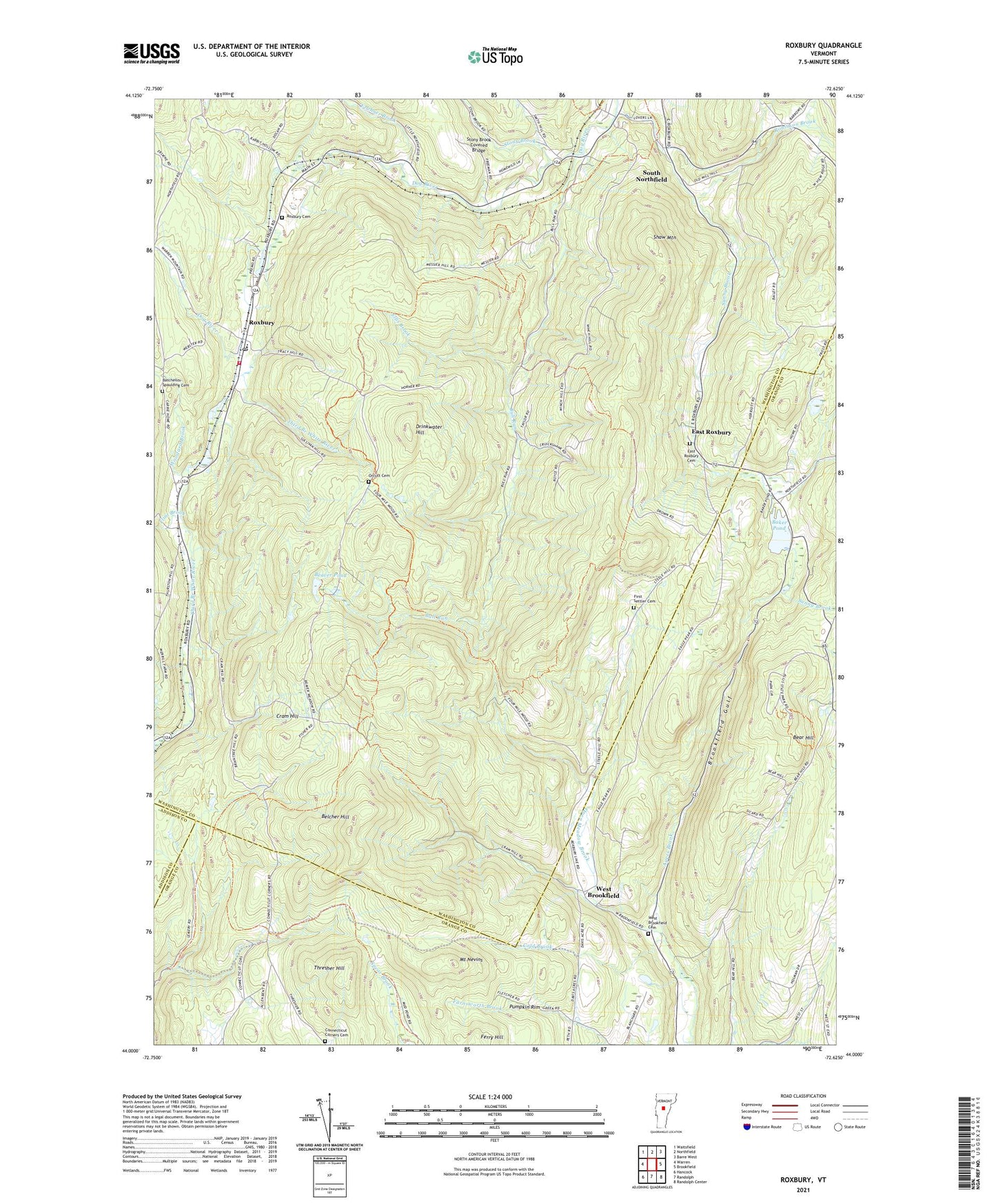
2024 topographic map quadrangle Roxbury in the state of Vermont. Scale: 1:24000. Based on the newly updated USGS 7.5' US Topo map series, this map is in the following counties: Washington, Orange, Addison. The map contains contour data, water features, and other items you are used to seeing on USGS maps, but also has updated roads and other features. This is the next generation of topographic maps. Printed on high-quality waterproof paper with UV fade-resistant inks.
Quads adjacent to this one:
West: Warren
Northwest: Waitsfield
North: Northfield
Northeast: Barre West
East: Brookfield
Southeast: Randolph Center
South: Randolph
Southwest: Hancock
This map covers the same area as the classic USGS quad with code o44072a6.
Contains the following named places: Allis State Park, Baker Pond, Baker Pond Dam, Batchellor-Spaulding Cemetery, Bear Hill, Bear Hill School, Bear Hill Trail, Beaver Pond, Belcher Hill, Brookfield Gulf, Bull Run, Bull Run School, Camp Wihakowi, Cold Brook, Connecticut Corners Cemetery, Cram Hill, Drinkwater Hill, East Roxbury, East Roxbury Cemetery, Ellis Brook, Felchner Brook, First Settler Cemetery, Flint Brook, Harlow Bridge School, Mount Nevins, Northfield Golf Course, Open Meadow Brook, Orcutt Cemetery, Pumpkin Rim, Rabbit Hollow School, Robinson Brook, Roxbury, Roxbury Cemetery, Roxbury Flat, Roxbury Post Office, Roxbury State Forest, Roxbury Village School, Roxbury Volunteer Fire Department, Shaw Mountain, South Northfield, State of Vermont, Stony Brook, Stony Brook Covered Bridge, Sunny Brook, Teela Wooket Camp, Thresher Hill, Town of Roxbury, Wardner Pond, West Brookfield, West Brookfield Cemetery, West Street School, Woodard Brook, ZIP Code: 05669