MyTopo
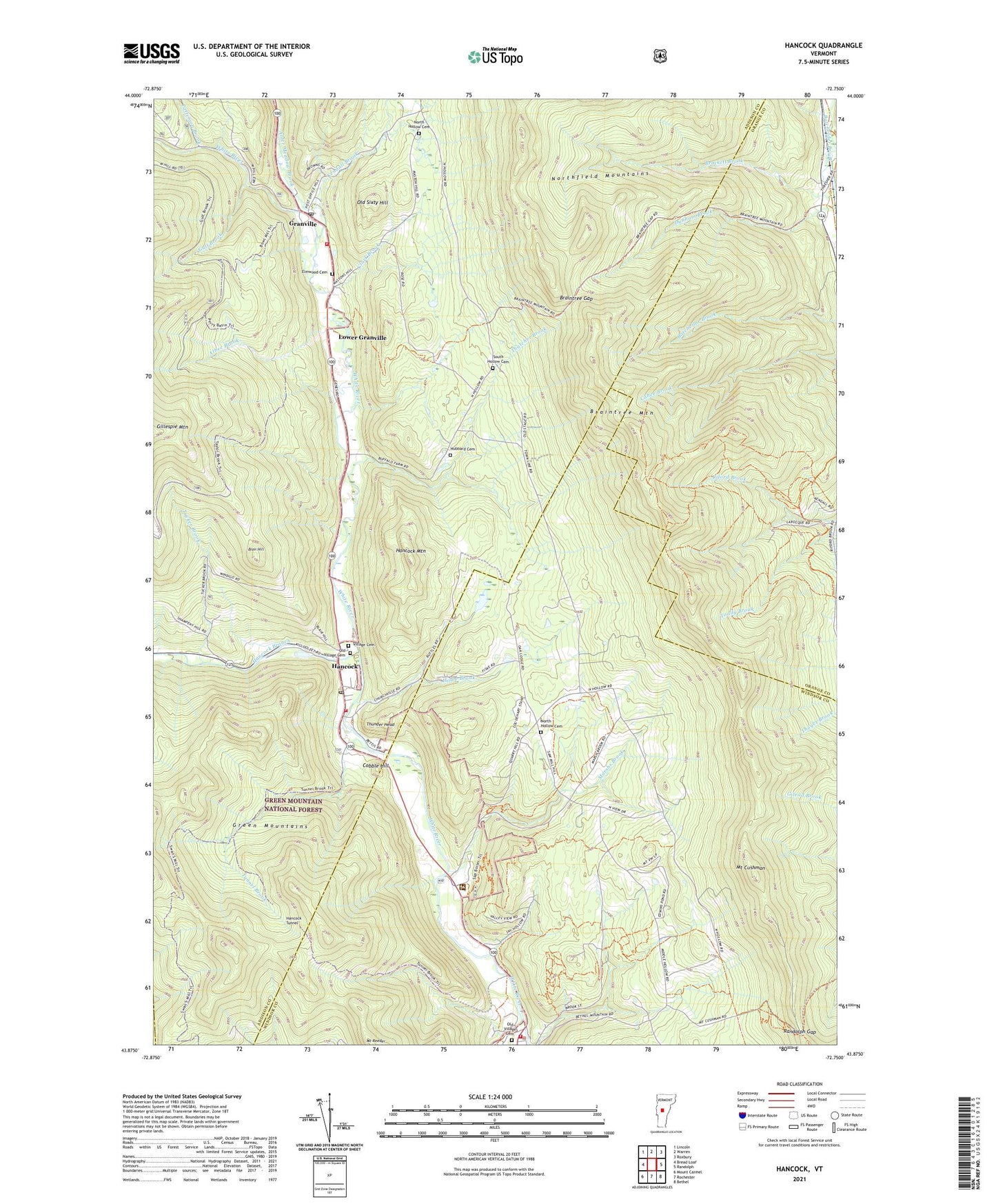
Hancock Vermont US Topo Map
Couldn't load pickup availability
Also explore the Hancock Forest Service Topo of this same quad for updated USFS data
2024 topographic map quadrangle Hancock in the state of Vermont. Scale: 1:24000. Based on the newly updated USGS 7.5' US Topo map series, this map is in the following counties: Addison, Windsor, Orange. The map contains contour data, water features, and other items you are used to seeing on USGS maps, but also has updated roads and other features. This is the next generation of topographic maps. Printed on high-quality waterproof paper with UV fade-resistant inks.
Quads adjacent to this one:
West: Bread Loaf
Northwest: Lincoln
North: Warren
Northeast: Roxbury
East: Randolph
Southeast: Bethel
South: Rochester
Southwest: Mount Carmel
This map covers the same area as the classic USGS quad with code o43072h7.
Contains the following named places: Albee Brook, Alder Meadow Brook, Batchelder Brook, Blair Hill, Braintree Gap, Braintree Mountain, Camp Killooleet, Clark Brook, Cobble Hill, Elmwood Cemetery, Granville, Granville Post Office, Granville Village School, Granville Volunteer Fire Department, Gulf Brook, Hancock, Hancock Branch, Hancock Fire Station, Hancock Free Public Library, Hancock Mountain, Hancock Post Office, Hancock Tunnel, Hancock Village School, Howe Brook, Hubbard Cemetery, Kendall Brook, Lower Granville, Marshs Brook, Mount Cushman, Mount Cushman State Park, Mountain Trails Campground, North Hollow Cemetery, North Hollow School, Old Sixty Hill, Old Village Cemetery, Patterson Brook, Randolph Gap, Rochester Volunteer Fire Department, South Hollow Cemetery, Thatcher Brook, Thunder Head, Town of Rochester, Tucker Brook, Tunnel Brook, Valley Rescue Squad, Village Cemetery, ZIP Code: 05767