MyTopo
Randolph Vermont US Topo Map
Couldn't load pickup availability
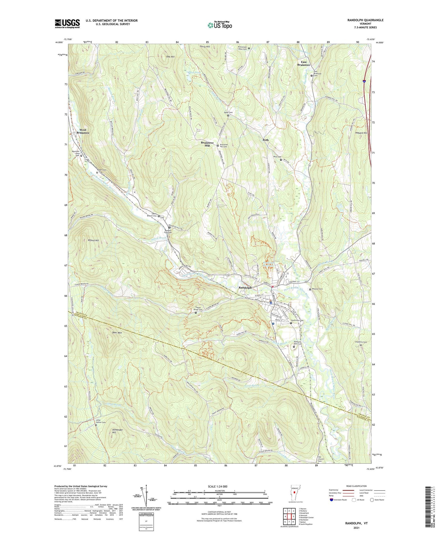
2024 topographic map quadrangle Randolph in the state of Vermont. Scale: 1:24000. Based on the newly updated USGS 7.5' US Topo map series, this map is in the following counties: Orange, Windsor. The map contains contour data, water features, and other items you are used to seeing on USGS maps, but also has updated roads and other features. This is the next generation of topographic maps. Printed on high-quality waterproof paper with UV fade-resistant inks.
Quads adjacent to this one:
West: Hancock
Northwest: Warren
North: Roxbury
Northeast: Brookfield
East: Randolph Center
Southeast: South Royalton
South: Bethel
Southwest: Rochester
This map covers the same area as the classic USGS quad with code o43072h6.
Contains the following named places: Adams Brook, Alexander Hill, Ayers Brook, Batchellor Brook, Battles Brook, Battles School, Beanville, Beanville School, Bethany Parish House, Bethany United Church of Christ, Bethel Gilead, Brackett Brook, Braintree Church, Braintree Elementary School, Braintree Hill, Braintree Hill Cemetery, Brown Cemetery, Burridge School, Cahee Brook, Chadwick Cemetery, Chandler Music Hall and Gallery, Christ Covenant School of Randolph, Christian Science Society, Deer Mountain, Depot Square Historic District, Dowdey Corner, Dunham Brook, East Braintree, East Braintree Cemetery, Farnsworth Brook, Ferry Hill, Flint Brook, General Thomas Monument, Gifford Medical Center, Gifford Memorial Hospital Health Information Center, Green Mountain Touring Center, Hebard Hill, Hutchinson - Mann Cemetery, Justin Morgan Christian School, Kimball Public Library, Little Hollow Cemetery, Lower Branch, Lower Branch Cemetery, Maple Brook, Mobile Acres Trailer Park, Montague Golf Course, Moulton Cemetery, Mountain View Cemetery, Mud Pond, Oak Hill, Old Church, Peth, Peth Cemetery, Pleasant View Cemetery, Randolph, Randolph Census Designated Place, Randolph Center Historic District, Randolph Chamber of Commerce, Randolph Elementary School, Randolph Municipal Forest, Randolph Police Department, Randolph Post Office, Randolph Reservoir, Randolph Schools, Randolph Technical Career Center, Randolph Town Hall, Randolph Union High School, Randolph Village Fire Department, Randolph-Town Recreation Center, Riford Brook, Riford Hill, Roswell Ford Cemetery, Saint Johns Episcopal Church, Saints Donatian and Rogatian Catholic Church, Smith Brook, South Branch School, Southview Cemetery, Spear Brook, Spear Cemetery, Thayer Brook, Thayer Brook Cemetery, Toddy Brook, Town of Braintree, Trout Brook, United Church of Randolph, West Braintree, WWWT-AM (Randolph), ZIP Code: 05060