MyTopo
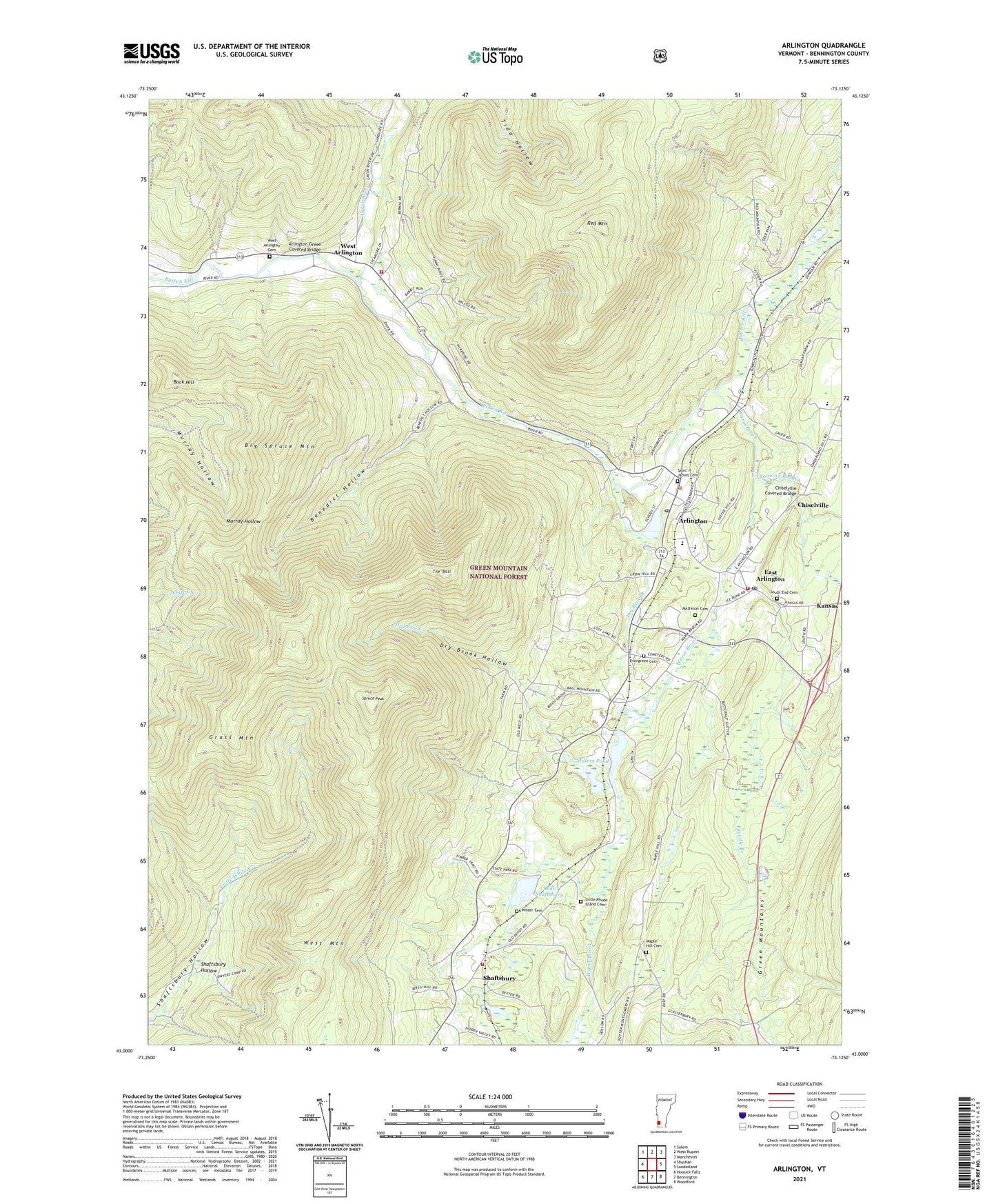
Arlington Vermont US Topo Map
Couldn't load pickup availability
Also explore the Arlington Forest Service Topo of this same quad for updated USFS data
2024 topographic map quadrangle Arlington in the state of Vermont. Scale: 1:24000. Based on the newly updated USGS 7.5' US Topo map series, this map is in the following counties: Bennington. The map contains contour data, water features, and other items you are used to seeing on USGS maps, but also has updated roads and other features. This is the next generation of topographic maps. Printed on high-quality waterproof paper with UV fade-resistant inks.
Quads adjacent to this one:
West: Shushan
Northwest: Salem
North: West Rupert
Northeast: Manchester
East: Sunderland
Southeast: Woodford
South: Bennington
Southwest: Hoosick Falls
This map covers the same area as the classic USGS quad with code o43073a2.
Contains the following named places: Arlington, Arlington Census Designated Place, Arlington Fire Department - East Station, Arlington Fire Department - West Station, Arlington Green Covered Bridge, Arlington Memorial High School, Arlington Municipal Forest, Arlington Post Office, Arlington Rescue Squad, Arlington State Forest, Arlington Town Hall, Arlington Village Historic District, Battenkill Valley Supervisory Union, Beaver Meadow Brook, Benedict Hollow, Big Spruce Mountain, Buck Hill, Camp Avalon, Camping on the Batten Kill Campground, Chiselville, Chiselville Covered Bridge, Dry Brook, Dry Brook Hollow, East Arlington, East Arlington Federated Church, East Arlington Post Office, Evergreen Cemetery, Fayville Branch, Fisher Elementary School, Grass Mountain, Green River, Grove Picnic Shelter, Healing Springs Nature Trail, Hidden Valley, Howells Camping Area, Kansas, Lake Shaftsbury, Lake Shaftsbury Dam, Little Rhode Island Cemetery, Maple Hill Cemetery, Martha Canfield Memorial Free Library, Matteson Cemetery, Millers Pond, Millers Pond Dam, Mount Pleasant School, Peter Matteson Tavern, Red Mountain, Redeemer Lutheran Church, Roaring Branch, Saint James Cemetery, Saint James Episcopal Church, Shaftsburg State Park, Shaftsbury, Shaftsbury Fire Department Station 2, Shaftsbury State Park, South End Cemetery, Spruce Peak, Sunderland Elementary School, The Arlington Gallery, The Ball, Topping Tavern Museum, Town of Arlington, Vermont Healing Springs, Warm Brook, West Arlington, West Arlington Cemetery, West Arlington Methodist Church, West Mountain, Wilder Cemetery, ZIP Code: 05250