MyTopo
South Royalton Vermont US Topo Map
Couldn't load pickup availability
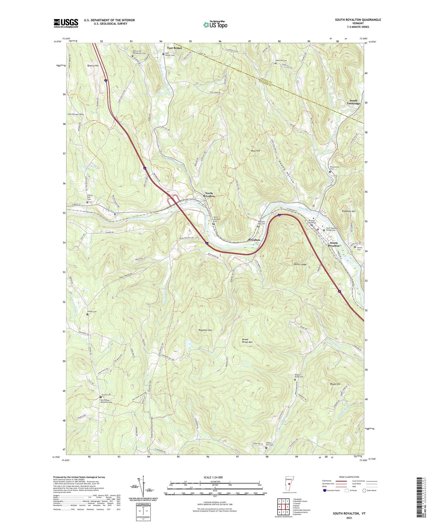
2024 topographic map quadrangle South Royalton in the state of Vermont. Scale: 1:24000. Based on the newly updated USGS 7.5' US Topo map series, this map is in the following counties: Windsor, Orange. The map contains contour data, water features, and other items you are used to seeing on USGS maps, but also has updated roads and other features. This is the next generation of topographic maps. Printed on high-quality waterproof paper with UV fade-resistant inks.
Quads adjacent to this one:
West: Bethel
Northwest: Randolph
North: Randolph Center
Northeast: Chelsea
East: Sharon
Southeast: Quechee
South: Woodstock North
Southwest: Delectable Mountain
This map covers the same area as the classic USGS quad with code o43072g5.
Contains the following named places: Ansel Pond, Ashley - Ellis Cemetery, Boyds Hill, Branchview Cemetery, Broad Brook Cemetery, Broad Brook Mountain, Cherry Hill Cemetery, East Bethel, East Bethel Cemetery, Elephant Hill, First Branch White River, Happy Hollow, Haven Cemetery, Hickey Cemetery, Julian and Virginia Cornell Library, Kents Ledge, Lone Oak Farm, North Road - Methodist Cemetery, North Royalton, North Royalton Cemetery, Pleasant Hill Cemetery, Quarry Hill, Quarry Hill - Woodworth Cemetery, Royalton, Royalton Hill, Russ Hill, Russell Brook, Second Branch White River, Sewall Brook, South Royalton, South Royalton Census Designated Place, South Royalton Fire Department, South Royalton Post Office, South Royalton School, South Royalton Village Cemetery, South Tunbridge, Town of Royalton, Vermont Law School, Vermont State Police Troop B Royalton Barracks, Ward Hill Cemetery, ZIP Code: 05068