MyTopo
Ballsville Virginia US Topo Map
Couldn't load pickup availability
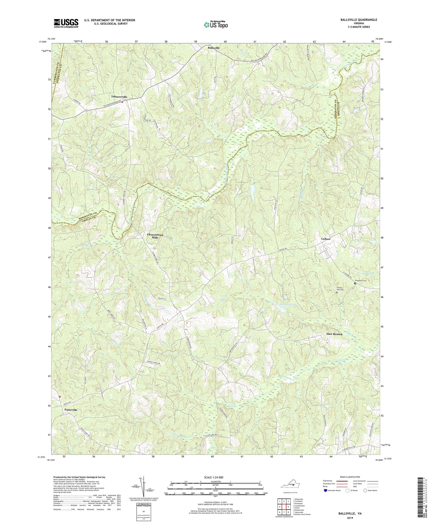
2019 topographic map quadrangle Ballsville in the state of Virginia. Scale: 1:24000. Based on the newly updated USGS 7.5' US Topo map series, this map is in the following counties: Amelia, Powhatan, Cumberland. The map contains contour data, water features, and other items you are used to seeing on USGS maps, but also has updated roads and other features. This is the next generation of topographic maps. Printed on high-quality waterproof paper with UV fade-resistant inks.
Quads adjacent to this one:
West: Cumberland
Northwest: Whiteville
North: Trenholm
Northeast: Powhatan
East: Chula
Southeast: Amelia Court House
South: Jetersville
Southwest: Deatonville
Contains the following named places: Amelia County Volunteer Fire Department Company 5 Paineville, Ballsville, Bardens Dam, Bardens Pond, Bent Creek, Clementown Mills, Dolittle Creek, Epworth Church, Flower Hill Baptist Church Cemetery, Flower Hill Church, Haw Branch, Hobsons Chapel, Horsepen Creek, Hunter-Brooks Dam, Little Bent Creek, Little Union Church, Little Union School, Lodore, Morven, Paineville, Paineville School, Piedmont Cemetery, Piedmont Church, Powhatan County Fire Department Company 3 - Macon District Volunteer Fire Department, Powhatan County Volunteer Rescue Squad Substation 2, Stock Creek, Tobaccoville, Union Church