MyTopo
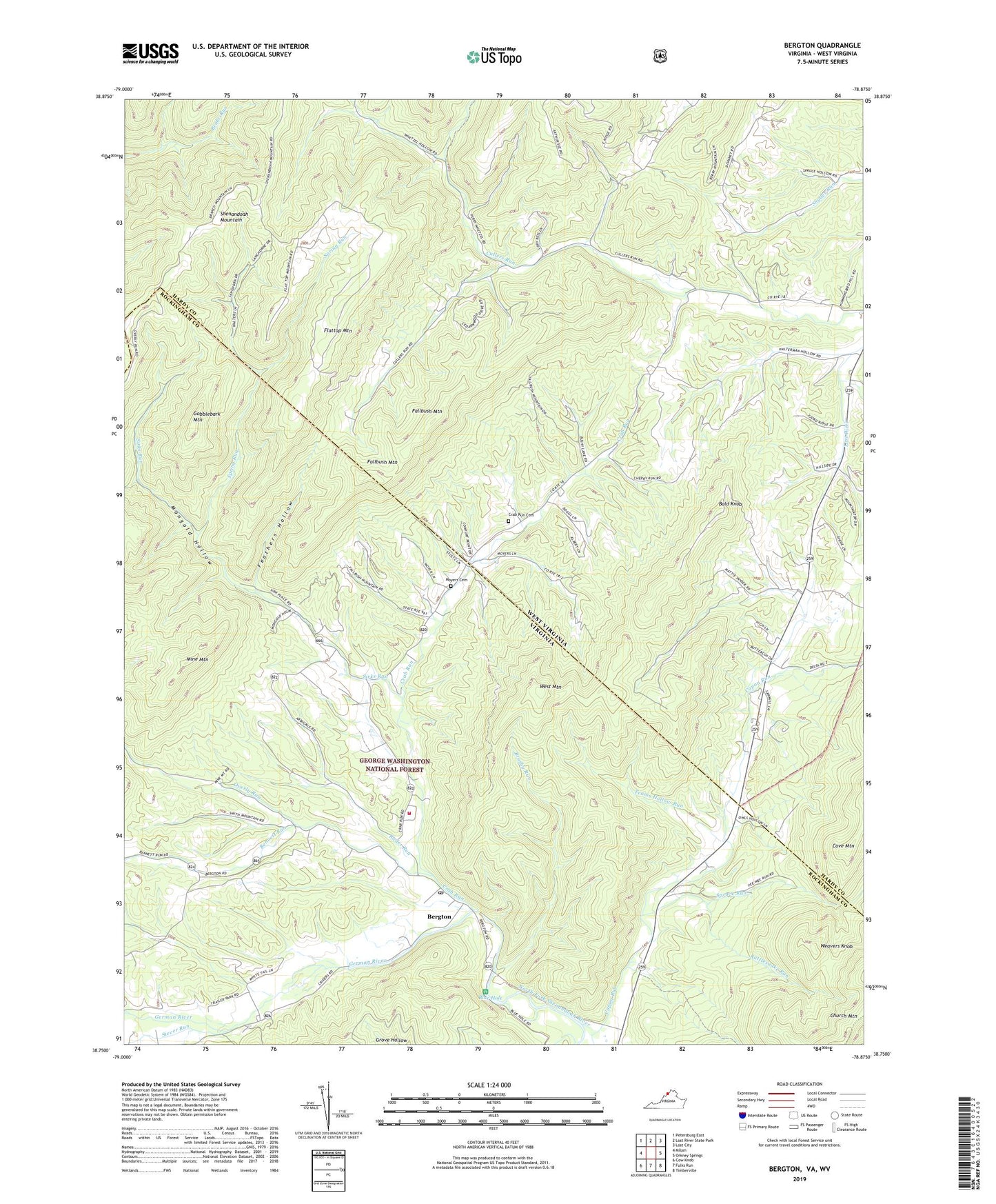
Bergton Virginia US Topo Map
Couldn't load pickup availability
Also explore the Bergton Forest Service Topo of this same quad for updated USFS data
2022 topographic map quadrangle Bergton in the states of West Virginia, Virginia. Scale: 1:24000. Based on the newly updated USGS 7.5' US Topo map series, this map is in the following counties: Rockingham, Hardy. The map contains contour data, water features, and other items you are used to seeing on USGS maps, but also has updated roads and other features. This is the next generation of topographic maps. Printed on high-quality waterproof paper with UV fade-resistant inks.
Quads adjacent to this one:
West: Milam
Northwest: Petersburg East
North: Lost River State Park
Northeast: Lost City
East: Orkney Springs
Southeast: Timberville
South: Fulks Run
Southwest: Cow Knob
Contains the following named places: Bald Knob, Bennett Run, Bergton, Bergton Elementary School, Bergton Emergency Squad, Bergton Gospel Center, Bergton Post Office, Bergton Volunteer Fire Company, Blue Hole, Blue Hole Campground, Brushy Run, Caldwell School, Cleaves School, Crab Run, Crab Run Cemetery, Crab Run Church, Crab Run School, Culler Run School, Fallbush Mountain, Feathers Hollow, Flattop Mountain, German River, Gobblebark Mountain, Halterman Hollow, Halterman School, Jenkins Chapel, Martin Lick Run, Martin Luther Church, Mine Mountain, Mongold Hollow, Mount Hermon Church, Moyers Cemetery, Overly Run, Rader Run, Rattlesnake Run, Saint Johns Church, Shipe Hollow, Siever Run, Sirks Run, Snyder Springs School, Spring Run, Spruce Run, Teams Hollow Run, Weavers Knob, West Mountain, Wetzel Hollow, ZIP Code: 22811