MyTopo
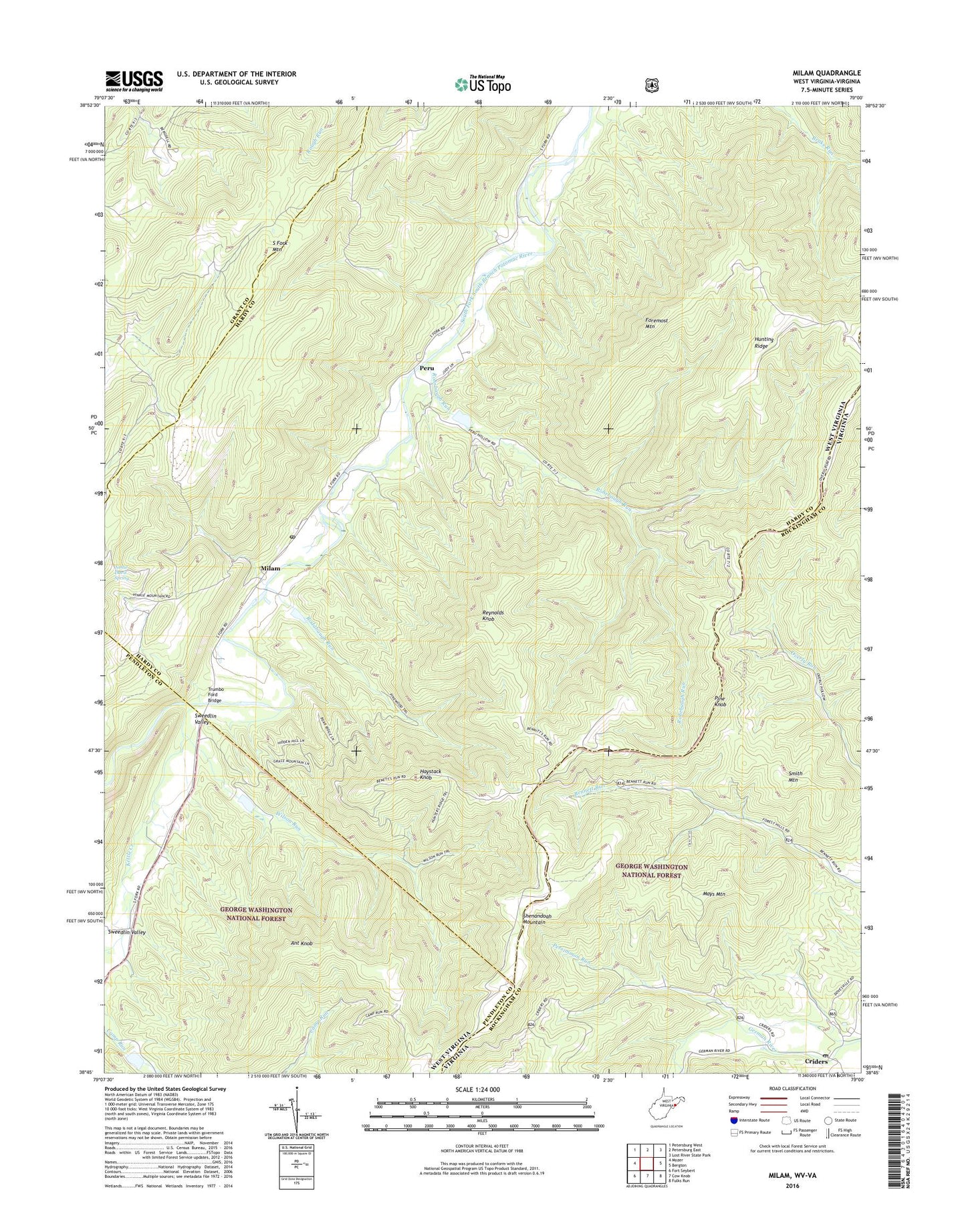
Milam West Virginia US Topo Map
Couldn't load pickup availability
Also explore the Milam Forest Service Topo of this same quad for updated USFS data
2023 topographic map quadrangle Milam in the states of West Virginia, Virginia. Scale: 1:24000. Based on the newly updated USGS 7.5' US Topo map series, this map is in the following counties: Hardy, Rockingham, Pendleton, Grant. The map contains contour data, water features, and other items you are used to seeing on USGS maps, but also has updated roads and other features. This is the next generation of topographic maps. Printed on high-quality waterproof paper with UV fade-resistant inks.
Quads adjacent to this one:
West: Mozer
Northwest: Petersburg West
North: Petersburg East
Northeast: Lost River State Park
Southeast: Fulks Run
South: Cow Knob
Southwest: Fort Seybert
This map covers the same area as the classic USGS quad with code o38079g1.
Contains the following named places: Ant Knob, Bergdoll School, Clover Hill Volunteer Fire Company and Rescue 17, Criders, Criders Church, Criders Post Office, Criders School, Damascus Church, Deep Spring School, Foremost Mountain, Haystack Knob, Hinkle School, Hunting Ridge, Hupp School, Kettle Creek, Mays Mountain, Milam, Milam Post Office, Mount Hope School, Mount Olive Church, Mount Pleasant School, Nettie Davis Spring, Persimmon Run, Peru, Pine Knob, Reynolds Knob, Rodabaugh Run, Rohrbaugh Run, Shenandoah Mountain, Smith Mountain, Smith School, South Fork Mountain, South Fork Structure 37 Dam, South Fork Structure Five Dam, South Fork Structure Four Dam, South Fork Structure Six Dam, Sweedlin Valley, Sweedlin Valley School, Trumbo Ford Bridge, Valley View Church, Wilson Run, Wine Spring School, Zion Church