MyTopo
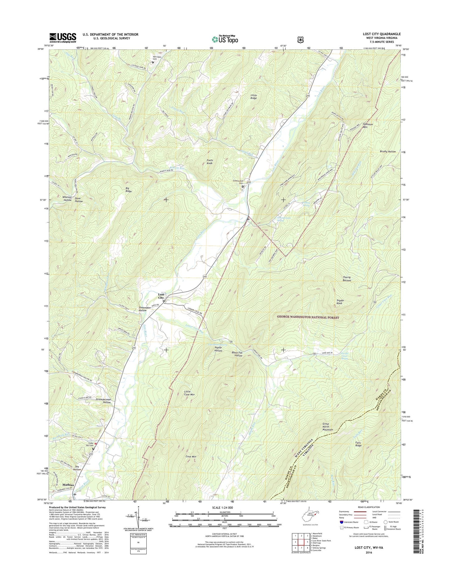
Lost City West Virginia US Topo Map
Couldn't load pickup availability
Also explore the Lost City Forest Service Topo of this same quad for updated USFS data
2023 topographic map quadrangle Lost City in the states of West Virginia, Virginia. Scale: 1:24000. Based on the newly updated USGS 7.5' US Topo map series, this map is in the following counties: Hardy, Shenandoah. The map contains contour data, water features, and other items you are used to seeing on USGS maps, but also has updated roads and other features. This is the next generation of topographic maps. Printed on high-quality waterproof paper with UV fade-resistant inks.
Quads adjacent to this one:
West: Lost River State Park
Northwest: Moorefield
North: Needmore
Northeast: Baker
East: Wolf Gap
Southeast: Conicville
South: Orkney Springs
This map covers the same area as the classic USGS quad with code o38078h7.
Contains the following named places: Adams Run, Black Fox Hollow, Bowman School, Camp Branch, Cedar Hill Cemetery, Cove Mountain, Dove Hollow, Falls Ridge, Fouts Knob, Fravel Run, Fravel Run School, Free Mason Spring, Gap Run, Gap Run School, Garrett's Chapel United Methodist Church, Gerdie Vance Spring, Greenwood Cemetery, Heishman Church, Holly Hill Church, Hommon Mountain, Howards Lick Run, Kimsey Run, Kimzies School, Little Cove Mountain, Lost City, Lost City Post Office, Lost River, Lost River Baptist Church, Lost River District, Lost River Post Office, Lower Cove Run, Mathias, Mathias Baker Volunteer Fire Department and Rescue, Mathias Post Office, Mill Gap Run, Mill Gap School, Mountain View Church, Mountain View School, New Dale Cemetery, New Dale Church, North Mountain Trail, Poplar Hollow, Rush Lick Run, See Hollow, Shoemaker Hollow, Shoemaker School, Snyder Knob, Stranderman Spring, Strawderman Hollow, Terra Alta School, Upper Cove Run, Whetzel Hollow, Whitehead Run, Wilkens Spring, ZIP Code: 26810