MyTopo
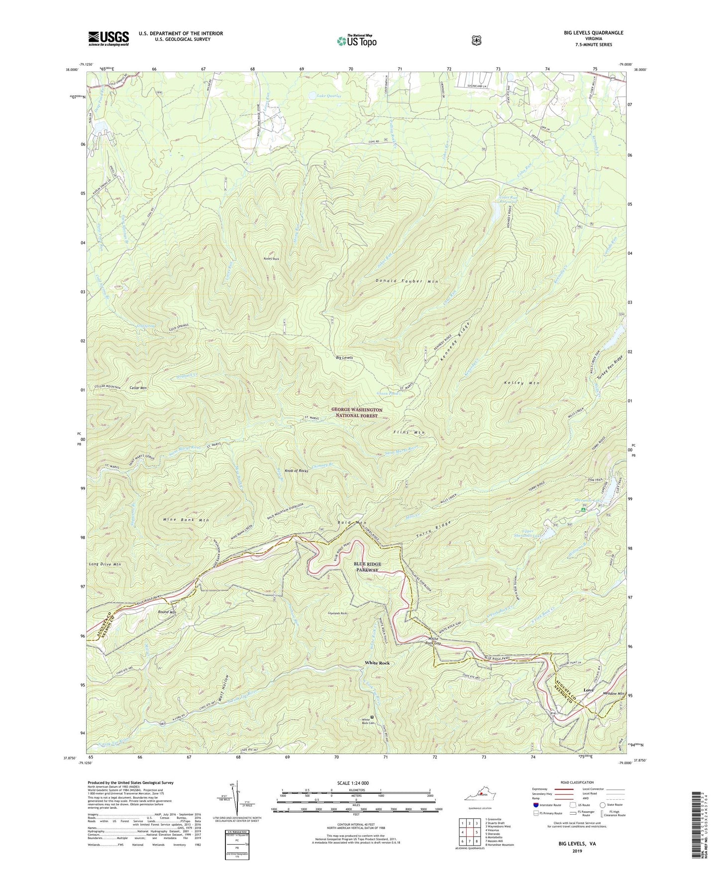
Big Levels Virginia US Topo Map
Couldn't load pickup availability
Also explore the Big Levels Forest Service Topo of this same quad for updated USFS data
2022 topographic map quadrangle Big Levels in the state of Virginia. Scale: 1:24000. Based on the newly updated USGS 7.5' US Topo map series, this map is in the following counties: Augusta, Nelson. The map contains contour data, water features, and other items you are used to seeing on USGS maps, but also has updated roads and other features. This is the next generation of topographic maps. Printed on high-quality waterproof paper with UV fade-resistant inks.
Quads adjacent to this one:
West: Vesuvius
Northwest: Greenville
North: Stuarts Draft
Northeast: Waynesboro West
East: Sherando
Southeast: Horseshoe Mountain
South: Massies Mill
Southwest: Montebello
This map covers the same area as the classic USGS quad with code o37079h1.
Contains the following named places: Bald Mountain, Bald Mountain Overlook, Bear Branch, Big Levels, Camp Thunderbird, Cellar Mountain, Chimney Branch, Cold Spring, Cold Spring Bald Mountain Trail, Cold Spring Branch, Coles Run Dam, Coles Run Reservoir, Copelands Rocks, Donald Fauber Mountain, Durham Run, Flint Mountain, Fork Mountain Overlook, Green Pond, Gum Springs Branch, Hogback Creek, Hunting Camp, Kelley Mountain, Kennedy Fields Campgrounds, Kennedy Mine, Kennedy Ridge, Kennedy Ridge Trail, Knob of Rocks, Lake Quarles, Long Drive Mountain, Love, Mill Creek, Mills Creek Trail, Mine Bank Creek, Mine Bank Mountain, Mountain Lake, Mountain Top Church, Pine Spring Camp, Rankin Church, Rankin Run, Red Mountain Mine, Round Mountain, Russell Rock, Saint Mary's Wilderness, Sengers Mountain Lake, Shenandoah Acres, Sherando Dam, Sherando Lake, Sherando Lake Campground, South River Number 10a Dam, South River Number 27 Dam, South River Number Six Dam, Stony Run Trail, Sugartree Branch, The Priest Overlook, The Slacks Overlook, Torry Ridge, Turkey Pen Ridge, Twenty Minute Cliff Overlook, Upper Sherando Lake, White Rock, White Rock Cemetery, White Rock Creek, White Rock Gap, White Rock Gap Trail, Williams Branch, Wolf Hollow