MyTopo
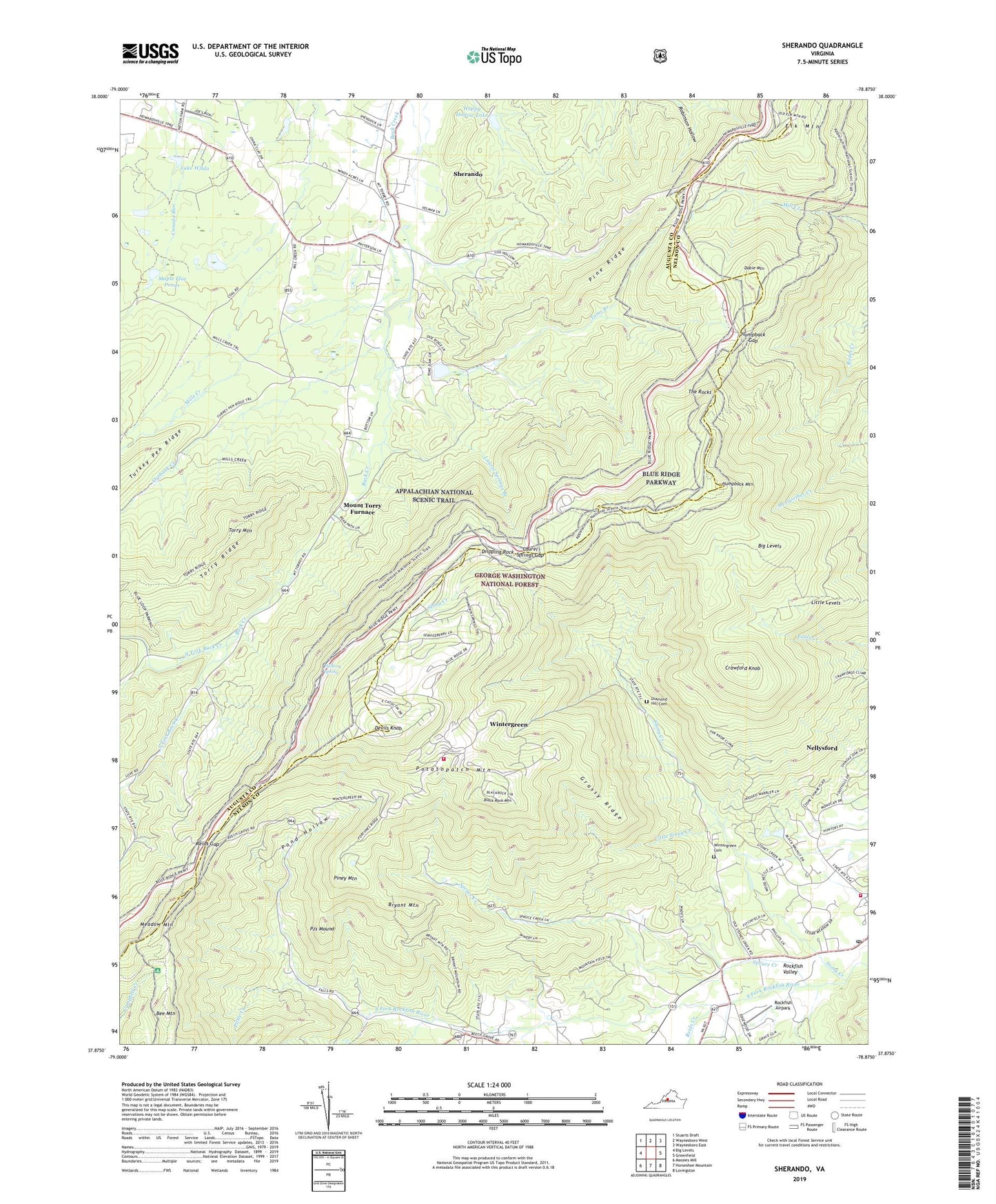
Sherando Virginia US Topo Map
Couldn't load pickup availability
Also explore the Sherando Forest Service Topo of this same quad for updated USFS data
2022 topographic map quadrangle Sherando in the state of Virginia. Scale: 1:24000. Based on the newly updated USGS 7.5' US Topo map series, this map is in the following counties: Augusta, Nelson. The map contains contour data, water features, and other items you are used to seeing on USGS maps, but also has updated roads and other features. This is the next generation of topographic maps. Printed on high-quality waterproof paper with UV fade-resistant inks.
Quads adjacent to this one:
West: Big Levels
Northwest: Stuarts Draft
North: Waynesboro West
Northeast: Waynesboro East
East: Greenfield
Southeast: Lovingston
South: Horseshoe Mountain
Southwest: Massies Mill
This map covers the same area as the classic USGS quad with code o37078h8.
Contains the following named places: Bee Mountain, Beech Grove, Big Levels, Black Rock Mountain, Blue Ridge Parkway Visitors Center, Bryant Mountain, Crawford Knob, Devils Knob, Diamond Hill Cemetery, Dobie Mountain, Dripping Rock, Elk Hill Church, Falling Rocks Lake, Grassy Ridge, Greenstone Overlook, Happy Hollow Lake, Hickory Spring, Humpback Gap, Humpback Mountain, Humpback Rocks Visitors Center, Lake Wilda, Laurel Springs Branch, Laurel Springs Gap, Little Country Church, Little Creek, Little Levels, Little Stony Creek, Maple Flat Ponds, Maupin Field Shelter, Meadow Mountain, Mills Creek, Mount Torry Furnace, Mountain View Church, Nellysford Census Designated Place, Nellysford Post Office, North Fork Back Creek, Orebank Creek, Pine Ridge, Piney Mountain, PJs Mound, Pond Hollow, Potatopatch Mountain, Ravens Roost Overlook, Reids Creek, Reids Gap, Rock Point Overlook, Rockfish Airpark, Sherando, Sherando Camp, Sherando Census Designated Place, Sherando Church, South Fork Back Creek, South River District, South River Number 11 Dam, South River Number 24 Dam, South River Number 25 Dam, Spruce Creek, Stony Creek, The Rocks, Three Ridges Overlook, Toms Branch, Torry Mountain, Turkey Pen Ridge Trail, Wintergreen, Wintergreen Cemetery, Wintergreen Census Designated Place, Wintergreen Fire and Rescue Station 1, Wintergreen Fire and Rescue Station 2, ZIP Codes: 22952, 22958