MyTopo
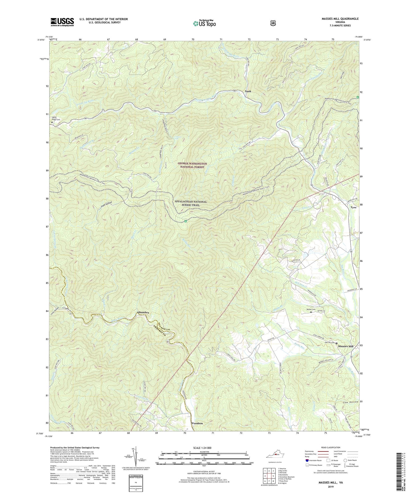
Massies Mill Virginia US Topo Map
Couldn't load pickup availability
Also explore the Massies Mill Forest Service Topo of this same quad for updated USFS data
2022 topographic map quadrangle Massies Mill in the state of Virginia. Scale: 1:24000. Based on the newly updated USGS 7.5' US Topo map series, this map is in the following counties: Nelson, Amherst. The map contains contour data, water features, and other items you are used to seeing on USGS maps, but also has updated roads and other features. This is the next generation of topographic maps. Printed on high-quality waterproof paper with UV fade-resistant inks.
Quads adjacent to this one:
West: Montebello
Northwest: Vesuvius
North: Big Levels
Northeast: Sherando
East: Horseshoe Mountain
Southeast: Arrington
South: Piney River
Southwest: Forks of Buffalo
This map covers the same area as the classic USGS quad with code o37079g1.
Contains the following named places: Alhambra, Bethel Cemetery, Campbell Creek, Cash Hollow, Coghill Ridge, Coxs Creek, Crabtree Creek, Crabtree Falls, Crawleys Creek, Cripple Creek, Cub Creek, Evergreen Church, Fork Mountain, Grace Church, Harmony Church, Harpers Creek, Harpers Creek Shelter, Jacks Hill, Little Friar, Little Hollow, Little Priest, Louisa Spring Branch, Maidenhead Branch, Maintop Mountain, Massies Mill, Massies Mill District, Meadow Creek, Muddy Branch, Nash, North Fork Piney River, North Fork Tye River, Oak Hill Cemetery, Oak Hill Church, Piney River Church, Pinnacle Ridge, Priest Trail Shelter, Priest Wilderness, Rocky Run, Sandy Ridge Cemetery, Shoe Creek, Silver Creek, South Fork Piney River, South Fork Tye River, Spy Rock, The Friar, The Priest, Tyro, West District, White Rock School, Woodson, ZIP Codes: 22967, 22976, 24464