MyTopo
Boykins Virginia US Topo Map
Couldn't load pickup availability
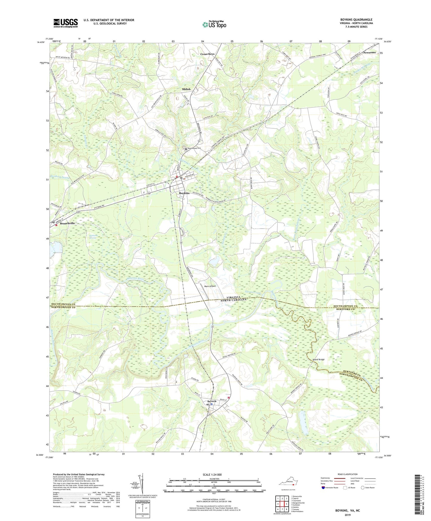
2019 topographic map quadrangle Boykins in the states of Virginia, North Carolina. Scale: 1:24000. Based on the newly updated USGS 7.5' US Topo map series, this map is in the following counties: Southampton, Northampton, Hertford. The map contains contour data, water features, and other items you are used to seeing on USGS maps, but also has updated roads and other features. This is the next generation of topographic maps. Printed on high-quality waterproof paper with UV fade-resistant inks.
Quads adjacent to this one:
West: Margarettsville
Northwest: Drewryville
North: Capron
Northeast: Courtland
East: Sunbeam
Southeast: Murfreesboro
South: Conway
Southwest: Galatia
Contains the following named places: Beechwood Cemetery, Boone Bridge, Boykins, Boykins Elementary School, Boykins Police Department, Boykins Post Office, Boykins Volunteer Fire Department and Rescue Squad, Branchville, Branchville Post Office, Branchville Volunteer Fire Department, Buckhorn Swamp, Burnt Reeds Swamp, Cross Keys, Flat Swamp, Galilee Church, Johnsons School, Mann Airport, Meherrin School, Oak Grove Church, Rich Chapel, Rosa Swamp, Severn, Severn Fire Department, Severn Police Department, Severn Post Office, Shiloh, Smiths Mill, Southeastern Public Service Authority Boykins Transfer Station, Tarrara Creek, Town of Boykins, Town of Severn, Woodland Park, ZIP Code: 23827