MyTopo
Conway North Carolina US Topo Map
Couldn't load pickup availability
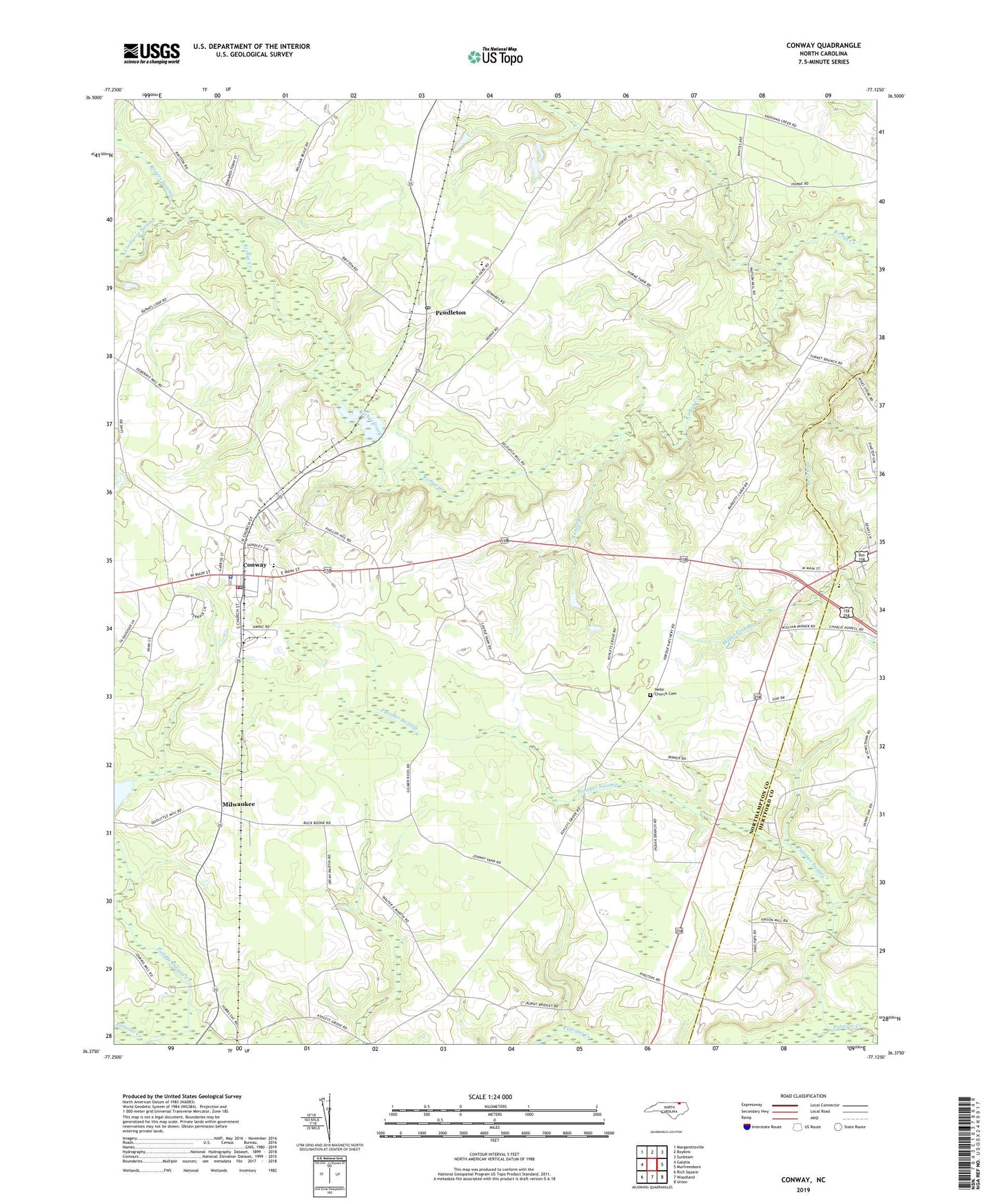
2022 topographic map quadrangle Conway in the state of North Carolina. Scale: 1:24000. Based on the newly updated USGS 7.5' US Topo map series, this map is in the following counties: Northampton, Hertford. The map contains contour data, water features, and other items you are used to seeing on USGS maps, but also has updated roads and other features. This is the next generation of topographic maps. Printed on high-quality waterproof paper with UV fade-resistant inks.
Quads adjacent to this one:
West: Galatia
Northwest: Margarettsville
North: Boykins
Northeast: Sunbeam
East: Murfreesboro
Southeast: Union
South: Woodland
Southwest: Rich Square
This map covers the same area as the classic USGS quad with code o36077d2.
Contains the following named places: Ashley Grove Church, Bethan Church, Conway, Conway Junior High School, Conway Police Department, Conway Post Office, Conway Volunteer Fire Department, Corduroy Swamp, Mapel Fork Branch, Milwaukee, Milwaukee Census Designated Place, Nebo Church, Nebo Church Cemetery, Paddys Delight Creek, Panther Swamp, Pendleton, Pendleton Post Office, Reedy Branch, Revell Hill Church, Roberts Chapel, Rogers Swamp, Town of Conway, Township of Kirby, Vinsons Mill, Ward Airport, Willis-Hare Elementary School, WWDR-AM (Murfreesboro), WWDR-FM (Murfreesboro), ZIP Codes: 27820, 27862