MyTopo
Galatia North Carolina US Topo Map
Couldn't load pickup availability
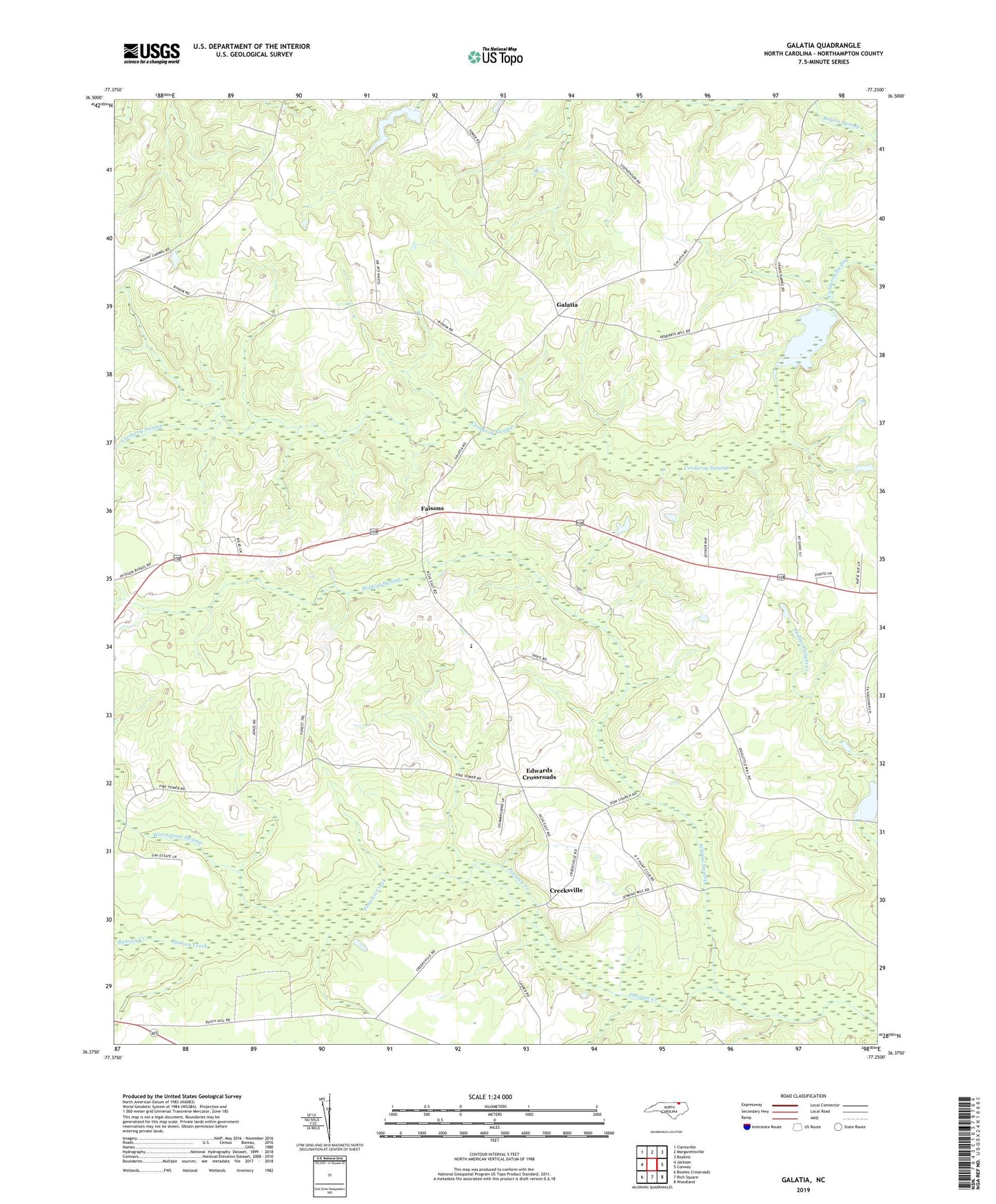
2022 topographic map quadrangle Galatia in the state of North Carolina. Scale: 1:24000. Based on the newly updated USGS 7.5' US Topo map series, this map is in the following counties: Northampton. The map contains contour data, water features, and other items you are used to seeing on USGS maps, but also has updated roads and other features. This is the next generation of topographic maps. Printed on high-quality waterproof paper with UV fade-resistant inks.
Quads adjacent to this one:
West: Jackson
Northwest: Claresville
North: Margarettsville
Northeast: Boykins
East: Conway
Southeast: Woodland
South: Rich Square
Southwest: Boones Crossroads
This map covers the same area as the classic USGS quad with code o36077d3.
Contains the following named places: Allen Chapel, Creeksville, Debary Millpond, Debary Millpond Dam, Doolittle Mill Pond Dam, Doolittle Millpond, Edwards Crossroads, Faisons, Galatia, Northampton High East, Ramsey Creek, Saint Johns Church, Taylors Mill Pond Dam, Township of Wiccacanee, Wiccacanee Lake Dam, Wiccacanee Pond, Wiccacanee Swamp, Wildcat Swamp, Zion Church, Zion Hill Church, Zoar Church