MyTopo
Brandy Station Virginia US Topo Map
Couldn't load pickup availability
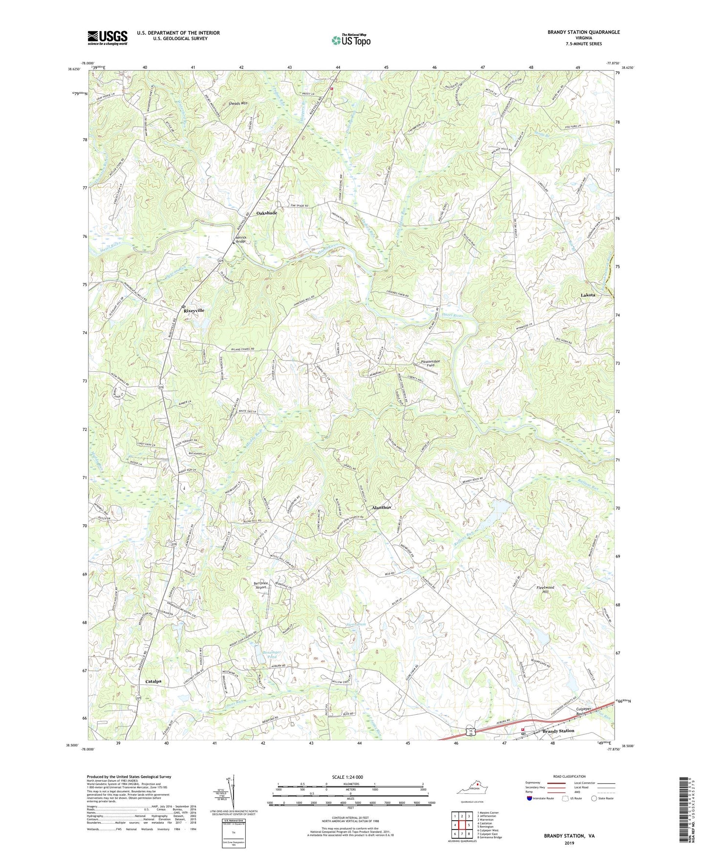
2022 topographic map quadrangle Brandy Station in the state of Virginia. Scale: 1:24000. Based on the newly updated USGS 7.5' US Topo map series, this map is in the following counties: Culpeper, Fauquier. The map contains contour data, water features, and other items you are used to seeing on USGS maps, but also has updated roads and other features. This is the next generation of topographic maps. Printed on high-quality waterproof paper with UV fade-resistant inks.
Quads adjacent to this one:
West: Castleton
Northwest: Massies Corner
North: Jeffersonton
Northeast: Warrenton
East: Remington
Southeast: Germanna Bridge
South: Culpeper East
Southwest: Culpeper West
This map covers the same area as the classic USGS quad with code o38077e8.
Contains the following named places: Alanthus, Beauregard Dam Number One, Beauregard Number Two Dam, Bee Branch, Benzinger Dam, Benzinger Pond, Berryvale Airport, Brandy Church, Brandy Rock Farm Dam, Brandy Rock Farm Lake, Brandy Station, Brandy Station Post Office, Brandy Station Volunteer Fire Department, Calvary Faith Tabernacle, Catalpa, Churchill, Clarksburg Church, Delridge Run, Duncan Run, Emerald Hill Elementary School, Fleetwood Church, Fleetwood Hill, Freemans Ford, Homeland Airport, Hoppers Branch, Indian Run, Jefferson District, Kerrick Bridge, Lakota, Little Fork Volunteer Fire and Rescue Company, Little Indian Run, Mount Zion Church, Mount Zion School, Muddy Run, Muddy Run School, Oak Shade Church, Oakshade, Pleasantdale Field, Ridgelea, Rixeyville, Rixeyville Post Office, Rixeyville School, Sheads Mountain, Shiloh Church, Shiloh School, Swan Dam, Waterford Run, ZIP Codes: 22714, 22724