MyTopo
Massies Corner Virginia US Topo Map
Couldn't load pickup availability
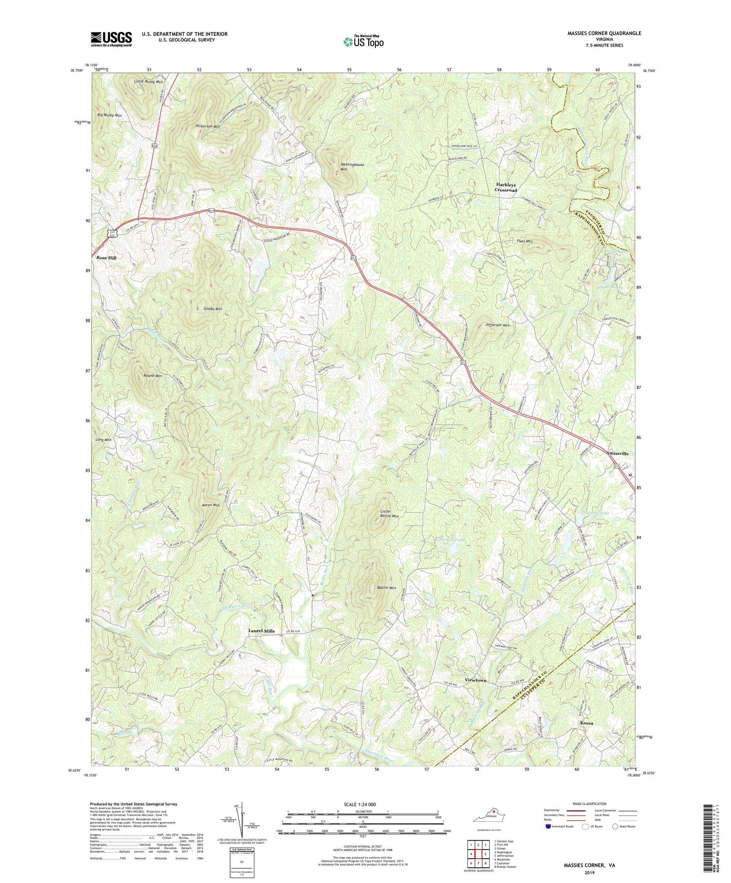
2022 topographic map quadrangle Massies Corner in the state of Virginia. Scale: 1:24000. Based on the newly updated USGS 7.5' US Topo map series, this map is in the following counties: Rappahannock, Culpeper, Fauquier. The map contains contour data, water features, and other items you are used to seeing on USGS maps, but also has updated roads and other features. This is the next generation of topographic maps. Printed on high-quality waterproof paper with UV fade-resistant inks.
Quads adjacent to this one:
West: Washington
Northwest: Chester Gap
North: Flint Hill
Northeast: Orlean
East: Jeffersonton
Southeast: Brandy Station
South: Castleton
Southwest: Woodville
This map covers the same area as the classic USGS quad with code o38078f1.
Contains the following named places: Aaron Mountain, Amissville Church, Amissville School, Amissville Volunteer Fire and Rescue Company, Battle Mountain, Battle Run, Battle Run Church, Ben Venue, Bethel Church, Cannons Run, Forest Grove Church, Forest Grove School, Googe Mountain, Hackleys Crossroad, Hawkins Run, Hickerson Mountain, Jackson District, Jefferson Mountain, Korea, Lake Mosby, Lake Wilson, Laurel Mills, Little Battle Mountain, Little Mulky Mountain, Liverman Dam, Liverman Pond, Long Mountain, Long Mountain Nursery, Massanova, Massanova Christian Academy, Massanova Church, Massies Corner, Meetinghouse Mountain, Mill Run, Mosby Dam, Mount Moriah Church, Muskrat Haven Farm, Newbus Cross Roads, Poes Mountain, Round Mountain, Smiley Dam, Sweeney Dam, Sweeney Lake, Tapps Ford, Thornton River Airport, Viewtown, Williams Orchard, ZIP Codes: 20106, 22716