MyTopo
Jeffersonton Virginia US Topo Map
Couldn't load pickup availability
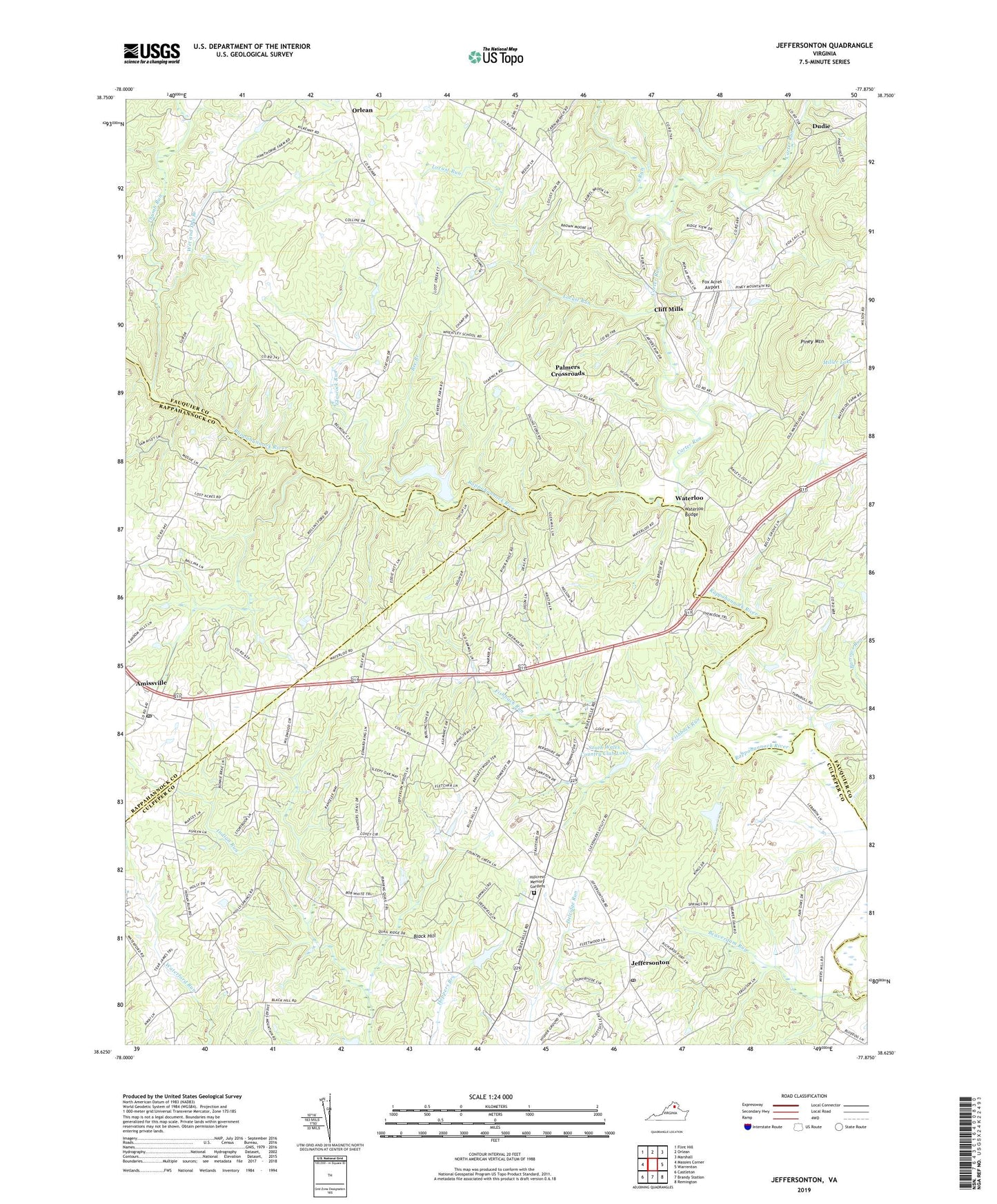
2022 topographic map quadrangle Jeffersonton in the state of Virginia. Scale: 1:24000. Based on the newly updated USGS 7.5' US Topo map series, this map is in the following counties: Fauquier, Culpeper, Rappahannock. The map contains contour data, water features, and other items you are used to seeing on USGS maps, but also has updated roads and other features. This is the next generation of topographic maps. Printed on high-quality waterproof paper with UV fade-resistant inks.
Quads adjacent to this one:
West: Massies Corner
Northwest: Flint Hill
North: Orlean
Northeast: Marshall
East: Warrenton
Southeast: Remington
South: Brandy Station
Southwest: Castleton
This map covers the same area as the classic USGS quad with code o38077f8.
Contains the following named places: Amissville, Amissville Post Office, Beaverdam Run, Bee Branch, Black Hill, Carter Run, Carter Run Church, Cliff Mills, Corbin School, Countryside Estates, Deerfield Estates, Dudie, Erinbrook, Fauquier Springs Country Club, First Baptist Church, Fishback Run, Fox Acres Airport, Glascock Run, Glascock Run Dam, Harts Crossroads, Hillcrest Memory Gardens, Jeffersonton, Jeffersonton Baptist Church, Jeffersonton Post Office, Johnson Dam, Johnson Pond, Locust Run, Magee, Miller Lake, Mission Church, Old Conde, Orlean Methodist Episcopal Church, Palmers Crossroads, Piney Mountain, Piney Mountain School, Providence Church, Rising Zion Church, South Church, South Run, South Wales, South Wales Country Club Dam, South Wales Country Club Lake, South Wales Golf Course, Thumb Run, Upper Zion Church, Waterloo, Waterloo Bridge, Waterloo School, Wesley Chapel, Wet and Dry Branch