MyTopo
Caledonia Virginia US Topo Map
Couldn't load pickup availability
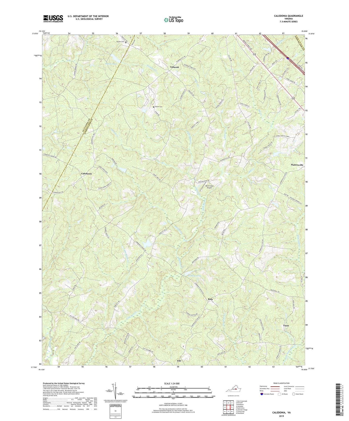
2019 topographic map quadrangle Caledonia in the state of Virginia. Scale: 1:24000. Based on the newly updated USGS 7.5' US Topo map series, this map is in the following counties: Goochland, Fluvanna, Louisa. The map contains contour data, water features, and other items you are used to seeing on USGS maps, but also has updated roads and other features. This is the next generation of topographic maps. Printed on high-quality waterproof paper with UV fade-resistant inks.
Quads adjacent to this one:
West: Columbia
Northwest: Zion Crossroads
North: Ferncliff
Northeast: Pendleton
East: South Anna
Southeast: Goochland
South: Cartersville
Southwest: Lakeside Village
Contains the following named places: Bethany Church, Bonneys Dam, Bonneys Pond, Bowles Cemetery, Bowles Dam, Bowles Pond, Bula, Byrd Creek Airport, Byrd Elementary School, Caledonia, Chimney Springs, District 1, Enon, Forest Grove Church, Georges Landing, Hidden Acres, Horsepen Creek, Johnson Creek, Little Byrd Creek Community House, Little White Creek, Little Whittle Creek, Mayo-Alexander and Hadens Dam, Mill Creek, Mispah Church, Mount Gilead Church, Payne Cemetery, Perkins Church, Peters Creek, Pleasant Grove Church, Ransome Creek, Rattlesnake Run, Rising Mount Zion Baptist Church, Royal Oaks Estates, Second Union Church, Shannon Hills Farms, Tabscott, Tabscott East, Windsor Park, Windsor Park Lake Dam