MyTopo
South Anna Virginia US Topo Map
Couldn't load pickup availability
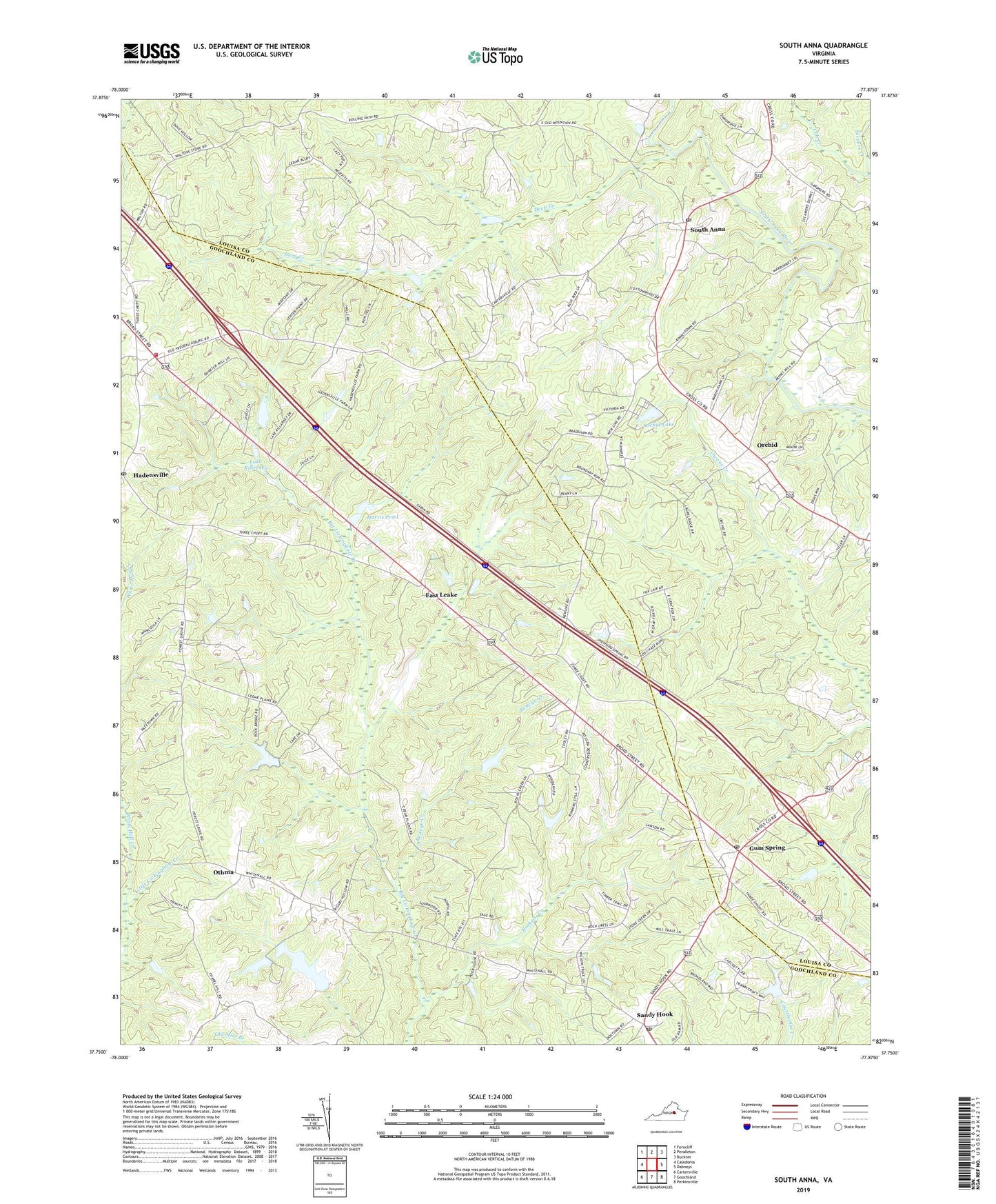
2022 topographic map quadrangle South Anna in the state of Virginia. Scale: 1:24000. Based on the newly updated USGS 7.5' US Topo map series, this map is in the following counties: Louisa, Goochland. The map contains contour data, water features, and other items you are used to seeing on USGS maps, but also has updated roads and other features. This is the next generation of topographic maps. Printed on high-quality waterproof paper with UV fade-resistant inks.
Quads adjacent to this one:
West: Caledonia
Northwest: Ferncliff
North: Pendleton
Northeast: Buckner
East: Dabneys
Southeast: Perkinsville
South: Goochland
Southwest: Cartersville
This map covers the same area as the classic USGS quad with code o37077g8.
Contains the following named places: Busbee and Son Mill, Childress, Countryside West, Deep Creek, Deep Woods, Deerwood, East Leake, Forest Grove Church, Goochland County Volunteer Fire and Rescue Company 6 Hadensville, Gum Spring, Gum Spring Post Office, Hadensville, Hadensville Estates, Hadensville Farms, Hadensville Post Office, Harris Pond, Harris Pond Dam, Jackson Memorial School, Lake Killarney, Lake Killerney, Lake Killerney Dam, New Line Church, Orchid, Orchid Lake, Othma, Providence Church, Pruitts Dam, Pruitts Pond, Redeye Creek, Rocketts Creek, Running Still, Sandy Hook, Sandy Hook Post Office, Shelfar School, South Anna, South Anna Church, South Anna Post Office, Tally Ho Estates, Turners Creek, Waltons Store, Waltons Store Post Office, White Hall Creek, ZIP Codes: 23065, 23153