MyTopo
Pendleton Virginia US Topo Map
Couldn't load pickup availability
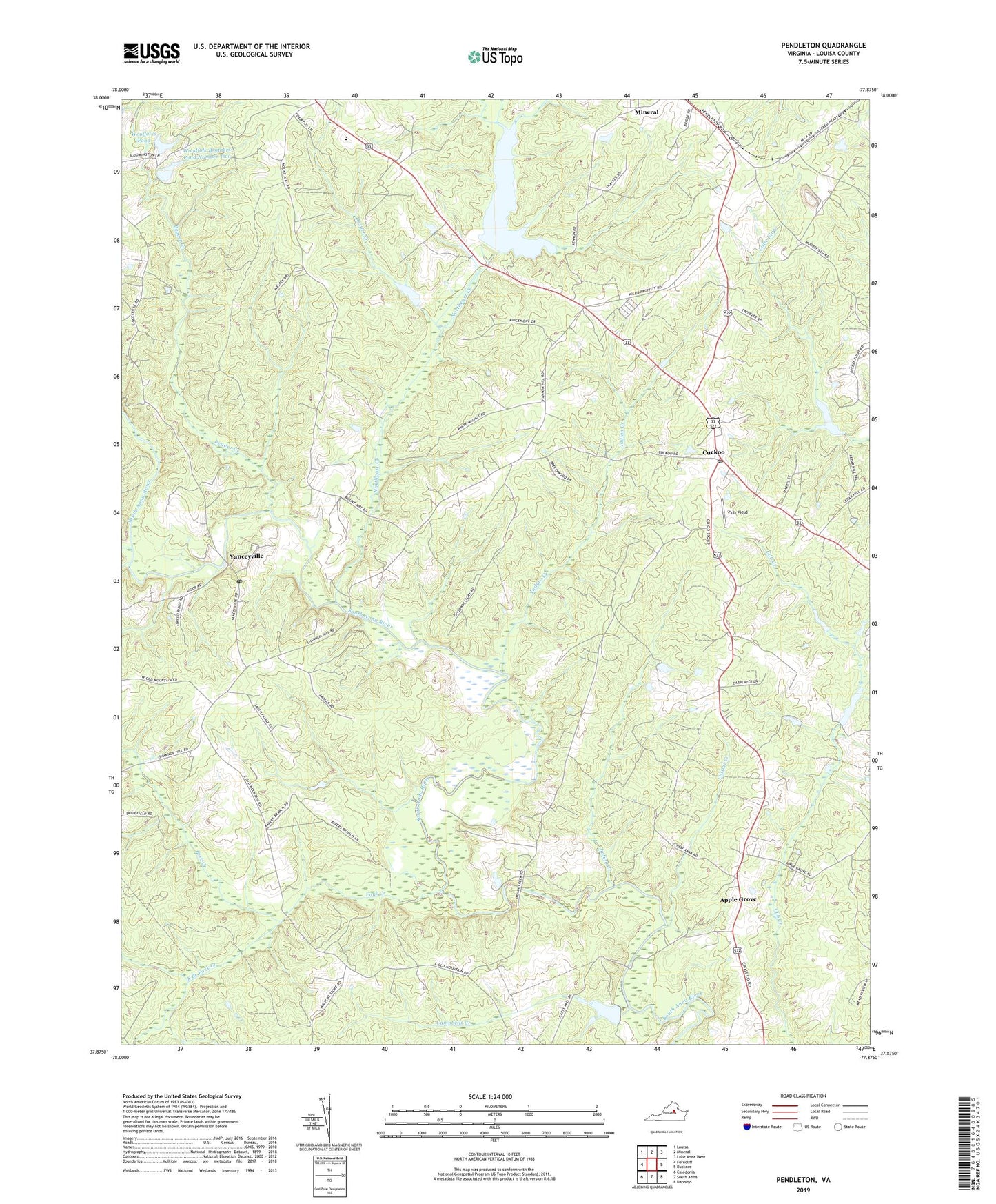
2022 topographic map quadrangle Pendleton in the state of Virginia. Scale: 1:24000. Based on the newly updated USGS 7.5' US Topo map series, this map is in the following counties: Louisa. The map contains contour data, water features, and other items you are used to seeing on USGS maps, but also has updated roads and other features. This is the next generation of topographic maps. Printed on high-quality waterproof paper with UV fade-resistant inks.
Quads adjacent to this one:
West: Ferncliff
Northwest: Louisa
North: Mineral
Northeast: Lake Anna West
East: Buckner
Southeast: Dabneys
South: South Anna
Southwest: Caledonia
This map covers the same area as the classic USGS quad with code o37077h8.
Contains the following named places: Apple Grove, Beaver Creek, Campbells Creek, Cattail Creek, Cub Field, Cuckoo, Cuckoo Post Office, Desper Creek, Devine Church, Eagle Church, Ebenezer Church, Fork Creek, Gilboa Church, Goodwins Store, Indian Creek, Little River Number One Dam, Louisa County, New Anna Church, Northeast Creek, Northeast Creek Reservoir, Pendleton, Pendleton Post Office, Phillipi Church, Richardson High School, Smiths Mill, South Branch Fork Creek, Thomas Jefferson Elementary School, Vigor, Vigor Post Office, Woodfolk Brothers Dam Number One, Woodfolk Brothers Dam Number Two, Woodfolk Brothers Pond Number Two, Woolfolks Dam, Woolfolks Pond, Yanceyville, Yanceyville Church, Yanceyville Dam, Yanceyville Millpond