MyTopo
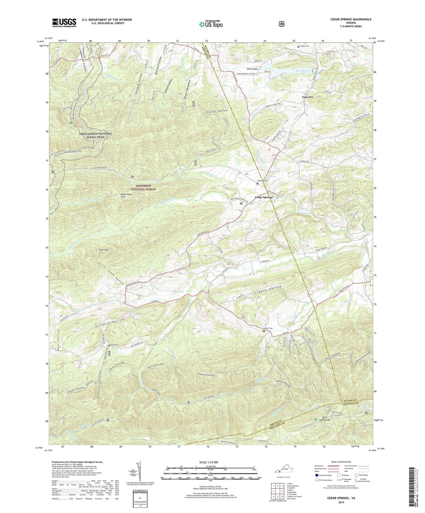
Cedar Springs Virginia US Topo Map
Couldn't load pickup availability
Also explore the Cedar Springs Forest Service Topo of this same quad for updated USFS data
2022 topographic map quadrangle Cedar Springs in the state of Virginia. Scale: 1:24000. Based on the newly updated USGS 7.5' US Topo map series, this map is in the following counties: Smyth, Wythe, Grayson. The map contains contour data, water features, and other items you are used to seeing on USGS maps, but also has updated roads and other features. This is the next generation of topographic maps. Printed on high-quality waterproof paper with UV fade-resistant inks.
Quads adjacent to this one:
West: Atkins
Northwest: Nebo
North: Rural Retreat
Northeast: Crockett
East: Speedwell
Southeast: Elk Creek
South: Middle Fox Creek
Southwest: Trout Dale
This map covers the same area as the classic USGS quad with code o36081g3.
Contains the following named places: Asbury Church, Asbury School, Ashland Hollow, Blue Spring, Blue Spring Church, Blue Spring Creek, Blue Spring Gap, Blue Spring School, Buchanan Mountain, Bullins Branch, Buzzard Rock, Camp, Canadays Ridge, Carmi Cemetery, Carmi Church, Cave Ridge, Cedar Spring, Cedar Springs, Chestnut Ridge, Cress Lake, Crigger Creek, Crigger Creek Trail, Dark Hollow, Dry Creek, Fairview, Fairview School, Glade Mountain, Glade Mountain Shelter, Granny Branch, Gray Branch, Groseclose Chapel, Hale Dam, Hale Lake, Harvel Creek, Harvel Knob, Heldreth Hollow, Horne Knob, Huckleberry Knob, Jones Creek, Keesling Cemetery, Killinger Creek, Kinser Creek, Kirk Cemetery, Kirk Hollow, Laurel Hollow, Leading Ridge, Lindamood School, Little Huckleberry Knob, Little Mountain, Locust Mountain, Middle Creek, Panther Knob, Parks Creek, Pine Glade, Pool Spring Branch, Raccoon Branch, Rural Retreat Dam, Rural Retreat Lake, Scott Gap, Scott Hollow, Sharon Church, Shop Hollow, Sinclair Preston Landscape for the Future, Snake Den Mountain, Spruce Pine Hollow, Steffy Cemetery, Suminit Church, Summit, Summit School, Union Church, Union County School, Union School, Virginia Highland Trail, White Rock Cliff, White Rock Creek, White Rock Mountain, Wolf Rock Hollow