MyTopo
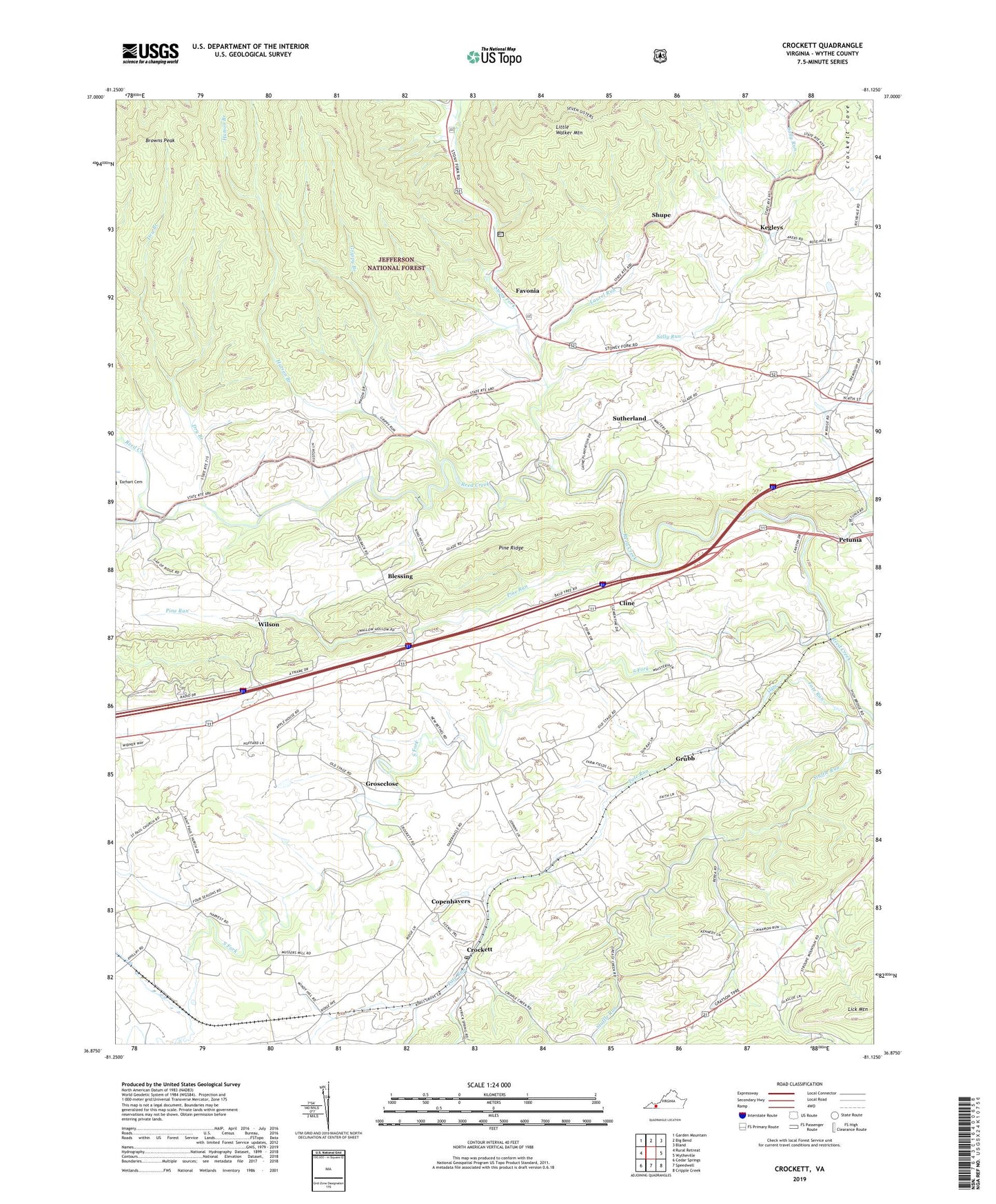
Crockett Virginia US Topo Map
Couldn't load pickup availability
Also explore the Crockett Forest Service Topo of this same quad for updated USFS data
2022 topographic map quadrangle Crockett in the state of Virginia. Scale: 1:24000. Based on the newly updated USGS 7.5' US Topo map series, this map is in the following counties: Wythe. The map contains contour data, water features, and other items you are used to seeing on USGS maps, but also has updated roads and other features. This is the next generation of topographic maps. Printed on high-quality waterproof paper with UV fade-resistant inks.
Quads adjacent to this one:
West: Rural Retreat
Northwest: Garden Mountain
North: Big Bend
Northeast: Bland
East: Wytheville
Southeast: Cripple Creek
South: Speedwell
Southwest: Cedar Springs
This map covers the same area as the classic USGS quad with code o36081h2.
Contains the following named places: Ball Hill School, Berea Church, Blessing, Browns Peak, Cave School, Cline, Copenhavers, Crockett, Crockett Cove, Crockett Post Office, Dark Hollow Picnic Area, Dark Horse Hollow Campground, Dry Branch, Fairview, Fairview United Methodist Church, Favonia, Glade School, Government Siding, Grippy Branch, Groseclose, Grubb, Grubb Dairy Farm, Holy Advent Church, Huddle School, Hutson Branch, Kegley School, Kegleys, Kings Grove Church, Laurel Run, Lebanon Church, Locust Hill School, Marvin Church, Mill Creek, Mount Ephraim Church, Mount Mitchell Church, Mount Pleasant Church, Mount Pleasant School, Mountain View School, New Bethel Church, Pine Ridge, Pine Run, Royal Oak School, Saint Paul School, Saint Pauls Church, Sally Run, Shupe, South Fork, Stony Fork, Stuffle Run, Sutherland, WCRR-AM (Rural Retreat), WCRR-FM (Rural Retreat), West Wytheville District, Wilson, Wytheville National Fish Hatchery Number 1