MyTopo
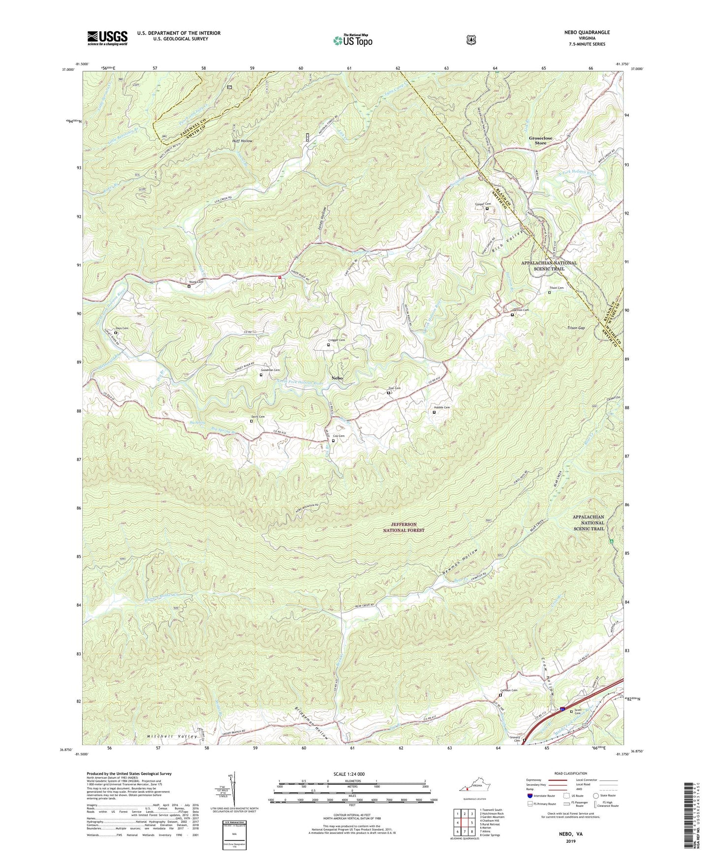
Nebo Virginia US Topo Map
Couldn't load pickup availability
Also explore the Nebo Forest Service Topo of this same quad for updated USFS data
2022 topographic map quadrangle Nebo in the state of Virginia. Scale: 1:24000. Based on the newly updated USGS 7.5' US Topo map series, this map is in the following counties: Smyth, Bland, Tazewell, Wythe. The map contains contour data, water features, and other items you are used to seeing on USGS maps, but also has updated roads and other features. This is the next generation of topographic maps. Printed on high-quality waterproof paper with UV fade-resistant inks.
Quads adjacent to this one:
West: Chatham Hill
Northwest: Tazewell South
North: Hutchinson Rock
Northeast: Garden Mountain
East: Rural Retreat
Southeast: Cedar Springs
South: Atkins
Southwest: Marion
This map covers the same area as the classic USGS quad with code o36081h4.
Contains the following named places: Atkins District, Bear Creek Church, Bear Creek School, Big Spring, Big Spring Branch, Bridgeman Hollow, Brushy Mountain, Bryants Knob, Calhoun Cemetery, Carter Mountain, Cave School, Cooper Cemetery, Cox Branch, Cox Cemetery, Cregger Cemetery, Crow Branch, Crow Hollow, Davis Cemetery, Dry Branch, Ezell School, Ezelle Church, Fairview Church, Goat Knob, Goodman Cemetery, Goodwill Church, Grape Ridge, Groseclose Store, Harmon Branch, Harmon Cemetery, Hayes Chapel, Hays Cemetery, Hubble Cemetery, Huff Hollow, Jones Hollow, Laurel Branch, Lick Branch, Lick Creek, Lick Creek School, Little Brushy Mountain, Little Mountain, Lynn Camp Creek, McDonald Branch, Nebo, Nebo School, Nebo Volunteer Fire Department Station 2, Newman Hollow, Pine Ridge, Possum Creek, Scott Cemetery, Snavely Branch, Snavely Cemetery, Steer Knob, Tilson Cemetery, Tilson Gap, Tilson Mill, Young Cemetery, Young Chapel, Zion Cemetery, Zion Church, ZIP Code: 24318