MyTopo
Cluster Springs Virginia US Topo Map
Couldn't load pickup availability
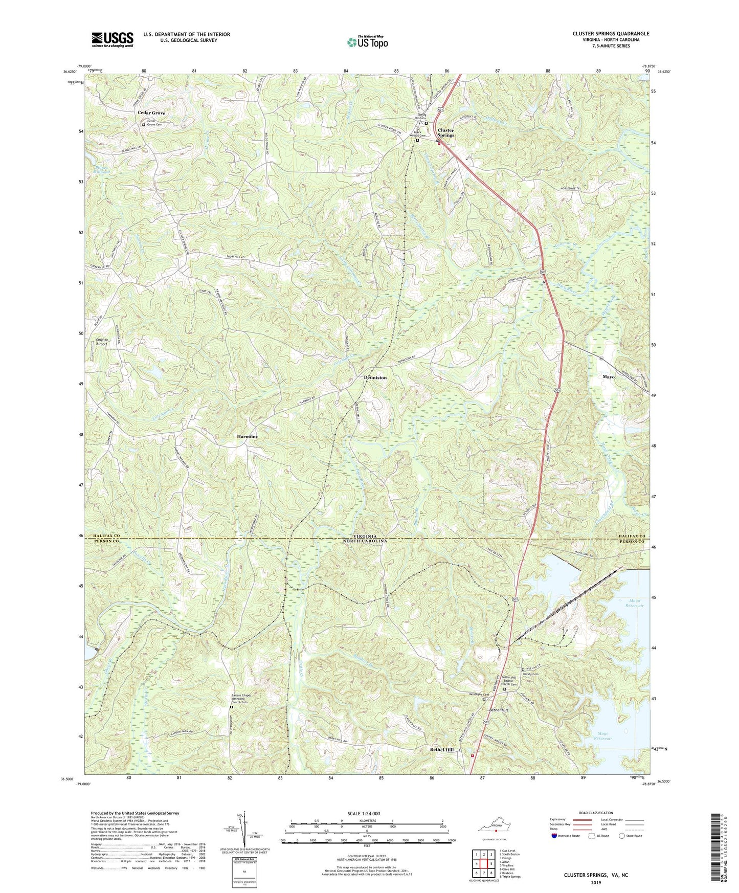
2019 topographic map quadrangle Cluster Springs in the states of Virginia, North Carolina. Scale: 1:24000. Based on the newly updated USGS 7.5' US Topo map series, this map is in the following counties: Halifax, Person. The map contains contour data, water features, and other items you are used to seeing on USGS maps, but also has updated roads and other features. This is the next generation of topographic maps. Printed on high-quality waterproof paper with UV fade-resistant inks.
Quads adjacent to this one:
West: Alton
Northwest: Oak Level
North: South Boston
Northeast: Omega
East: Virgilina
Southeast: Triple Springs
South: Roxboro
Southwest: Olive Hill
Contains the following named places: Baileys Chapel Methodist Church, Baileys Chapel Methodist Church Cemetery, Bales Spring Branch, Bamboo Branch, Bethel Hill, Bethel Hill Baptist Church, Bethel Hill Baptist Church Cemetery, Bethel Hill Elementary School, Bethel Hill High School, Black Walnut Cemetery, Black Walnut Church, Blanes Mill Dam, Blanes Millpond, Bowes Branch, Castle Creek, Cedar Grove, Cedar Grove Cemetery, Cedar Grove United Methodist Church, Church Spring Branch, Cluster Springs, Cluster Springs Census Designated Place, Cluster Springs Elementary School, Cluster Springs Post Office, Cluster Springs Volunteer Fire Department, Coleman Creek, Crutchfield Branch, Denniston, Denniston School, Dry Creek, Ghent Creek, Halfway Creek, Harmony, Little Coleman Creek, Marlowe Creek, Mayo, Mayo Creek, Mayo Grove Church, Montague Cemetery, Mount Pisgah Church, Orange Grove Church, Orange Grove School, Powells Creek, R R Jones Dam, Rogersville, Spring Hill Cemetery, Spring Hill Church, Storys Creek, Traynham Grove Church, Vaughan Airport, Woodsdale Fire Department, Woody Cemetery