MyTopo
Triple Springs North Carolina US Topo Map
Couldn't load pickup availability
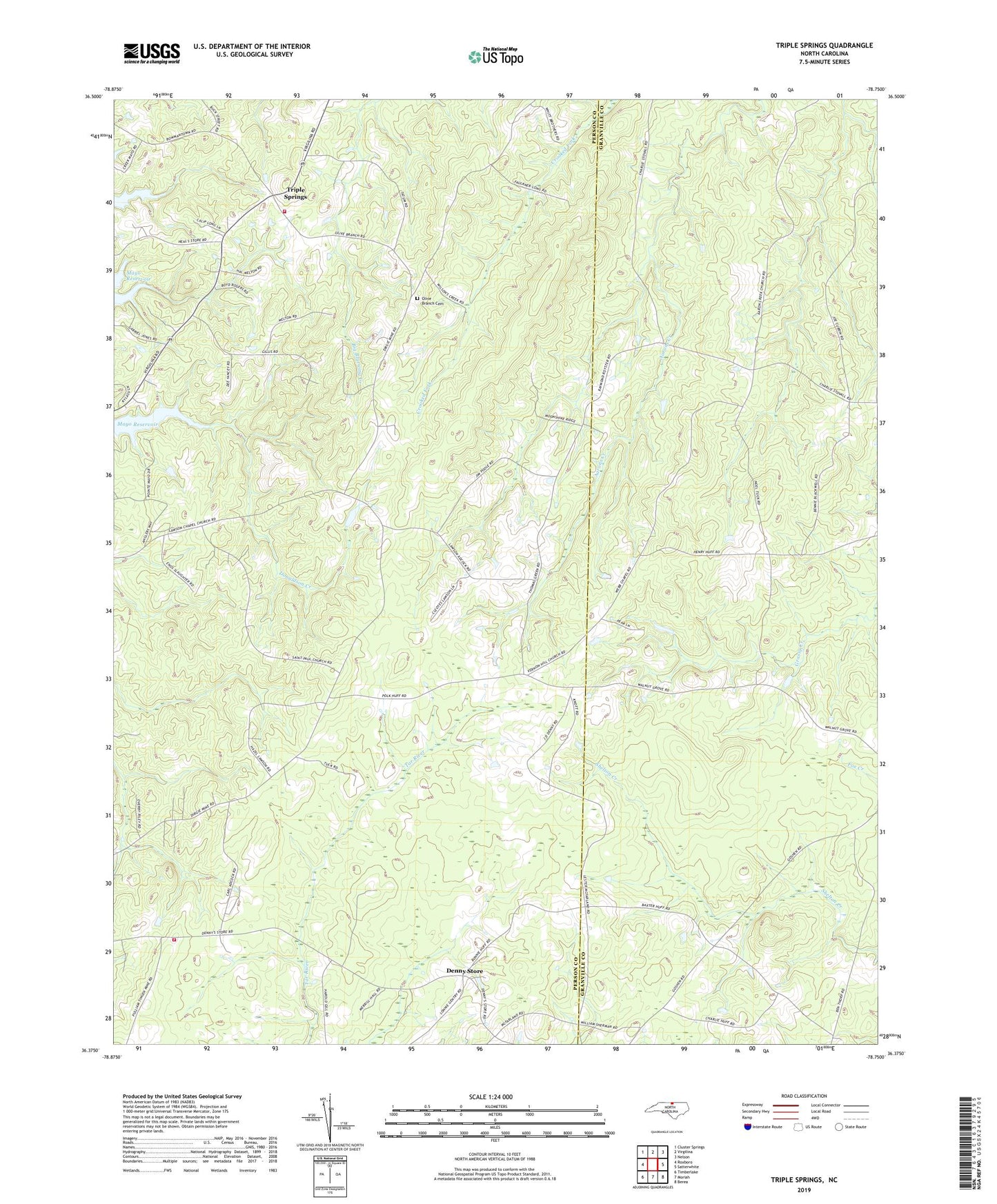
2022 topographic map quadrangle Triple Springs in the state of North Carolina. Scale: 1:24000. Based on the newly updated USGS 7.5' US Topo map series, this map is in the following counties: Person, Granville. The map contains contour data, water features, and other items you are used to seeing on USGS maps, but also has updated roads and other features. This is the next generation of topographic maps. Printed on high-quality waterproof paper with UV fade-resistant inks.
Quads adjacent to this one:
West: Roxboro
Northwest: Cluster Springs
North: Virgilina
Northeast: Nelson
East: Satterwhite
Southeast: Berea
South: Moriah
Southwest: Timberlake
This map covers the same area as the classic USGS quad with code o36078d7.
Contains the following named places: Allensville Volunteer Fire Department, Burma Church, Catilina, Denny Store, Durgy Mine, Five Fork School, Goshen, Goshen Church, Halloway, Lawsons Chapel, Mount Gideon Church, Olive Branch Baptist Church, Olive Branch Cemetery, Saint Pauls Church, Sappony State Designated Tribal Statistical Area, Sharon Church, Sharon School, Smith School, Township of Allensville, Township of Holloway, Triple Springs, Triple Springs Volunteer Fire Department, Vernon Hill Church, Webb Church, ZIP Code: 27574