MyTopo
Colonial Beach South Virginia US Topo Map
Couldn't load pickup availability
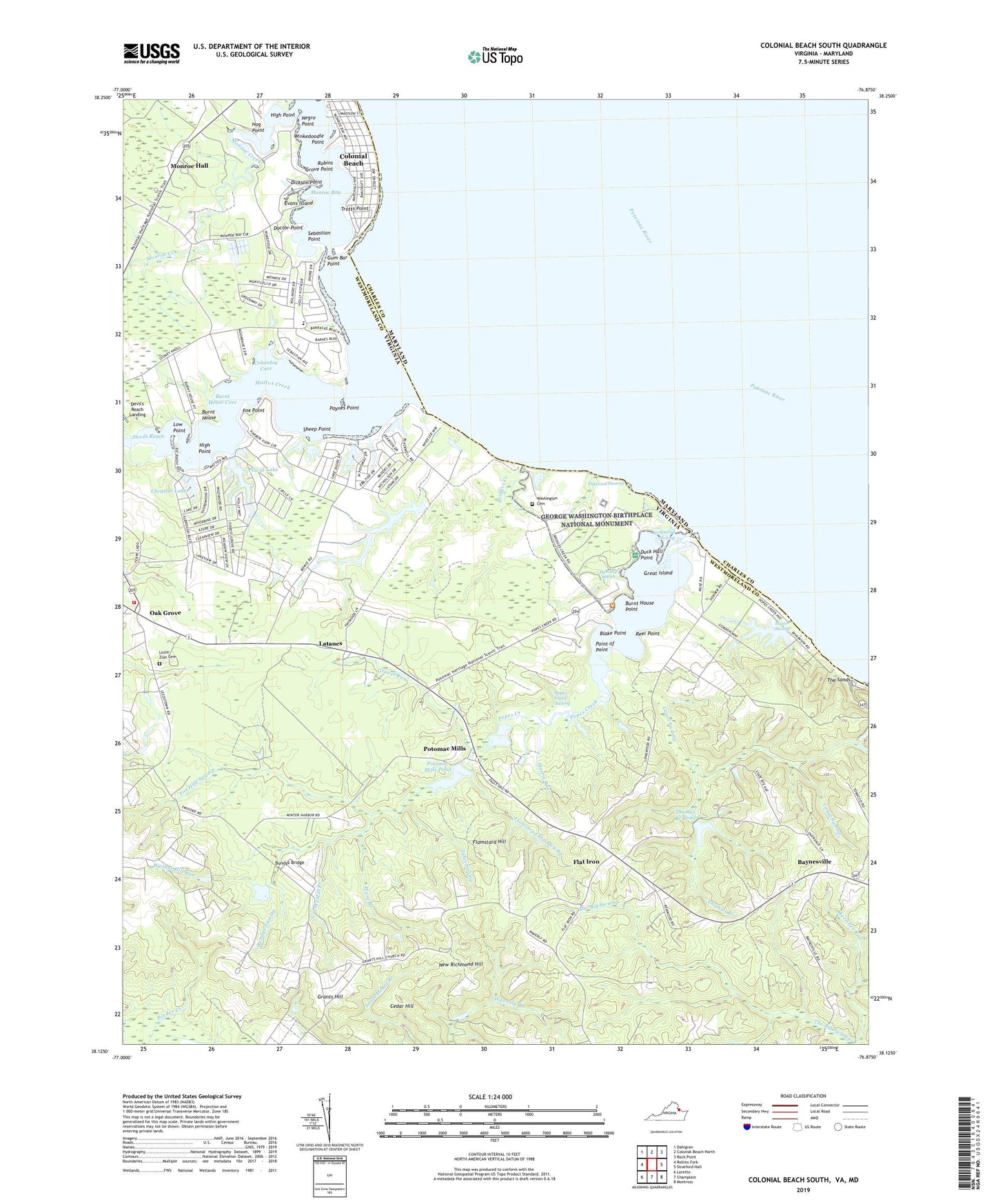
2022 topographic map quadrangle Colonial Beach South in the state of Virginia. Scale: 1:24000. Based on the newly updated USGS 7.5' US Topo map series, this map is in the following counties: Westmoreland, Charles. The map contains contour data, water features, and other items you are used to seeing on USGS maps, but also has updated roads and other features. This is the next generation of topographic maps. Printed on high-quality waterproof paper with UV fade-resistant inks.
Quads adjacent to this one:
West: Rollins Fork
Northwest: Dahlgren
North: Colonial Beach North
Northeast: Rock Point
East: Stratford Hall
Southeast: Montross
South: Champlain
Southwest: Loretto
This map covers the same area as the classic USGS quad with code o38076b8.
Contains the following named places: Baynesville, Baynesville Landing, Blake Point, Blenheim, Bridges Creek, Bridges Creek Landing, Broadview, Bundys Bridge, Bundys Swamp, Burnt House, Burnt House Cove, Burnt House Point, Canal Swamp, Castlewood Park, Cedar Hill, Chrystal Lake, Church Point, Church Point Farm, Colonial Beach United Methodist Church, Columbia Cove, Dancing Marsh, Devils Reach, Dickson Point, Digwood Swamp, Dixon Stop, Doctor Point, Duck Hall Point, Eleanor Park Tourist Camp, Evans Island, Flamstard Hill, Flamstead Hill Swamp, Flat Iron, Fox Hall Swamp, Fox Point, Freedom Point, George Washington Birthplace National Monument, George Washington School, Grants Hill, Grants Hill Branch, Grants Hill Church, Grants Hill School, Gravel Run, Gravel Run School, Great Island, Gum Bar Point, Harts, Haywood, High Point, Hog Point, Latanes, Latanes Dam, Latanes Pond, Laurel Grove, Little Zion Cemetery, Little Zion Church, Longwood Swamp, Low Point, Mason Swamp, Massey Wharf, Mattox Creek, Monroe Bay, Monroe Bay Christian Academy, Monroe Chapel, Monroe Creek, Monroe Hall, Monrovia Church, Morris Dam, Morris Pond, Morris Run, Morris Store, Muses Beach, New Monrovia Church, New Richmond Hill, Oak Grove, Oak Grove Volunteer Fire Department Engine Company 4, Paynes Point, Placid Lake, Placid Lake Dam, Point of Point, Pope Creek Church, Popes Creek, Popes Creek Landing, Popes Creek Swamp, Potomac Mills, Potomac Mills Pond, Potter Branch, Reel Point, Robins Grove Point, Saint Elizabeths Catholic Church, Sebastian Point, Sheep Point, Smith Landing, Springfield, Stave Landing, Tates Swamp, The Sands, Thomas Branch, Thomas Branch Dam, Thomas Branch Pond, Trotts Point, Twiford, Wakefield, Wakefield Corner, Wakefield Mansion, Walnut Hill, Walnut Hill Run, Ware Branch, Washington Cemetery, Washington District, West Moreland Independent Baptist Church, Winkedoodle Point, Wirt Wharf, Wirts Mill, ZIP Code: 22443