MyTopo
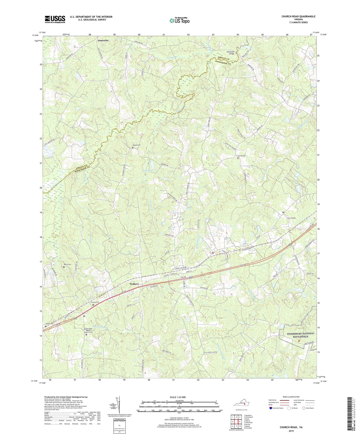
Church Road Virginia US Topo Map
Couldn't load pickup availability
2022 topographic map quadrangle Church Road in the state of Virginia. Scale: 1:24000. Based on the newly updated USGS 7.5' US Topo map series, this map is in the following counties: Dinwiddie, Amelia. The map contains contour data, water features, and other items you are used to seeing on USGS maps, but also has updated roads and other features. This is the next generation of topographic maps. Printed on high-quality waterproof paper with UV fade-resistant inks.
Quads adjacent to this one:
West: Hebron
Northwest: Mannboro
North: Winterpock
Northeast: Beach
East: Sutherland
Southeast: Dinwiddie
South: DeWitt
Southwest: Darvills
This map covers the same area as the classic USGS quad with code o37077b6.
Contains the following named places: Central Baptist Church, Church Road, Church Road Post Office, Corinth Cemetery, Corinth Church, District 1, Eades Dam, Eades Pond, Fellowbed Branch, Ford, Ford Post Office, Ford Volunteer Fire Department Station 2, Georges Branch, Jones Dam, Jones Store, Kit Branch, Marmona, Marmora Church, Mispah Cemetery, Mount Poole Baptist Church Cemetery, Mount Poole Church, Mount Zion Baptist Church, Namozine, Namozine Bridge, Namozine Church, Norris Cemetery, Poole Christian Church, Poole Siding, Pucketts Branch, Saint Peters Church, Stokes Dam, Trinity Cemetery, Trinity Church, Tylers Branch, Union Church, Walkers, Watkins Farm, Whites Cemetery, Wilkersons Store, ZIP Code: 23833