MyTopo
Hebron Virginia US Topo Map
Couldn't load pickup availability
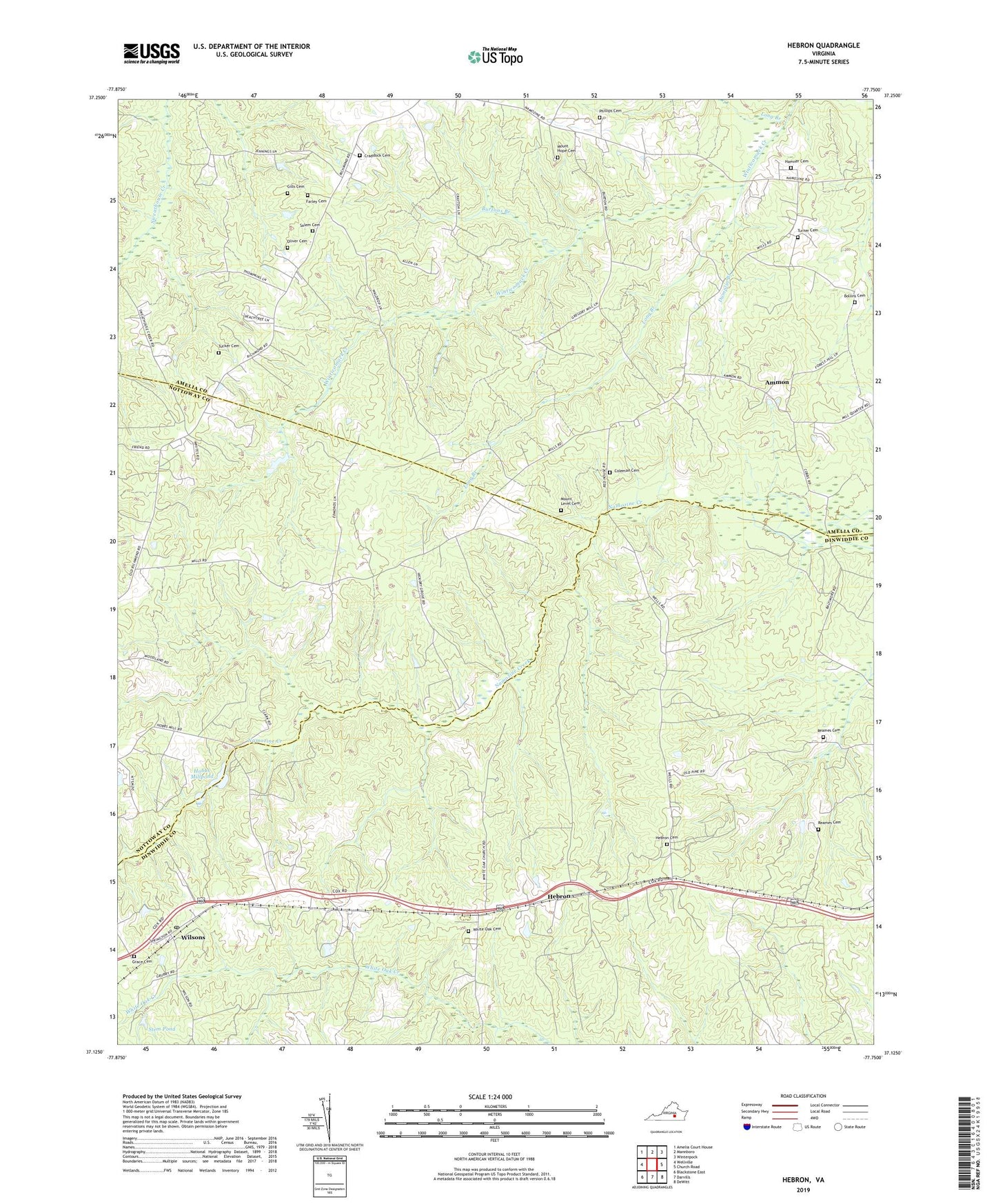
2022 topographic map quadrangle Hebron in the state of Virginia. Scale: 1:24000. Based on the newly updated USGS 7.5' US Topo map series, this map is in the following counties: Dinwiddie, Amelia, Nottoway. The map contains contour data, water features, and other items you are used to seeing on USGS maps, but also has updated roads and other features. This is the next generation of topographic maps. Printed on high-quality waterproof paper with UV fade-resistant inks.
Quads adjacent to this one:
West: Wellville
Northwest: Amelia Court House
North: Mannboro
Northeast: Winterpock
East: Church Road
Southeast: DeWitt
South: Darvills
Southwest: Blackstone East
This map covers the same area as the classic USGS quad with code o37077b7.
Contains the following named places: Ammon, Ammon School, Bethel Church, Bollins Cemetery, Broomfield Church, Burtons Branch, Coleman Cemetery, Craddock Cemetery, Dumplin Branch, Farley Cemetery, Ford School, Gills Cemetery, Grace Cemetery, Grace Church, Hamner Cemetery, Harris Store, Hebron, Hebron Cemetery, Hebron Church, Hobbs Dam, Hobbs Mill, Hobbs Millpond, King David Lodge Hall, Liberty Church, Long Branch, Mallorys Store, Mission Light School, Mount Hope Baptist Church, Mount Hope Cemetery, Mount Level Cemetery, Mount Level Church, Oliver Cemetery, Phillips Cemetery, Poplar Hill Church, Reames Cemetery, Salem Cemetery, Salem Methodist Episcopal Church, Stem Pond, Tucker Cemetery, Turner Cemetery, White Oak Cemetery, White Oak Church, Wilsons, Wilsons Post Office, ZIP Code: 23850