MyTopo
DeWitt Virginia US Topo Map
Couldn't load pickup availability
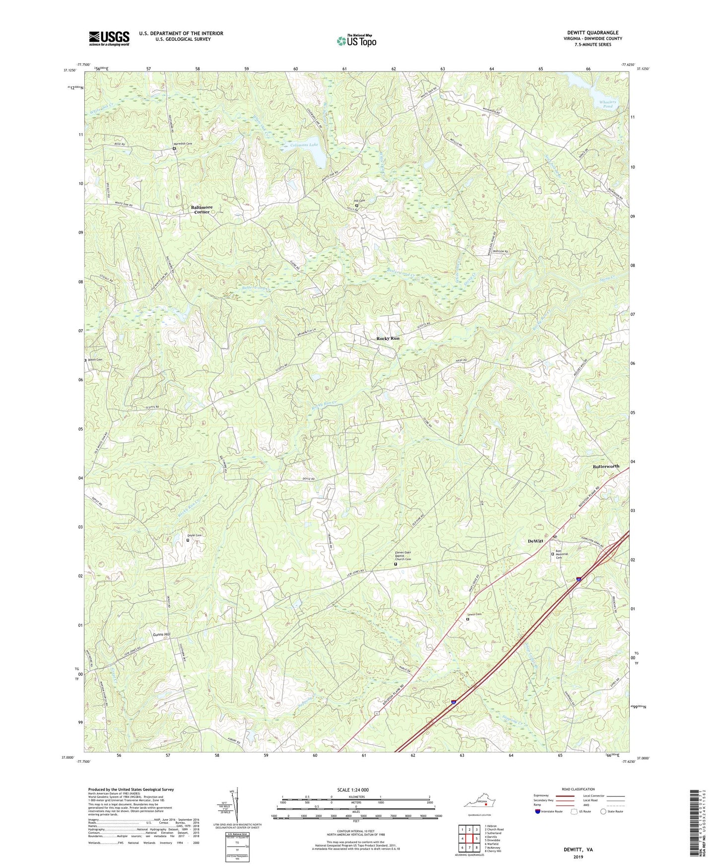
2019 topographic map quadrangle DeWitt in the state of Virginia. Scale: 1:24000. Based on the newly updated USGS 7.5' US Topo map series, this map is in the following counties: Dinwiddie. The map contains contour data, water features, and other items you are used to seeing on USGS maps, but also has updated roads and other features. This is the next generation of topographic maps. Printed on high-quality waterproof paper with UV fade-resistant inks.
Quads adjacent to this one:
West: Darvills
Northwest: Hebron
North: Church Road
Northeast: Sutherland
East: Dinwiddie
Southeast: Cherry Hill
South: McKenney
Southwest: Warfield
Contains the following named places: Baltimore Corner, Bar Swamp Creek, Booth Cemetery, Borthwick, Bott Memorial Cemetery, Bott Memorial Church, Butterwood Creek, Butterworth, Center Star, Coleman Dam, Colemans Lake, DeWitt, DeWitt Post Office, DeWitt School, Dinwiddie County, District 5, Doyle Cemetery, Eleven Oaks Baptist Church Cemetery, Eleven Oaks Church, Gunns Hill, Hill Cemetery, Hills Mill, Lewis Cemetery, LG and E Westmoreland, Meredith Cemetery, Mount Calvary Church, Prospect Church, Reade Store, Rocky Run, Rocky Run Church, Rocky Run Creek, Snap Lodge Branch, Wheelers Dam, Wheelers Pond, White Oak Creek, Wilkinsons Store, ZIP Code: 23840