MyTopo
Disputanta South Virginia US Topo Map
Couldn't load pickup availability
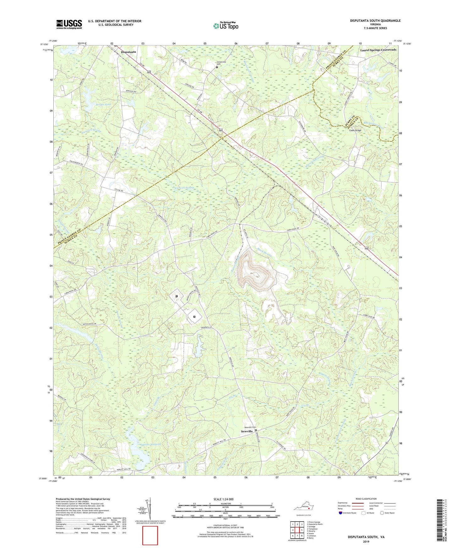
2022 topographic map quadrangle Disputanta South in the state of Virginia. Scale: 1:24000. Based on the newly updated USGS 7.5' US Topo map series, this map is in the following counties: Sussex, Prince George, Surry. The map contains contour data, water features, and other items you are used to seeing on USGS maps, but also has updated roads and other features. This is the next generation of topographic maps. Printed on high-quality waterproof paper with UV fade-resistant inks.
Quads adjacent to this one:
West: Templeton
Northwest: Prince George
North: Disputanta North
Northeast: Savedge
East: Waverly
Southeast: Manry
South: Littleton
Southwest: Sussex
This map covers the same area as the classic USGS quad with code o37077a2.
Contains the following named places: Atlantic Waste Disposal Sussex County Landfill, Black Swamp, Blackwater Swamp, Cabin Branch, Centerville Cemetery, Centerville Church, Chappell Hill School, Cooks Bridge, Disputanta, Disputanta Branch Appomattox Regional Library, Disputanta Census Designated Place, Disputanta Post Office, Dobie Swamp, First Baptist Church, Game Reserve Dam, Ivy Branch, Joseph Swamp, Josephs Mill Pond, Laurel Springs Crossroads, Nebletts Dam, Nebletts Mill, Nebletts Millpond, Newville, Newville Baptist Church, Newville Cemetery, Newville School, Pigeon Swamp, Roland Crossroads, School Number 2, School Number 7, Sussex I State Prison, Sussex II State Prison, Van Metre Dam, Warwick Swamp, Wilburn Church, Wright Dam, Wright Pond, ZIP Code: 23891