MyTopo
Dunnsville Virginia US Topo Map
Couldn't load pickup availability
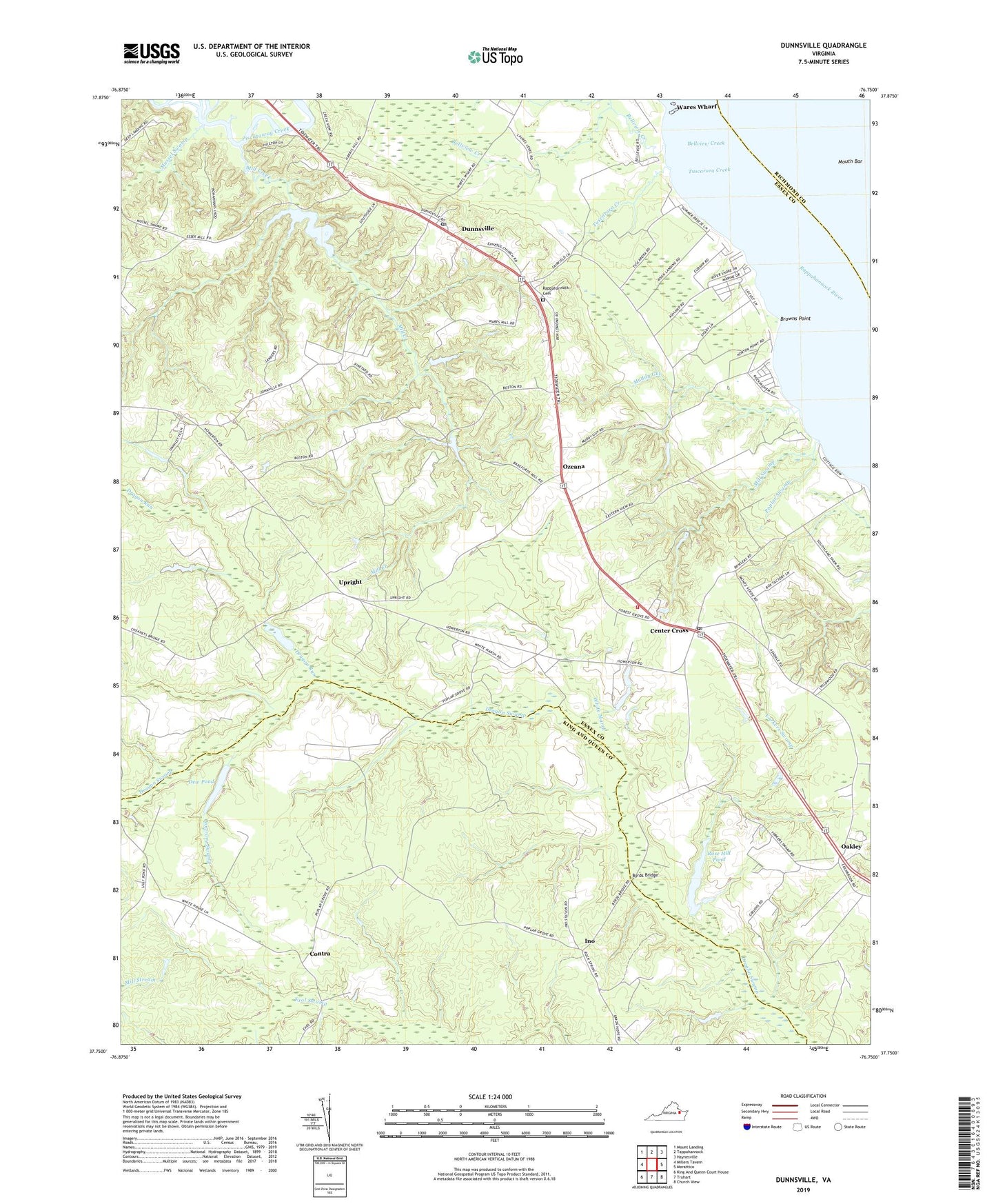
2019 topographic map quadrangle Dunnsville in the state of Virginia. Scale: 1:24000. Based on the newly updated USGS 7.5' US Topo map series, this map is in the following counties: Essex, King and Queen, Richmond. The map contains contour data, water features, and other items you are used to seeing on USGS maps, but also has updated roads and other features. This is the next generation of topographic maps. Printed on high-quality waterproof paper with UV fade-resistant inks.
Quads adjacent to this one:
West: Millers Tavern
Northwest: Mount Landing
North: Tappahannock
Northeast: Haynesville
East: Morattico
Southeast: Church View
South: Truhart
Southwest: King And Queen Court House
Contains the following named places: Angel Visit Church, Bellview Creek, Bowlers Wharf, Browns Point, Byrds Bridge, Center Cross, Center Cross Church of God, Center Cross Post Office, Center Cross School, Contra, Contrary Swamp, Dew Dam, Dew Pond, Dragon Run, Dunnsville, Dunnsville Post Office, Ephesus Church, Essex Mill, Essex Mill Dam, Essex Millpond, Eubank, Good Hope Church, Hundley Dam, Ino, Lebanon Church, Macedonia Church, Marry Gold Plantation, Merryvayle Creek, Mill Creek, Mill Stream, Mill Swamp, Miller Greenhouses, Mouth Bar, Muddy Gut, Mussel Swamp, North Branch Beaverdam Swamp, Oakley, Ozeana, Poplar Swamp, Rappahannock Cemetery, Rappahannock Church, Rappahannock District School, Rappahannock Independent Academy, Rose Hill Dam, Rose Hill Pond, Saint Andrews Church, Saint Lukes Church, Smith and Rices Mill, South District, Stiffs Mill, Tappahannock - Essex Volunteer Fire Department Station 2, Trinity Church, Tuscarora Creek, Union Hope Baptist Church, Union Hope Church, Upright, Ware Dam, Wares Mill, Wares Wharf, Waterview Plantation, White Marsh, Wyatts Dam, Yorkers Swamp, ZIP Codes: 22437, 22454