MyTopo
Mount Landing Virginia US Topo Map
Couldn't load pickup availability
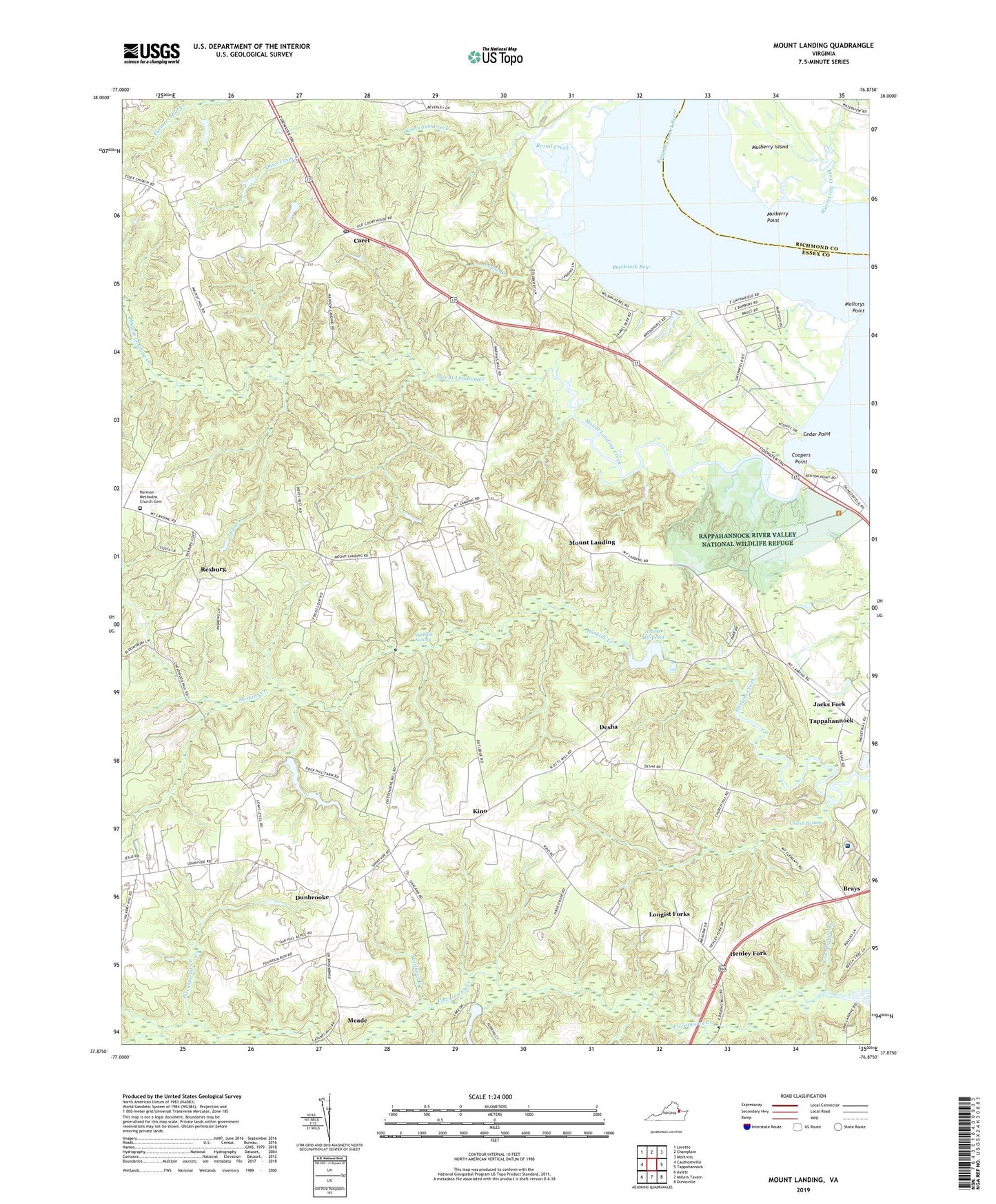
2022 topographic map quadrangle Mount Landing in the state of Virginia. Scale: 1:24000. Based on the newly updated USGS 7.5' US Topo map series, this map is in the following counties: Essex, Richmond. The map contains contour data, water features, and other items you are used to seeing on USGS maps, but also has updated roads and other features. This is the next generation of topographic maps. Printed on high-quality waterproof paper with UV fade-resistant inks.
Quads adjacent to this one:
West: Cauthornville
Northwest: Loretto
North: Champlain
Northeast: Montross
East: Tappahannock
Southeast: Dunnsville
South: Millers Tavern
Southwest: Aylett
This map covers the same area as the classic USGS quad with code o37076h8.
Contains the following named places: Baker Landing, Bakers Landing, Brecknock Bay, Broad Creek, Caret, Caret Post Office, Cedar Point, Central District, Cheatswood Mill Dam, Cheatwood Millpond, Church Swamp, Coopers Point, Cortney Dam, Criddlin Swamp, Croxton Mill, Desha, Dunbrooke, Essex County, Essex House Assisted Living Facility, First Union Church, Gram Landing, Harry Lane Swamp, Henley Fork, Hermon Church, Hermon Methodist Church Cemetery, Hickory Landing, Hickory Road School, Hutchinson Mill, Jacks Fork, Jenkins Landing, Kino, Latane Mill, Lewis Creek, Longist Forks, Mallorys Point, Mariners Branch, Meade, Mose Landing, Mount Landing, Mount Landing Creek, Mount Zion Church, Mulberry Island, Mulberry Point, Persimmon Tree Landing, Pigeon Hill, Quioccasin Creek, Rexburg, Riverside Tappahannock Hospital, Saint Johns Church, Salt Bank Landing, Scott Mill, Scotts Mill Dam, Scotts Millpond, Sturgeon Swamp, Tappahannock Seventh Day Adventist Church, Upper Mount Landing, Waterview Creek, Woodside Country Club, Youngs Swamp, ZIP Code: 22560